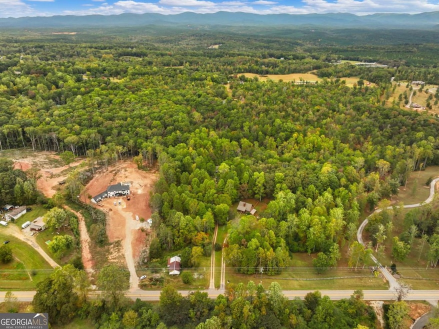

6418 Dawsonville Hwy Dahlonega, GA 30533
Estimated payment $2,642/month
Highlights
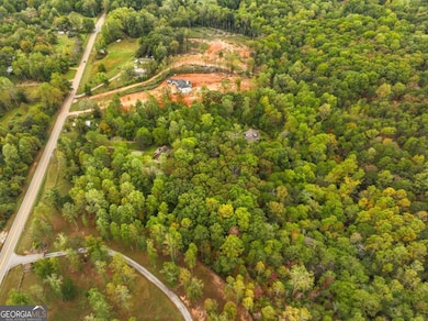
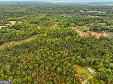
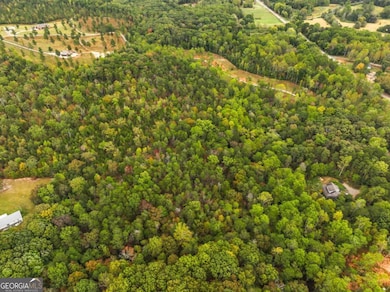
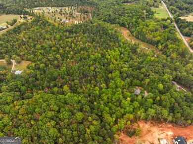
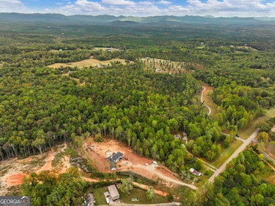
- 12.3 Acre Lot
- Private Lot
- No HOA
- Mountain View
- Wooded Lot
- Home fronts a stream
About This Lot
Beautiful North Georgia Acreage with great road frontage and an old home on the property. 12 plus acres of almost level land ready for your homesite or gentleman's farm. This land is convenient to Dahlonega, Dawsonville, and Highway 400. Property is eligible for the conservation tax break. Build your home with rippling streams, mature trees, and privacy with the convenience of being accessible to all the conveniences or renovate the current home and unleash the possibilities for this beautiful land.....Dont Miss Out
Property Details
Property Type
- Land
Est. Annual Taxes
- $3,812
Lot Details
- 12.3 Acre Lot
- Home fronts a stream
- Property fronts a highway
- Private Lot
- Level Lot
- Wooded Lot
Schools
- Blackburn Elementary School
- Lumpkin County Middle School
- New Lumpkin County High School
Utilities
- Private Water Source
- High Speed Internet
Additional Features
- Mountain Views
- Residence on Property
Listing and Financial Details
- Tax Lot 43
Community Details
Overview
- No Home Owners Association
Recreation
- Outbuilding
Map
Home Values in the Area
Average Home Value in this Area
Tax History
| Year | Tax Paid | Tax Assessment Tax Assessment Total Assessment is a certain percentage of the fair market value that is determined by local assessors to be the total taxable value of land and additions on the property. | Land | Improvement |
|---|---|---|---|---|
| 2024 | $631 | $26,057 | $19,934 | $6,123 |
| 2023 | $506 | $21,528 | $21,528 | $0 |
| 2022 | $444 | $17,940 | $17,940 | $0 |
Property History
| Date | Event | Price | List to Sale | Price per Sq Ft |
|---|---|---|---|---|
| 11/06/2025 11/06/25 | Price Changed | $440,000 | +76.0% | -- |
| 10/16/2025 10/16/25 | For Sale | $250,000 | -- | -- |
Purchase History
| Date | Type | Sale Price | Title Company |
|---|---|---|---|
| Warranty Deed | $190,000 | -- |
Source: Georgia MLS
MLS Number: 10626143
APN: 022-000-333-000
Disclaimer: Certain information contained herein is derived from information provided by parties other than Homes.com. All information provided is deemed reliable, but is not guaranteed to be accurate and should be independently verified.
![]() The data relating to real estate for sale on this web site comes in part from the Broker Reciprocity Program of Georgia MLS. Real estate listings held by brokerage firms other than Redfin are marked with the Broker Reciprocity logo and detailed information about them includes the name of the listing brokers. Information deemed reliable but not guaranteed. Copyright 2025 Georgia MLS. All rights reserved.
The data relating to real estate for sale on this web site comes in part from the Broker Reciprocity Program of Georgia MLS. Real estate listings held by brokerage firms other than Redfin are marked with the Broker Reciprocity logo and detailed information about them includes the name of the listing brokers. Information deemed reliable but not guaranteed. Copyright 2025 Georgia MLS. All rights reserved.
- 50 Hannahs Ct
- 27 Bryn Ct
- 49 Makers Way
- 322 Miller Dr
- 0x Pink Williams Rd
- 0x Pink Williams Rd Unit 124AC
- 0 Rider Rd Unit 7481902
- 0 Rider Rd Unit 10408283
- 1861 Mill Creek Rd
- 1044 Rider Rd
- 0 Mill Creek Unit 411255
- 382 Candler Ln
- 194 Deerfield Dr
- 150 Buck Run E
- 3050 Burt Creek Rd
- 0 Rainmore Dr Unit 7620063
- 0 Rainmore Dr Unit 10570615
- 437 Morgan Ln
- 460 Morgan Ln
- 7065 Dawsonville Hwy Unit A
- 7128 Dawsonville Hwy
- 2331 Highway 52 W Unit Suite E
- 635 Ben Higgins Rd
- 361 Tower Dr
- 419 Georgia 9
- 14 Pearl Chambers Dr
- 416 Highway 9 S Unit A
- 38 Wheeler Place
- 113 Roberta Ave
- 3 Bellamy Place
- 13 Housley Dr
- 343 Chastain Mill Rd
- 137 Quail Pass
- 181 Longleaf St
- 41 Oak St
- 364 Stoneybrook Dr
- 215 Stephens St
- 502 Wimpy Mill Rd
- 25 Stoneybrook Dr
