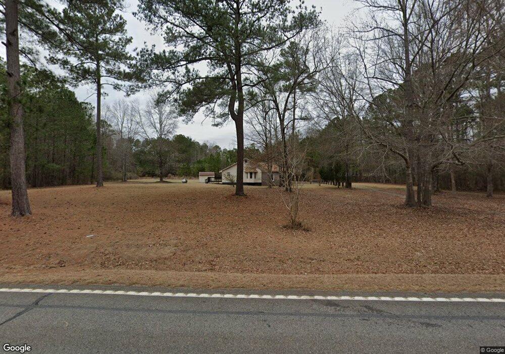
6418 Ga Highway 42 N Forsyth, GA 31029
Estimated Value: $281,033 - $289,000
--
Bed
3
Baths
2,170
Sq Ft
$132/Sq Ft
Est. Value
About This Home
This home is located at 6418 Ga Highway 42 N, Forsyth, GA 31029 and is currently estimated at $285,758, approximately $131 per square foot. 6418 Ga Highway 42 N is a home located in Monroe County with nearby schools including Katherine B. Sutton Elementary School and Mary Persons High School.
Ownership History
Date
Name
Owned For
Owner Type
Purchase Details
Closed on
Aug 6, 2021
Sold by
Willis Agnes Celia
Bought by
Price Dwain Julian
Current Estimated Value
Purchase Details
Closed on
Sep 25, 2015
Sold by
Willis Agnes Celia
Bought by
Wilson F Bradford and Wilson Agnes Celia Wil C
Purchase Details
Closed on
Jul 22, 2002
Sold by
Willis Robert L
Bought by
Willis Robert L and Agnes Celia
Purchase Details
Closed on
Apr 9, 1991
Sold by
Gibbs Eddie E and Gibbs Nina G
Bought by
Willis Robert L
Create a Home Valuation Report for This Property
The Home Valuation Report is an in-depth analysis detailing your home's value as well as a comparison with similar homes in the area
Home Values in the Area
Average Home Value in this Area
Purchase History
| Date | Buyer | Sale Price | Title Company |
|---|---|---|---|
| Price Dwain Julian | -- | -- | |
| Wilson F Bradford | -- | -- | |
| Willis Robert L | -- | -- | |
| Willis Robert L | $8,000 | -- |
Source: Public Records
Tax History Compared to Growth
Tax History
| Year | Tax Paid | Tax Assessment Tax Assessment Total Assessment is a certain percentage of the fair market value that is determined by local assessors to be the total taxable value of land and additions on the property. | Land | Improvement |
|---|---|---|---|---|
| 2024 | $780 | $59,720 | $15,120 | $44,600 |
| 2023 | $749 | $52,320 | $15,120 | $37,200 |
| 2022 | $1,417 | $52,320 | $15,120 | $37,200 |
| 2021 | $570 | $52,320 | $15,120 | $37,200 |
| 2020 | $497 | $49,280 | $12,080 | $37,200 |
| 2019 | $500 | $49,280 | $12,080 | $37,200 |
| 2018 | $502 | $49,280 | $12,080 | $37,200 |
| 2017 | $1,432 | $49,280 | $12,080 | $37,200 |
| 2016 | $477 | $49,280 | $12,080 | $37,200 |
| 2015 | $531 | $52,320 | $15,120 | $37,200 |
| 2014 | $512 | $52,320 | $15,120 | $37,200 |
Source: Public Records
Map
Nearby Homes
- 6418 Georgia 42
- 49 Homestead Cir Unit LOT 49A
- 160 Aaron Ct
- 196 Craig Rd
- 40 Timber Dr
- 381 Homestead Cir
- 738 Teagle Rd
- 3528 Highway 42 S
- 120 Torbet Rd
- LOT 48 Stokes Store Rd
- 49 Stokes Store Rd Unit 49
- 49 Stokes Store Rd
- 0 Garr Rd Unit 10439858
- 56 Ivey Cir
- 674 Stokes Store Rd
- 739 Westbrooks Rd
- 61 Duncan Cir
- 0 Duncan Cir Unit 24915548
- 1649 Stokes Store Rd
- 1649 Stokes Store Rd Unit 52
- 1465 Teagle Rd
- 0 Hwy 42 and Craig Rd Unit PARCEL 1 8259966
- 0 Hwy 42 and Craig Rd Unit 1 7527778
- 0 Hwy 42 and Craig Rd Unit 2&3 7527771
- 0 Hwy 42 and Craig Rd Unit PARCEL 1 7527750
- 1372 Teagle Rd
- 1494 Teagle Rd
- 000 Highway 42
- 1462 Teagle Rd
- 105 Jacob Ct
- 0 Teagle Rd Unit 8328178
- 0 Teagle Rd Unit LOT8 7360181
- 0 Teagle Rd Unit 8 7574944
- 0 Teagle Rd Unit 36471998
- 0 Teagle Rd Unit 36469701
- 0 Teagle Rd Unit 36476314
- 0 Teagle Rd Unit 36501896
- 0 Teagle Rd Unit 36476327
- 0 Teagle Rd Unit 21190175
- 0 Teagle Rd Unit 7311844