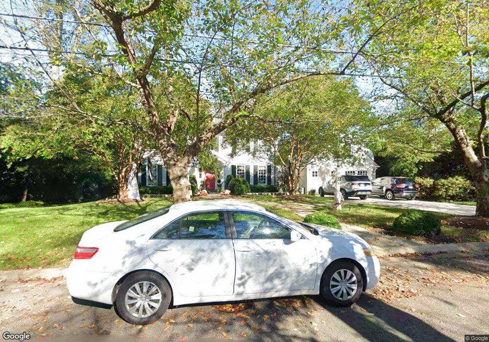
6419 Brookside Dr Chevy Chase, MD 20815
Kenwood Park NeighborhoodEstimated Value: $4,259,042 - $4,879,000
6
Beds
7
Baths
7,311
Sq Ft
$634/Sq Ft
Est. Value
About This Home
This home is located at 6419 Brookside Dr, Chevy Chase, MD 20815 and is currently estimated at $4,637,511, approximately $634 per square foot. 6419 Brookside Dr is a home located in Montgomery County with nearby schools including Westbrook Elementary School, Westland Middle School, and Bethesda-Chevy Chase High School.
Ownership History
Date
Name
Owned For
Owner Type
Purchase Details
Closed on
Feb 26, 2025
Sold by
Hampden Trust and Firth Thomas T
Bought by
Peterson Theodore L and Peterson Laura E
Current Estimated Value
Home Financials for this Owner
Home Financials are based on the most recent Mortgage that was taken out on this home.
Original Mortgage
$1,825,000
Outstanding Balance
$1,808,397
Interest Rate
5.38%
Mortgage Type
New Conventional
Estimated Equity
$2,829,114
Purchase Details
Closed on
Feb 5, 1997
Sold by
C Edward T and C Colbert S
Bought by
Hampden Trust
Create a Home Valuation Report for This Property
The Home Valuation Report is an in-depth analysis detailing your home's value as well as a comparison with similar homes in the area
Home Values in the Area
Average Home Value in this Area
Purchase History
| Date | Buyer | Sale Price | Title Company |
|---|---|---|---|
| Peterson Theodore L | $4,825,000 | First American Title | |
| Peterson Theodore L | $4,825,000 | First American Title | |
| Hampden Trust | $1,109,250 | -- |
Source: Public Records
Mortgage History
| Date | Status | Borrower | Loan Amount |
|---|---|---|---|
| Open | Peterson Theodore L | $1,825,000 | |
| Closed | Peterson Theodore L | $1,825,000 |
Source: Public Records
Tax History
| Year | Tax Paid | Tax Assessment Tax Assessment Total Assessment is a certain percentage of the fair market value that is determined by local assessors to be the total taxable value of land and additions on the property. | Land | Improvement |
|---|---|---|---|---|
| 2025 | $36,386 | $3,148,033 | -- | -- |
| 2024 | $36,386 | $3,044,300 | $1,396,100 | $1,648,200 |
| 2023 | $33,835 | $2,763,500 | $0 | $0 |
| 2022 | $27,950 | $2,482,700 | $0 | $0 |
| 2021 | $24,734 | $2,201,900 | $1,269,100 | $932,800 |
| 2020 | $24,734 | $2,201,900 | $1,269,100 | $932,800 |
| 2019 | $24,686 | $2,201,900 | $1,269,100 | $932,800 |
| 2018 | $29,012 | $2,592,400 | $1,208,600 | $1,383,800 |
| 2017 | $28,023 | $2,458,967 | $0 | $0 |
| 2016 | -- | $2,325,533 | $0 | $0 |
| 2015 | $22,350 | $2,192,100 | $0 | $0 |
| 2014 | $22,350 | $2,192,100 | $0 | $0 |
Source: Public Records
Map
Nearby Homes
- 5205 Woodlawn Ave
- 5208 Woodlawn Ave
- 6413 Garnett Dr
- 5104 Fairglen Ln
- 5102 Fairglen Ln
- 5410 Bradley Blvd
- 6721 Kenwood Forest Ln
- 5900 Kennedy Dr
- 5511 Pollard Rd
- 5100 Dorset Ave Unit 111
- 5100 Dorset Ave Unit 506
- 5100 Dorset Ave Unit 314
- 5100 Dorset Ave Unit 100
- 7113 Fairfax Rd
- 4902 Derussey Pkwy
- 7005 Exfair Rd
- 4838 Langdrum Ln
- 4905 Dorset Ave
- 4822 Chevy Chase Blvd
- 5828 Tanglewood Dr
- 6416 Elmwood Rd
- 5216 Chamberlin Ave
- 6415 Brookside Dr
- 6420 Elmwood Rd
- 6412 Elmwood Rd
- 6424 Brookside Dr
- 6411 Brookside Dr
- 6416 Brookside Dr
- 6408 Elmwood Rd
- 5208 Chamberlin Ave
- 6409 Elmwood Rd
- 5215 Chamberlin Ave
- 5209 Chamberlin Ave
- 5300 Chamberlin Ave
- 6423 Shadow Rd
- 5301 Chamberlin Ave
- 6405 Elmwood Rd
- 5205 Chamberlin Ave
- 6412 Brookside Dr
- 6407 Brookside Dr
Your Personal Tour Guide
Ask me questions while you tour the home.