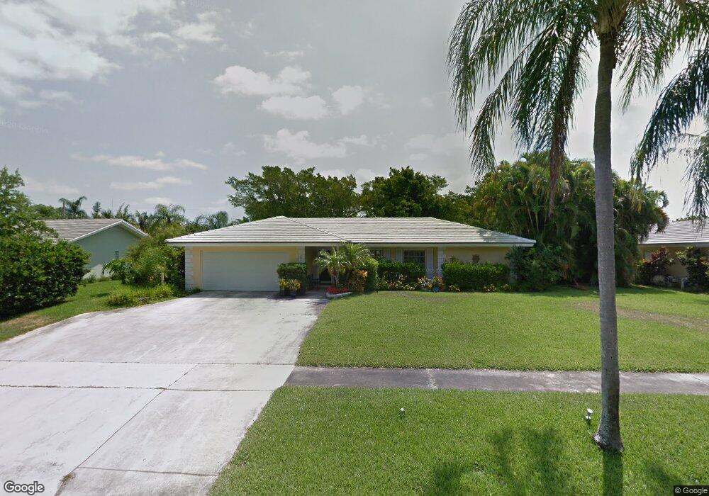
642 Atlantic Rd North Palm Beach, FL 33408
Estimated Value: $1,056,000 - $1,166,000
3
Beds
2
Baths
1,785
Sq Ft
$621/Sq Ft
Est. Value
About This Home
This home is located at 642 Atlantic Rd, North Palm Beach, FL 33408 and is currently estimated at $1,108,535, approximately $621 per square foot. 642 Atlantic Rd is a home located in Palm Beach County with nearby schools including The Conservatory School at North Palm Beach, Howell L. Watkins Middle School, and Palm Beach Gardens Community High School.
Ownership History
Date
Name
Owned For
Owner Type
Purchase Details
Closed on
Jul 19, 2018
Sold by
Tucker Leigh E
Bought by
Garbose James L
Current Estimated Value
Purchase Details
Closed on
Nov 17, 1995
Sold by
Voss Richard and Voss Marilyn
Bought by
Tucker Leigh and Garbose James L
Home Financials for this Owner
Home Financials are based on the most recent Mortgage that was taken out on this home.
Original Mortgage
$65,000
Interest Rate
7.54%
Create a Home Valuation Report for This Property
The Home Valuation Report is an in-depth analysis detailing your home's value as well as a comparison with similar homes in the area
Home Values in the Area
Average Home Value in this Area
Purchase History
| Date | Buyer | Sale Price | Title Company |
|---|---|---|---|
| Garbose James L | -- | Attorney | |
| Tucker Leigh | $185,000 | -- |
Source: Public Records
Mortgage History
| Date | Status | Borrower | Loan Amount |
|---|---|---|---|
| Previous Owner | Tucker Leigh | $65,000 |
Source: Public Records
Tax History Compared to Growth
Tax History
| Year | Tax Paid | Tax Assessment Tax Assessment Total Assessment is a certain percentage of the fair market value that is determined by local assessors to be the total taxable value of land and additions on the property. | Land | Improvement |
|---|---|---|---|---|
| 2024 | $4,574 | $260,146 | -- | -- |
| 2023 | $4,350 | $252,569 | $0 | $0 |
| 2022 | $4,303 | $245,213 | $0 | $0 |
| 2021 | $4,276 | $238,071 | $0 | $0 |
| 2020 | $4,228 | $234,784 | $0 | $0 |
| 2019 | $4,161 | $229,505 | $0 | $0 |
| 2018 | $3,960 | $225,226 | $0 | $0 |
| 2017 | $3,887 | $220,594 | $0 | $0 |
| 2016 | $3,877 | $216,057 | $0 | $0 |
| 2015 | $3,956 | $214,555 | $0 | $0 |
| 2014 | $3,959 | $212,852 | $0 | $0 |
Source: Public Records
Map
Nearby Homes
- 701 Buoy Rd
- 522 Eastwind Dr
- 206 Mariner Ct Unit 206
- 218 Mariner Ct
- 421 Driftwood Rd
- 107 Bowsprit Dr
- 130 Bowsprit Dr
- 440 Harbour Rd
- 439 Lighthouse Dr
- 504 Gulf Rd
- 109 Paradise Harbour Blvd Unit 415
- 109 Paradise Harbour Blvd Unit 211
- 109 Paradise Harbour Blvd Unit 508
- 124 Easterly Rd
- 108 Paradise Harbour Blvd Unit 107
- 104 Paradise Harbour Blvd Unit 203
- 104 Paradise Harbour Blvd Unit 215
- 104 Paradise Harbour Blvd Unit 112
- 104 Paradise Harbour Blvd Unit 305
- 100 Paradise Harbour 502 Blvd Unit 502
- 648 Atlantic Rd
- 636 Atlantic Rd
- 649 Lakeside Ct
- 655 Lakeside Ct
- 643 Atlantic Rd
- 637 Atlantic Rd
- 654 Atlantic Rd
- 131 Atlantic Rd
- 649 Atlantic Rd
- 631 Atlantic Rd
- 643 Lakeside Ct
- 125 Atlantic Rd
- 655 Atlantic Rd
- 660 Atlantic Rd
- 661 Lakeside Dr
- 667 Lakeside Dr
- 119 Atlantic Rd
- 637 Lakeside Dr
- 625 Atlantic Rd
- 673 Lakeside Dr