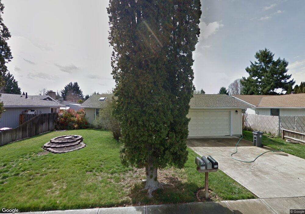
642 Hemlock Ave Central Point, OR 97502
Estimated Value: $359,689 - $388,000
3
Beds
2
Baths
1,427
Sq Ft
$261/Sq Ft
Est. Value
About This Home
This home is located at 642 Hemlock Ave, Central Point, OR 97502 and is currently estimated at $372,922, approximately $261 per square foot. 642 Hemlock Ave is a home located in Jackson County with nearby schools including Central Point Elementary School, Scenic Middle School, and Crater High School.
Ownership History
Date
Name
Owned For
Owner Type
Purchase Details
Closed on
Aug 16, 2014
Sold by
Mons Brian J and Mons Anne C
Bought by
Mons Anne C
Current Estimated Value
Home Financials for this Owner
Home Financials are based on the most recent Mortgage that was taken out on this home.
Original Mortgage
$146,371
Interest Rate
4.1%
Mortgage Type
New Conventional
Create a Home Valuation Report for This Property
The Home Valuation Report is an in-depth analysis detailing your home's value as well as a comparison with similar homes in the area
Purchase History
| Date | Buyer | Sale Price | Title Company |
|---|---|---|---|
| Mons Anne C | -- | First American Title Ins Co |
Source: Public Records
Mortgage History
| Date | Status | Borrower | Loan Amount |
|---|---|---|---|
| Closed | Mons Anne C | $146,371 |
Source: Public Records
Tax History
| Year | Tax Paid | Tax Assessment Tax Assessment Total Assessment is a certain percentage of the fair market value that is determined by local assessors to be the total taxable value of land and additions on the property. | Land | Improvement |
|---|---|---|---|---|
| 2026 | $3,660 | $218,490 | $126,000 | $92,490 |
| 2025 | $3,571 | $214,760 | $62,830 | $151,930 |
| 2024 | $3,571 | $208,510 | $61,000 | $147,510 |
| 2023 | $3,456 | $202,440 | $59,220 | $143,220 |
| 2022 | $3,375 | $202,440 | $59,220 | $143,220 |
| 2021 | $3,279 | $196,550 | $57,500 | $139,050 |
| 2020 | $3,183 | $190,830 | $55,820 | $135,010 |
| 2019 | $3,105 | $179,890 | $52,620 | $127,270 |
| 2018 | $3,010 | $174,660 | $51,090 | $123,570 |
| 2017 | $2,935 | $174,660 | $51,090 | $123,570 |
| 2016 | $2,849 | $164,650 | $48,170 | $116,480 |
| 2015 | $2,730 | $164,650 | $48,170 | $116,480 |
| 2014 | $2,549 | $155,210 | $45,400 | $109,810 |
Source: Public Records
Map
Nearby Homes
- 736 Hemlock Ave
- 755 S 4th St
- 3364 Bursell Rd
- 3358 Bursell Rd
- 555 Freeman Rd Unit 73
- 555 Freeman Rd Unit 254
- 555 Freeman Rd Unit 105
- 555 Freeman Rd Unit 209
- 887 Silver Fox Dr
- 1204 Heather Ln
- 114 Cedar St
- 533 Brittni Ln
- 918 Brandi Way
- 827 Isherwood Dr
- 301 Freeman Rd Unit 30
- 301 Freeman Rd Unit 92
- 301 Freeman Rd Unit 91
- 959 Westrop Dr
- 436 Cheney Loop
- 350 Alder St
- 634 Hemlock Ave Unit 3
- 652 Hemlock Ave
- 643 Rose Valley Ct
- 628 Hemlock Ave
- 635 Rose Valley Ct
- 655 Rose Valley Ct
- 658 Hemlock Ave
- 641 Hemlock Ave
- 627 Rose Valley Ct
- 633 Hemlock Ave
- 649 Hemlock Ave
- 624 Hemlock Ave
- 625 Hemlock Ave
- 667 Rose Valley Ct
- 664 Hemlock Ave
- 619 Rose Valley Ct
- 657 Hemlock Ave
- 662 Prairie Ct
- 617 Hemlock Ave
- 616 Hemlock Ave
Your Personal Tour Guide
Ask me questions while you tour the home.