Estimated Value: $297,000 - $334,000
3
Beds
1
Bath
1,483
Sq Ft
$208/Sq Ft
Est. Value
About This Home
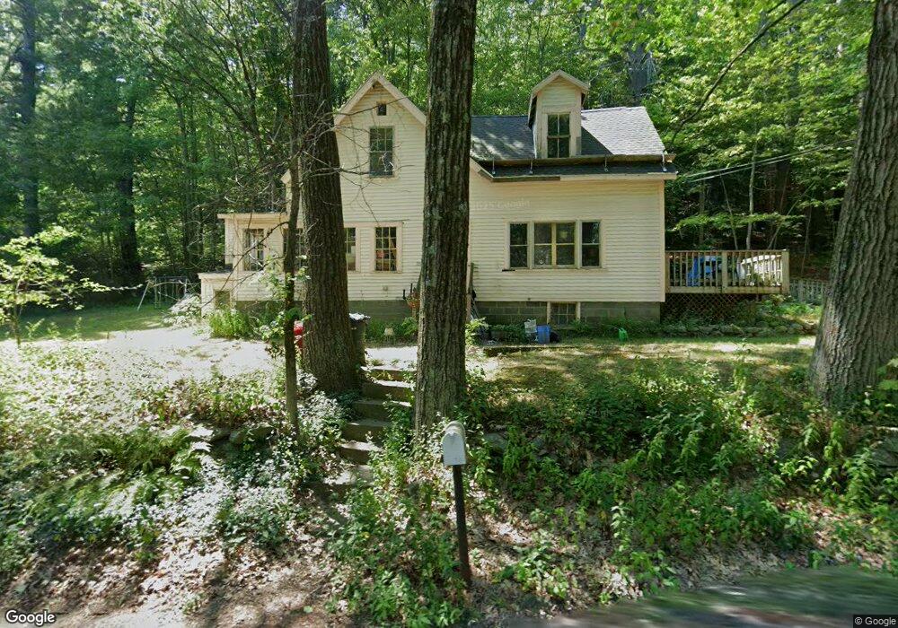
This home is located at 642 N Orange Rd, Athol, MA 01331 and is currently estimated at $307,921, approximately $207 per square foot. 642 N Orange Rd is a home located in Worcester County with nearby schools including Athol High School.
Ownership History
Date
Name
Owned For
Owner Type
Purchase Details
Closed on
Oct 20, 1987
Sold by
Macalister Kevin T
Bought by
Mckeon Michael
Current Estimated Value
Home Financials for this Owner
Home Financials are based on the most recent Mortgage that was taken out on this home.
Original Mortgage
$61,000
Interest Rate
10.63%
Mortgage Type
Purchase Money Mortgage
Create a Home Valuation Report for This Property
The Home Valuation Report is an in-depth analysis detailing your home's value as well as a comparison with similar homes in the area
Home Values in the Area
Average Home Value in this Area
Purchase History
| Date | Buyer | Sale Price | Title Company |
|---|---|---|---|
| Mckeon Michael | $67,900 | -- |
Source: Public Records
Mortgage History
| Date | Status | Borrower | Loan Amount |
|---|---|---|---|
| Closed | Mckeon Michael | $61,000 |
Source: Public Records
Tax History
| Year | Tax Paid | Tax Assessment Tax Assessment Total Assessment is a certain percentage of the fair market value that is determined by local assessors to be the total taxable value of land and additions on the property. | Land | Improvement |
|---|---|---|---|---|
| 2025 | $2,923 | $230,000 | $58,800 | $171,200 |
| 2024 | $2,761 | $215,200 | $58,800 | $156,400 |
| 2023 | $2,623 | $186,800 | $42,500 | $144,300 |
| 2022 | $2,507 | $156,200 | $40,500 | $115,700 |
| 2021 | $2,328 | $131,800 | $36,600 | $95,200 |
| 2020 | $0 | $125,600 | $33,100 | $92,500 |
| 2019 | $2,021 | $115,800 | $31,400 | $84,400 |
| 2018 | $3,645 | $101,300 | $28,600 | $72,700 |
| 2017 | $1,993 | $97,700 | $28,600 | $69,100 |
| 2016 | $1,838 | $92,700 | $28,600 | $64,100 |
| 2015 | $1,764 | $92,700 | $28,600 | $64,100 |
| 2014 | $1,708 | $92,700 | $28,600 | $64,100 |
Source: Public Records
Map
Nearby Homes
- 330 N Orange Rd
- 38 Twichell St
- 660 Pinedale Ave
- 23 Mount Pleasant St
- 70 Mount Pleasant St
- 31 Locke Ave
- 31 Freedom St
- 225 Wallingford Ave
- 55 South St
- 15 Tully Rd
- 193 Freedom St
- 67 Fern St
- 73 Fern St
- 182 Harrison St
- 87 Bellevue Dr E
- 45 Pike St
- 15 Wilson Ave
- 5 Lombard Ave
- 0 W Royalston Rd
- 65 Lakeview Ave
- 935 N Orange Rd
- 620 N Orange Rd
- 596 N Orange Rd
- 0 Brooks Rd Unit 71063768
- 0 Brooks Rd
- 0 Brooks Rd Unit 70620110
- Lot 2 Brooks Rd
- 568 N Orange Rd
- 603 N Orange Rd
- 553 N Orange Rd
- 536 N Orange Rd
- 523 N Orange Rd
- 785 N Orange Rd
- 485 N Orange Rd
- 88 Brooks Rd
- 815 N Orange Rd
- 835 N Orange Rd
- 0 Lenox St Unit 70413794
- 0 Lenox St Unit 70692820
- 452 N Orange Rd
Your Personal Tour Guide
Ask me questions while you tour the home.