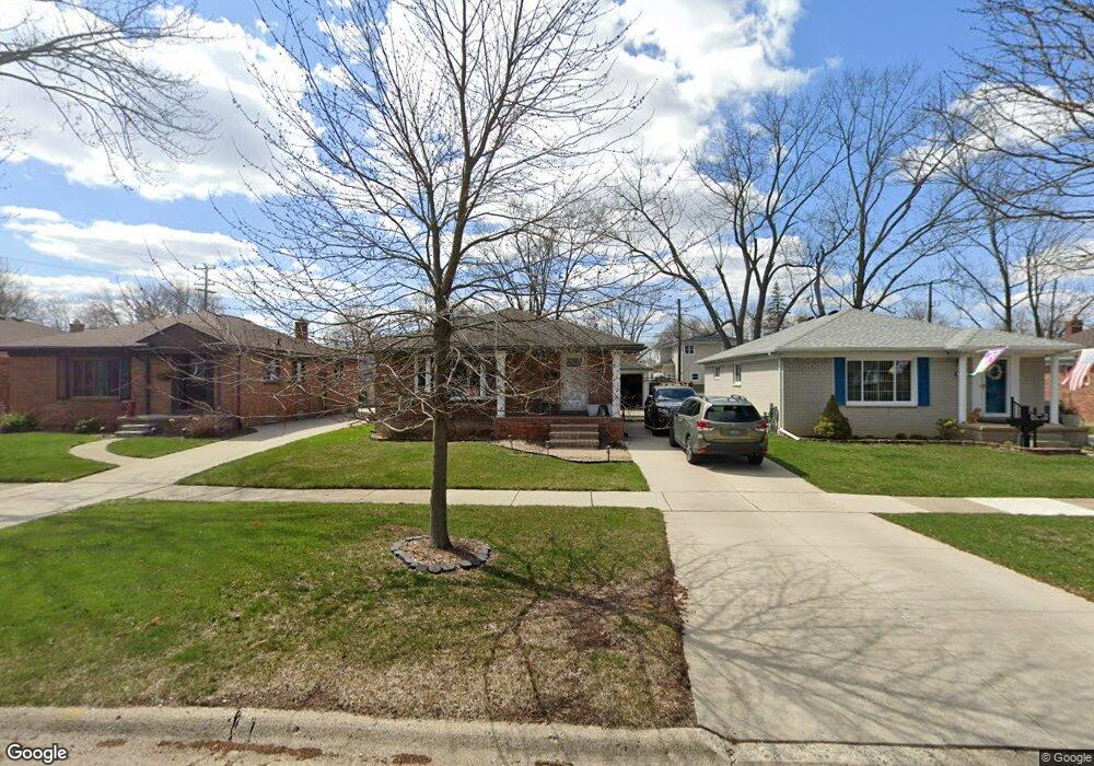
642 Redruth Ave Unit Bldg-Unit Clawson, MI 48017
Estimated Value: $323,000 - $367,000
3
Beds
2
Baths
1,100
Sq Ft
$317/Sq Ft
Est. Value
About This Home
This home is located at 642 Redruth Ave Unit Bldg-Unit, Clawson, MI 48017 and is currently estimated at $348,186, approximately $316 per square foot. 642 Redruth Ave Unit Bldg-Unit is a home located in Oakland County with nearby schools including Clawson Middle School, Clawson High School, and Japhet School.
Ownership History
Date
Name
Owned For
Owner Type
Purchase Details
Closed on
Feb 20, 2018
Sold by
Sitto Landy A and Sitto Megan
Bought by
Lewis Alexandria J and Page Christopher
Current Estimated Value
Home Financials for this Owner
Home Financials are based on the most recent Mortgage that was taken out on this home.
Original Mortgage
$203,700
Outstanding Balance
$172,026
Interest Rate
4.15%
Mortgage Type
Purchase Money Mortgage
Estimated Equity
$176,160
Purchase Details
Closed on
May 24, 2016
Sold by
Sitto Landy A and Sitto Megan
Bought by
Sitto Landy A and Sitto Megan
Home Financials for this Owner
Home Financials are based on the most recent Mortgage that was taken out on this home.
Original Mortgage
$175,500
Interest Rate
3.66%
Mortgage Type
New Conventional
Purchase Details
Closed on
May 23, 2014
Sold by
Shamaon Landy K
Bought by
Shamaon Landy A and Zoltowski Megan
Home Financials for this Owner
Home Financials are based on the most recent Mortgage that was taken out on this home.
Original Mortgage
$171,950
Interest Rate
4.28%
Mortgage Type
New Conventional
Purchase Details
Closed on
Apr 21, 2011
Sold by
Hayes Sarah
Bought by
Hayes Sarah and Sarah Hayes Revocable Trust
Purchase Details
Closed on
Nov 1, 2010
Sold by
Dery Fred
Bought by
Hayes Sarah
Home Financials for this Owner
Home Financials are based on the most recent Mortgage that was taken out on this home.
Original Mortgage
$96,626
Interest Rate
4.37%
Mortgage Type
FHA
Purchase Details
Closed on
Jun 22, 2010
Sold by
Carnacchi Thomas and Carnacchi Mary E
Bought by
Courtney Michael
Purchase Details
Closed on
Mar 30, 1995
Sold by
Meyst Charles A
Bought by
Carnacchi Thomas and Carnacchi Mary E
Home Financials for this Owner
Home Financials are based on the most recent Mortgage that was taken out on this home.
Original Mortgage
$77,400
Interest Rate
8.79%
Mortgage Type
New Conventional
Create a Home Valuation Report for This Property
The Home Valuation Report is an in-depth analysis detailing your home's value as well as a comparison with similar homes in the area
Home Values in the Area
Average Home Value in this Area
Purchase History
| Date | Buyer | Sale Price | Title Company |
|---|---|---|---|
| Lewis Alexandria J | $232,500 | Sterling Title Agency | |
| Sitto Landy A | -- | None Available | |
| Shamaon Landy A | -- | Abstract Title Agency | |
| Shamaon Landy | $181,000 | Abstract Title Agency | |
| Hayes Sarah | -- | None Available | |
| Hayes Sarah | $105,000 | None Available | |
| Courtney Michael | $51,014 | None Available | |
| Carnacchi Thomas | $81,500 | -- |
Source: Public Records
Mortgage History
| Date | Status | Borrower | Loan Amount |
|---|---|---|---|
| Open | Lewis Alexandria J | $203,700 | |
| Previous Owner | Sitto Landy A | $175,500 | |
| Previous Owner | Shamaon Landy A | $171,950 | |
| Previous Owner | Hayes Sarah | $96,626 | |
| Previous Owner | Carnacchi Thomas | $77,400 |
Source: Public Records
Tax History
| Year | Tax Paid | Tax Assessment Tax Assessment Total Assessment is a certain percentage of the fair market value that is determined by local assessors to be the total taxable value of land and additions on the property. | Land | Improvement |
|---|---|---|---|---|
| 2025 | $5,941 | $150,170 | $0 | $0 |
| 2024 | $5,677 | $142,060 | $0 | $0 |
| 2023 | $5,443 | $131,020 | $0 | $0 |
| 2022 | $5,485 | $121,610 | $0 | $0 |
| 2021 | $5,373 | $115,420 | $0 | $0 |
| 2020 | $5,206 | $109,440 | $0 | $0 |
| 2019 | $5,379 | $106,450 | $0 | $0 |
| 2018 | $4,419 | $98,890 | $0 | $0 |
| 2017 | $4,393 | $95,860 | $0 | $0 |
| 2016 | $4,438 | $89,600 | $0 | $0 |
| 2015 | -- | $83,270 | $0 | $0 |
| 2014 | -- | $72,790 | $0 | $0 |
| 2011 | -- | $64,860 | $0 | $0 |
Source: Public Records
Map
Nearby Homes
- 515 S Marias Ave
- 542 S Manitou Ave
- 135 Gerald Ave
- 421 W Sunnybrook Dr
- 101 Jefferson Ave
- 44 W Tacoma St
- 618 Mount Vernon Blvd
- 45 E Tacoma St
- 609 John M Ave
- 310 N Marias Ave
- 4227 Crooks Rd
- 4345 Crooks Rd Unit 26
- 4345 Crooks Rd Unit 36
- 4401 Crooks Rd
- 1212 W Windemere Ave
- 1723 Cresthill Ave
- 3319 N Washington Ave
- 615 W 13 Mile Rd
- 4101 Devon Rd
- 3915 Devon Rd
- 642 Redruth Ave
- 634 Redruth Ave
- 650 Redruth Ave
- 624 Redruth Ave
- 660 Redruth Ave
- 614 Redruth Ave
- 637 S Bywood Ave
- 647 S Bywood Ave
- 657 S Bywood Ave
- 579 S Bywood Ave
- 589 S Bywood Ave
- 604 Redruth Ave
- 706 Redruth Ave Unit Bldg-Unit
- 706 Redruth Ave
- 609 S Bywood Ave
- 599 S Bywood Ave
- 641 Redruth Ave
- 633 Redruth Ave
- 556 Redruth Ave
- 625 Massoit Rd
Your Personal Tour Guide
Ask me questions while you tour the home.