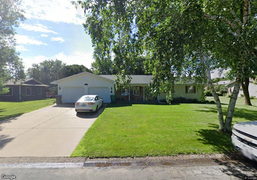
642 S Hill Dr New Richmond, WI 54017
Estimated Value: $313,000 - $353,000
3
Beds
2
Baths
--
Sq Ft
0.34
Acres
About This Home
This home is located at 642 S Hill Dr, New Richmond, WI 54017 and is currently estimated at $339,295. 642 S Hill Dr is a home located in St. Croix County with nearby schools including New Richmond High School and St. Mary School.
Ownership History
Date
Name
Owned For
Owner Type
Purchase Details
Closed on
Sep 12, 2017
Sold by
Lunning Chad W and Lunning Ashley M
Bought by
Engelhart Martin Todd and Engelhart Martin Sarah
Current Estimated Value
Purchase Details
Closed on
Jul 31, 2014
Sold by
Cederholm Jerald E and Cederholm Patricia M
Bought by
Lunning Chad W and Lunning Ashley M
Home Financials for this Owner
Home Financials are based on the most recent Mortgage that was taken out on this home.
Original Mortgage
$163,400
Interest Rate
4.19%
Mortgage Type
New Conventional
Create a Home Valuation Report for This Property
The Home Valuation Report is an in-depth analysis detailing your home's value as well as a comparison with similar homes in the area
Home Values in the Area
Average Home Value in this Area
Purchase History
| Date | Buyer | Sale Price | Title Company |
|---|---|---|---|
| Engelhart Martin Todd | $220,900 | -- | |
| Lunning Chad W | $172,000 | None Available |
Source: Public Records
Mortgage History
| Date | Status | Borrower | Loan Amount |
|---|---|---|---|
| Previous Owner | Lunning Chad W | $163,400 |
Source: Public Records
Tax History Compared to Growth
Tax History
| Year | Tax Paid | Tax Assessment Tax Assessment Total Assessment is a certain percentage of the fair market value that is determined by local assessors to be the total taxable value of land and additions on the property. | Land | Improvement |
|---|---|---|---|---|
| 2024 | $50 | $349,300 | $31,500 | $317,800 |
| 2023 | $4,695 | $344,000 | $31,500 | $312,500 |
| 2022 | $3,874 | $300,900 | $31,500 | $269,400 |
| 2021 | $4,150 | $258,900 | $31,500 | $227,400 |
| 2020 | $4,212 | $179,600 | $20,800 | $158,800 |
| 2019 | $4,011 | $179,600 | $20,800 | $158,800 |
| 2018 | $4,052 | $179,600 | $20,800 | $158,800 |
| 2017 | $3,892 | $179,600 | $20,800 | $158,800 |
| 2016 | $3,892 | $179,600 | $20,800 | $158,800 |
| 2015 | $3,958 | $179,600 | $20,800 | $158,800 |
| 2014 | $3,862 | $179,600 | $20,800 | $158,800 |
| 2013 | $3,785 | $179,600 | $20,800 | $158,800 |
Source: Public Records
Map
Nearby Homes
- 1208 Tierney Dr
- 1131 Alfred Place
- 1185 (Lot 2) Wisteria Ln
- 1448 Valley Creek Dr
- 572 Williamsburg Place
- 1575 Evan Ct
- 1203 Poppy Ct
- 1187 Wisteria Ln
- 1186 Wisteria Ln
- 1389 Mallard Ln
- 425 Paperjack Dr
- 1202 Poppy Ct
- 1102 Highpoint Ct
- 1104 Balsam Ct Unit 20B
- 1600 Hallewood Blvd
- 524 Cassandra Dr Unit 44
- 659 Park Ave
- 1336 Orchid Way
- 1350 Orchid Way
- Arlow Plan at Meadow Crossing
- 650 S Hill Dr
- 620 S Hill Dr
- 1287 Meadowlark Ln
- 1277 Meadowlark Ln
- 1303 Meadowlark Ln
- 653 S Hill Dr
- 608 S Hill Dr
- 664 S Hill Dr
- 1322 Bilmar Ave
- 1315 Meadowlark Ln
- 661 S Hill Dr
- 1263 Meadowlark Ln
- 1312 Bilmar Ave
- 1300 Meadowlark Ln
- 1240 Bilmar Ave
- 674 S Hill Dr
- 1280 Meadowlark Ln
- 630 Parkview Dr
- 620 Parkview Dr