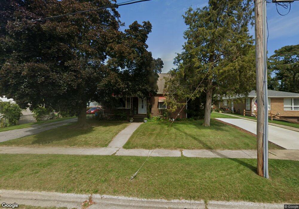
642 Saint Clair Ave Jackson, MI 49202
Lansing Avenue Heights NeighborhoodEstimated Value: $148,000 - $194,000
4
Beds
3
Baths
2,364
Sq Ft
$72/Sq Ft
Est. Value
About This Home
This home is located at 642 Saint Clair Ave, Jackson, MI 49202 and is currently estimated at $170,705, approximately $72 per square foot. 642 Saint Clair Ave is a home located in Jackson County with nearby schools including Hunt Elementary School, Middle School at Parkside, and Jackson High School.
Ownership History
Date
Name
Owned For
Owner Type
Purchase Details
Closed on
Feb 7, 2006
Sold by
Bloxom Mary G and Bloxom Ronald
Bought by
Bloxom Mary G and Mckenzie Christine R
Current Estimated Value
Purchase Details
Closed on
Jan 28, 2005
Sold by
Bloxom Mary G and Bloxom Ronald
Bought by
Bloxom Ronald and Bloxom Mary G
Purchase Details
Closed on
Dec 1, 2003
Sold by
Thomas Dorothy Lowe and Nethercott Leila P
Bought by
Bloxom Ronald and Bloxom Mary Rene
Home Financials for this Owner
Home Financials are based on the most recent Mortgage that was taken out on this home.
Original Mortgage
$110,000
Outstanding Balance
$51,434
Interest Rate
6.01%
Mortgage Type
Purchase Money Mortgage
Estimated Equity
$119,271
Create a Home Valuation Report for This Property
The Home Valuation Report is an in-depth analysis detailing your home's value as well as a comparison with similar homes in the area
Home Values in the Area
Average Home Value in this Area
Purchase History
| Date | Buyer | Sale Price | Title Company |
|---|---|---|---|
| Bloxom Mary G | -- | None Available | |
| Bloxom Ronald | -- | -- | |
| Bloxom Ronald | $140,000 | -- |
Source: Public Records
Mortgage History
| Date | Status | Borrower | Loan Amount |
|---|---|---|---|
| Open | Bloxom Ronald | $110,000 |
Source: Public Records
Tax History
| Year | Tax Paid | Tax Assessment Tax Assessment Total Assessment is a certain percentage of the fair market value that is determined by local assessors to be the total taxable value of land and additions on the property. | Land | Improvement |
|---|---|---|---|---|
| 2025 | $1,822 | $66,100 | $0 | $0 |
| 2024 | $15 | $59,100 | $0 | $0 |
| 2023 | $1,432 | $45,200 | $0 | $0 |
| 2022 | $1,670 | $45,700 | $0 | $0 |
| 2021 | $1,666 | $41,650 | $0 | $0 |
| 2020 | $1,649 | $42,700 | $0 | $0 |
| 2019 | $1,600 | $30,700 | $0 | $0 |
| 2018 | $1,694 | $36,200 | $0 | $0 |
| 2017 | $1,515 | $32,950 | $0 | $0 |
| 2016 | $1,229 | $32,700 | $32,700 | $0 |
| 2015 | $1,465 | $34,750 | $34,750 | $0 |
| 2014 | $1,465 | $33,400 | $0 | $0 |
| 2013 | -- | $33,400 | $33,400 | $0 |
Source: Public Records
Map
Nearby Homes
- 735 Royal Dr
- 1105 Clinton Rd
- 951 W Monroe St
- 550 Royal Dr
- 520 Andrew Ave
- 431 Madison St
- 1012 Lansing Ave
- 939 Backus St
- 919 Lincoln St
- 0 Shirley Dr Unit 24064060
- 828 Backus St
- 833 Backus St
- 718 Center St
- 319 W North St
- 1802 W Argyle St
- 923 Wayne St
- 713 Webb St
- 1422 Cooper St
- 1114 Hamilton St
- 1135 Hamilton St
- 638 Saint Clair Ave
- 644 St Clair
- 636 Saint Clair Ave
- 636 St Clair
- 634 Saint Clair Ave
- 661 Sparks St
- 657 Sparks St
- 665 Sparks St
- 669 Sparks St
- 632 Saint Clair Ave
- 632 St Clair St
- 649 Sparks St
- 675 Sparks St
- 637 Saint Clair Ave
- 1509 N West Ave
- 628 Saint Clair Ave
- 643 Sparks St
- 624 Saint Clair Ave
- 635 Sparks St
- 658 Sparks St
Your Personal Tour Guide
Ask me questions while you tour the home.