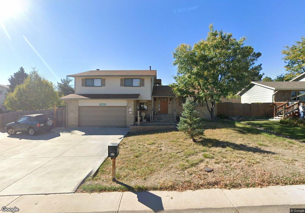
642 Scorpio Dr Lone Tree, CO 80124
Estimated Value: $576,228 - $622,000
4
Beds
3
Baths
2,150
Sq Ft
$279/Sq Ft
Est. Value
About This Home
This home is located at 642 Scorpio Dr, Lone Tree, CO 80124 and is currently estimated at $599,114, approximately $278 per square foot. 642 Scorpio Dr is a home located in Douglas County with nearby schools including Acres Green Elementary School, Cresthill Middle School, and Highlands Ranch High School.
Ownership History
Date
Name
Owned For
Owner Type
Purchase Details
Closed on
Jul 29, 1999
Sold by
Metzger Richard S and Metzger Leanne A
Bought by
Prang Ronald T and Prang Lorna L
Current Estimated Value
Home Financials for this Owner
Home Financials are based on the most recent Mortgage that was taken out on this home.
Original Mortgage
$79,900
Outstanding Balance
$21,262
Interest Rate
7.65%
Estimated Equity
$577,852
Purchase Details
Closed on
Jul 15, 1998
Sold by
Pittock Charles M and Pittock Esther L
Bought by
Metzger Richard S and Metzger Leanne A
Home Financials for this Owner
Home Financials are based on the most recent Mortgage that was taken out on this home.
Original Mortgage
$118,000
Interest Rate
7.09%
Purchase Details
Closed on
Sep 1, 1977
Sold by
Klafl John F and Klafl Marilyn A
Bought by
Pittock Charles M and Pittock Esther L
Create a Home Valuation Report for This Property
The Home Valuation Report is an in-depth analysis detailing your home's value as well as a comparison with similar homes in the area
Home Values in the Area
Average Home Value in this Area
Purchase History
| Date | Buyer | Sale Price | Title Company |
|---|---|---|---|
| Prang Ronald T | $189,900 | -- | |
| Metzger Richard S | $168,000 | Land Title | |
| Pittock Charles M | $56,000 | -- |
Source: Public Records
Mortgage History
| Date | Status | Borrower | Loan Amount |
|---|---|---|---|
| Open | Prang Ronald T | $79,900 | |
| Previous Owner | Metzger Richard S | $118,000 |
Source: Public Records
Tax History
| Year | Tax Paid | Tax Assessment Tax Assessment Total Assessment is a certain percentage of the fair market value that is determined by local assessors to be the total taxable value of land and additions on the property. | Land | Improvement |
|---|---|---|---|---|
| 2025 | $2,848 | $35,470 | $6,420 | $29,050 |
| 2024 | $2,848 | $41,410 | $7,580 | $33,830 |
| 2023 | $2,877 | $41,410 | $7,580 | $33,830 |
| 2022 | $2,116 | $30,700 | $6,430 | $24,270 |
| 2021 | $2,200 | $30,700 | $6,430 | $24,270 |
| 2020 | $1,992 | $29,200 | $6,110 | $23,090 |
| 2019 | $1,999 | $29,200 | $6,110 | $23,090 |
| 2018 | $1,505 | $24,970 | $5,340 | $19,630 |
| 2017 | $1,529 | $24,970 | $5,340 | $19,630 |
| 2016 | $1,245 | $22,120 | $3,620 | $18,500 |
| 2015 | $1,273 | $22,120 | $3,620 | $18,500 |
| 2014 | $519 | $18,780 | $3,980 | $14,800 |
Source: Public Records
Map
Nearby Homes
- 13226 Canopus Dr
- 219 Dianna Dr
- 181 Dianna Dr
- 8852 Chestnut Hill Ln
- 789 Mercury Cir
- 130 Dianna Dr
- 8047 E Phillips Cir
- 128 Olympus Cir
- 8170 S Tamarac St
- 8159 Lodgepole Trail
- 8049 Sweet Water Rd
- 8214 Lodgepole Trail
- 8739 E Otero Cir
- 8341 E Otero Cir
- 6823 Edgewood Place
- 8860 Kachina Way
- 8558 Gold Peak Ln Unit B
- 8631 E Otero Place
- 8540 Gold Peak Ln Unit C
- 8822 Fiesta Terrace
- 652 Scorpio Dr
- 13541 Virgo Dr
- 622 Scorpio Dr
- 13531 Virgo Dr
- 639 Scorpio Dr
- 13566 Omega Cir
- 629 Scorpio Dr
- 13552 Virgo Dr
- 13546 Omega Cir
- 649 Scorpio Dr
- 619 Scorpio Dr
- 13526 Omega Cir
- 659 Scorpio Dr
- 13617 Pisces Ct
- 13524 Virgo Dr
- 13521 Virgo Dr
- 13516 Omega Cir
- 13611 Pisces Ct
- 13621 Pisces Ct
- 13618 Omega Cir
Your Personal Tour Guide
Ask me questions while you tour the home.