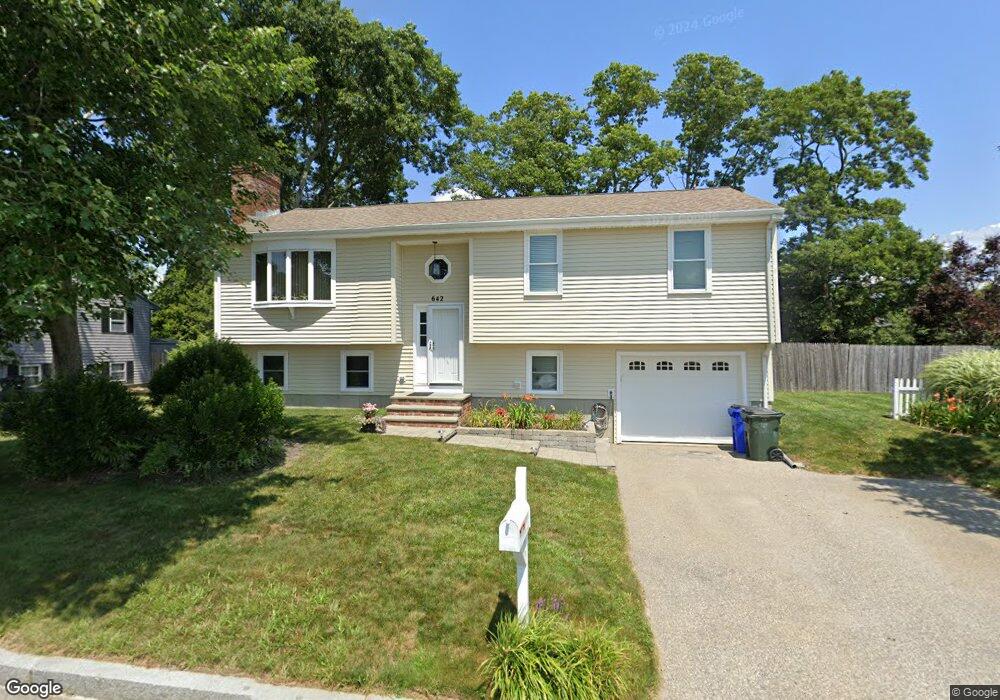
642 Spencer St Fall River, MA 02721
Maplewood NeighborhoodEstimated Value: $481,000 - $625,000
3
Beds
2
Baths
1,552
Sq Ft
$335/Sq Ft
Est. Value
About This Home
This home is located at 642 Spencer St, Fall River, MA 02721 and is currently estimated at $520,011, approximately $335 per square foot. 642 Spencer St is a home located in Bristol County with nearby schools including Letourneau Elementary School, Matthew J. Kuss Middle School, and B M C Durfee High School.
Ownership History
Date
Name
Owned For
Owner Type
Purchase Details
Closed on
May 18, 1995
Sold by
Spencer Rt and Mello Wayne
Bought by
Odriscoll David W and Odriscoll Joyce A
Current Estimated Value
Home Financials for this Owner
Home Financials are based on the most recent Mortgage that was taken out on this home.
Original Mortgage
$55,000
Interest Rate
8.34%
Mortgage Type
Purchase Money Mortgage
Create a Home Valuation Report for This Property
The Home Valuation Report is an in-depth analysis detailing your home's value as well as a comparison with similar homes in the area
Home Values in the Area
Average Home Value in this Area
Purchase History
| Date | Buyer | Sale Price | Title Company |
|---|---|---|---|
| Odriscoll David W | $129,000 | -- |
Source: Public Records
Mortgage History
| Date | Status | Borrower | Loan Amount |
|---|---|---|---|
| Open | Odriscoll David W | $58,500 | |
| Closed | Odriscoll David W | $20,000 | |
| Closed | Odriscoll David W | $55,000 | |
| Previous Owner | Odriscoll David W | $100,000 |
Source: Public Records
Tax History
| Year | Tax Paid | Tax Assessment Tax Assessment Total Assessment is a certain percentage of the fair market value that is determined by local assessors to be the total taxable value of land and additions on the property. | Land | Improvement |
|---|---|---|---|---|
| 2025 | $4,609 | $402,500 | $133,200 | $269,300 |
| 2024 | $4,126 | $359,100 | $128,200 | $230,900 |
| 2023 | $4,215 | $343,500 | $122,000 | $221,500 |
| 2022 | $3,709 | $293,900 | $113,000 | $180,900 |
| 2021 | $3,834 | $277,200 | $112,800 | $164,400 |
| 2020 | $3,725 | $257,800 | $106,500 | $151,300 |
| 2019 | $3,724 | $255,400 | $104,600 | $150,800 |
| 2018 | $3,582 | $245,000 | $104,600 | $140,400 |
| 2017 | $3,371 | $240,800 | $101,500 | $139,300 |
| 2016 | $3,192 | $234,200 | $101,500 | $132,700 |
| 2015 | $2,936 | $224,500 | $101,500 | $123,000 |
| 2014 | $2,824 | $224,500 | $101,500 | $123,000 |
Source: Public Records
Map
Nearby Homes
- 658 Spencer St
- 667 Dickinson St
- 624 Spencer St
- 676 Spencer St
- 615 Dickinson St
- 614 Spencer St
- 679 Dickinson St
- 591 Dickinson St
- 642 Dickinson St
- 620 Dickinson St
- 692 Spencer St
- 118 Fuller St
- 660 Dickinson St
- 571 Dickinson St
- 600 Dickinson St
- 596 Spencer St
- 555 Dickinson St
- 578 Dickinson St
- 696 Dickinson St
- 720 Spencer St
Your Personal Tour Guide
Ask me questions while you tour the home.