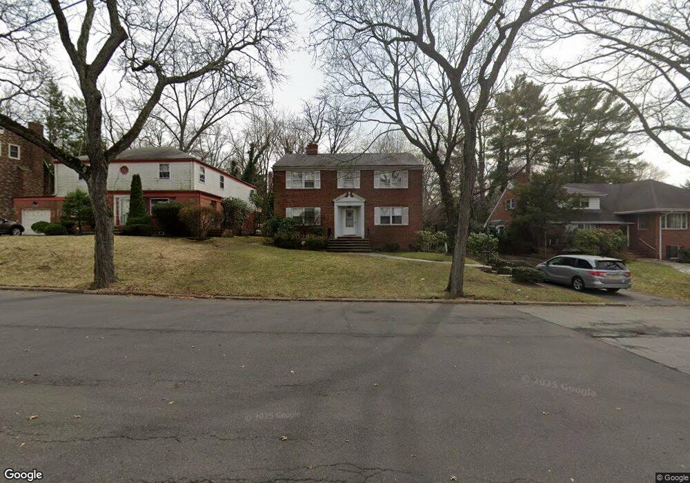
642 Sunderland Rd Teaneck, NJ 07666
Estimated Value: $1,075,465 - $1,450,000
--
Bed
--
Bath
2,928
Sq Ft
$438/Sq Ft
Est. Value
About This Home
This home is located at 642 Sunderland Rd, Teaneck, NJ 07666 and is currently estimated at $1,282,116, approximately $437 per square foot. 642 Sunderland Rd is a home located in Bergen County with nearby schools including Teaneck Senior High School, Teaneck Community Charter School, and Grace Lutheran School.
Ownership History
Date
Name
Owned For
Owner Type
Purchase Details
Closed on
Aug 25, 2004
Sold by
Kaszovitz Saul
Bought by
Piontnica Abraham and Piontnica Sandra
Current Estimated Value
Home Financials for this Owner
Home Financials are based on the most recent Mortgage that was taken out on this home.
Original Mortgage
$550,000
Interest Rate
5.71%
Purchase Details
Closed on
Jan 23, 1997
Sold by
Jacobs Hilda
Bought by
Kaszovitz Saul
Home Financials for this Owner
Home Financials are based on the most recent Mortgage that was taken out on this home.
Original Mortgage
$200,000
Interest Rate
7.6%
Create a Home Valuation Report for This Property
The Home Valuation Report is an in-depth analysis detailing your home's value as well as a comparison with similar homes in the area
Home Values in the Area
Average Home Value in this Area
Purchase History
| Date | Buyer | Sale Price | Title Company |
|---|---|---|---|
| Piontnica Abraham | $875,000 | -- | |
| Kaszovitz Saul | $370,000 | -- |
Source: Public Records
Mortgage History
| Date | Status | Borrower | Loan Amount |
|---|---|---|---|
| Previous Owner | Piontnica Abraham | $550,000 | |
| Previous Owner | Kaszovitz Saul | $200,000 |
Source: Public Records
Tax History Compared to Growth
Tax History
| Year | Tax Paid | Tax Assessment Tax Assessment Total Assessment is a certain percentage of the fair market value that is determined by local assessors to be the total taxable value of land and additions on the property. | Land | Improvement |
|---|---|---|---|---|
| 2025 | $20,064 | $918,700 | $407,200 | $511,500 |
| 2024 | $17,025 | $918,700 | $407,200 | $511,500 |
| 2023 | $16,690 | $515,600 | $243,600 | $272,000 |
| 2022 | $16,690 | $515,600 | $243,600 | $272,000 |
| 2021 | $16,788 | $515,600 | $243,600 | $272,000 |
| 2020 | $16,675 | $515,600 | $243,600 | $272,000 |
| 2019 | $16,484 | $515,600 | $243,600 | $272,000 |
| 2018 | $16,360 | $515,600 | $243,600 | $272,000 |
| 2017 | $16,205 | $515,600 | $243,600 | $272,000 |
| 2016 | $15,963 | $515,600 | $243,600 | $272,000 |
| 2015 | $15,710 | $515,600 | $243,600 | $272,000 |
| 2014 | $19,540 | $760,000 | $343,600 | $416,400 |
Source: Public Records
Map
Nearby Homes
- 711 Camperdown Rd
- 565 N Forest Dr
- 665 Northumberland Rd
- 506 Sunderland Rd
- 1106 Bromley Ave
- 654 Suffern Rd
- 526 Rutland Ave
- 700 Ramapo Rd
- 710 Ramapo Rd
- 606 Standish Rd
- 1329 Dickerson Rd
- 591 Warwick Ave
- 1105 Belle Ave
- 543 Sagamore Ave
- 536 Sagamore Ave
- 1328 Taft Rd
- 532 Winthrop Rd
- 364 Rutland Ave
- 364 Billington Rd
- 995 Grace Terrace
- 638 Sunderland Rd
- 648 Sunderland Rd
- 625 N Forest Dr
- 632 Sunderland Rd
- 633 Wilmerding Ave
- 621 N Forest Dr
- 654 Sunderland Rd
- 665 Camperdown Rd
- 626 Sunderland Rd
- 617 N Forest Dr
- 641 N Forest Dr
- 661 Sunderland Rd
- 1279 Somerset Rd
- 1280 Somerset Rd
- 662 Sunderland Rd
- 628 N Forest Dr
- 681 Camperdown Rd
- 1262 N Strand
- 673 Sunderland Rd
- 655 N Forest Dr