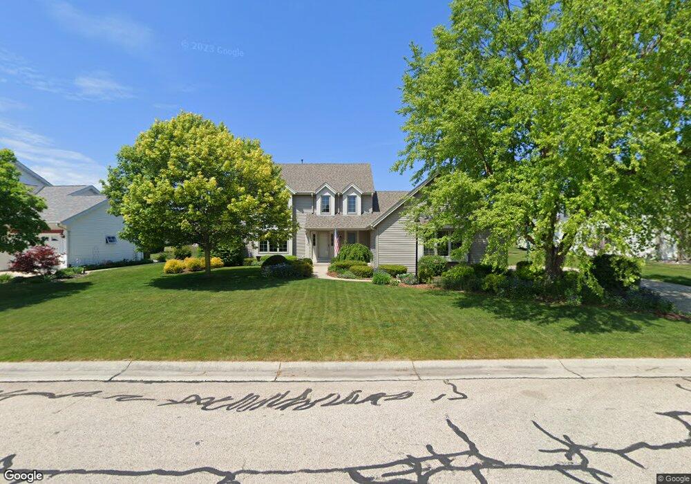
6420 Anforest Ln Mount Pleasant, WI 53406
Estimated Value: $462,384 - $518,000
3
Beds
3
Baths
2,222
Sq Ft
$223/Sq Ft
Est. Value
About This Home
This home is located at 6420 Anforest Ln, Mount Pleasant, WI 53406 and is currently estimated at $495,846, approximately $223 per square foot. 6420 Anforest Ln is a home located in Racine County with nearby schools including Gifford Elementary School, Case High School, and St. John Fisher Academy.
Ownership History
Date
Name
Owned For
Owner Type
Purchase Details
Closed on
Feb 23, 2007
Sold by
Allison Linda W and As May Be Amended F 09 1 As May Be Ame 09 1
Bought by
Trick Bradley R and Trick Jenny L
Current Estimated Value
Home Financials for this Owner
Home Financials are based on the most recent Mortgage that was taken out on this home.
Original Mortgage
$251,100
Outstanding Balance
$151,399
Interest Rate
6.28%
Mortgage Type
New Conventional
Estimated Equity
$344,447
Create a Home Valuation Report for This Property
The Home Valuation Report is an in-depth analysis detailing your home's value as well as a comparison with similar homes in the area
Home Values in the Area
Average Home Value in this Area
Purchase History
| Date | Buyer | Sale Price | Title Company |
|---|---|---|---|
| Trick Bradley R | $279,000 | -- |
Source: Public Records
Mortgage History
| Date | Status | Borrower | Loan Amount |
|---|---|---|---|
| Open | Trick Bradley R | $251,100 |
Source: Public Records
Tax History Compared to Growth
Tax History
| Year | Tax Paid | Tax Assessment Tax Assessment Total Assessment is a certain percentage of the fair market value that is determined by local assessors to be the total taxable value of land and additions on the property. | Land | Improvement |
|---|---|---|---|---|
| 2024 | $6,477 | $414,100 | $61,700 | $352,400 |
| 2023 | $6,267 | $389,800 | $57,500 | $332,300 |
| 2022 | $5,456 | $336,900 | $57,500 | $279,400 |
| 2021 | $5,689 | $313,100 | $52,300 | $260,800 |
| 2020 | $5,381 | $286,500 | $47,000 | $239,500 |
| 2019 | $5,134 | $286,500 | $47,000 | $239,500 |
| 2018 | $4,918 | $254,900 | $39,600 | $215,300 |
| 2017 | $4,878 | $248,200 | $39,600 | $208,600 |
| 2016 | $4,618 | $222,000 | $39,600 | $182,400 |
| 2015 | $4,578 | $222,000 | $39,600 | $182,400 |
| 2014 | $4,323 | $222,000 | $39,600 | $182,400 |
| 2013 | $4,653 | $222,000 | $39,600 | $182,400 |
Source: Public Records
Map
Nearby Homes
- 2421 Dover Ln
- 2314 Raintree Ln
- Weston Traditional Plan at Auburn Hills
- 3234 Blue Star Cir
- 3240 Blue Star Cir
- Kimberly Plan at Auburn Hills
- Thomas Plan at Auburn Hills
- Springfield Plan at Auburn Hills
- Oakland Plan at Auburn Hills
- 6130 Northwestern Ave
- 3232 Bergamot Dr
- 3242 Bergamot Dr
- 3306 Bergamont Dr
- 6147 Carriage Hills Dr
- 7136 Parkside Ln Unit 122
- 3605 Emmertsen Rd
- 3620 Fenceline Rd
- 7131 Fieldview Dr
- 5535 Sandy Ln
- 5402 Cynthia Ln
- 6410 Anforest Ln
- 6427 Norfolk Ln
- 6417 Norfolk Ln
- 6437 Norfolk Ln
- 6440 Anforest Ln
- 6423 Anforest Ln
- 6400 Anforest Ln
- 6413 Anforest Ln
- 6409 Norfolk Ln
- 6433 Anforest Ln
- 6447 Norfolk Ln
- 6403 Anforest Ln
- 6450 Anforest Ln
- 6410 Norfolk Ln
- 6430 Norfolk Ln
- 6443 Anforest Ln
- 6420 Norfolk Ln
- 6440 Norfolk Ln
- 6416 Wembly Ln
- 6424 Wembly Ln