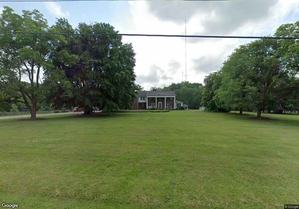
6420 Branson Davis Rd Randleman, NC 27317
Estimated Value: $518,000 - $874,000
6
Beds
6
Baths
5,081
Sq Ft
$133/Sq Ft
Est. Value
About This Home
This home is located at 6420 Branson Davis Rd, Randleman, NC 27317 and is currently estimated at $678,246, approximately $133 per square foot. 6420 Branson Davis Rd is a home located in Randolph County with nearby schools including New Market Elementary School, Randleman Middle School, and Randleman High School.
Ownership History
Date
Name
Owned For
Owner Type
Purchase Details
Closed on
Mar 29, 2006
Sold by
Davis Lester Eugene and Davis Sheila B
Bought by
Branch Banking & Trust Co
Current Estimated Value
Home Financials for this Owner
Home Financials are based on the most recent Mortgage that was taken out on this home.
Original Mortgage
$71,000
Interest Rate
5.84%
Mortgage Type
Stand Alone Second
Purchase Details
Closed on
Sep 26, 2005
Sold by
Davis Lester E and Davis Sheila B
Bought by
Countrywide Home Loans Inc and Banc Of America Mortgage Capital Corp
Create a Home Valuation Report for This Property
The Home Valuation Report is an in-depth analysis detailing your home's value as well as a comparison with similar homes in the area
Home Values in the Area
Average Home Value in this Area
Purchase History
| Date | Buyer | Sale Price | Title Company |
|---|---|---|---|
| Branch Banking & Trust Co | $51,980 | None Available | |
| Countrywide Home Loans Inc | $410,000 | -- |
Source: Public Records
Mortgage History
| Date | Status | Borrower | Loan Amount |
|---|---|---|---|
| Closed | Branch Banking & Trust Co | $71,000 |
Source: Public Records
Tax History Compared to Growth
Tax History
| Year | Tax Paid | Tax Assessment Tax Assessment Total Assessment is a certain percentage of the fair market value that is determined by local assessors to be the total taxable value of land and additions on the property. | Land | Improvement |
|---|---|---|---|---|
| 2025 | $3,453 | $531,190 | $88,290 | $442,900 |
| 2024 | $3,453 | $531,190 | $88,290 | $442,900 |
| 2023 | $3,453 | $531,190 | $88,290 | $442,900 |
| 2022 | $3,028 | $386,920 | $60,210 | $326,710 |
| 2021 | $3,028 | $386,920 | $60,210 | $326,710 |
| 2020 | $3,001 | $386,920 | $60,210 | $326,710 |
| 2019 | $3,001 | $386,920 | $60,210 | $326,710 |
| 2018 | $2,978 | $371,070 | $53,860 | $317,210 |
| 2016 | $2,889 | $371,065 | $53,860 | $317,205 |
| 2015 | $2,899 | $371,065 | $53,860 | $317,205 |
| 2014 | -- | $371,065 | $53,860 | $317,205 |
Source: Public Records
Map
Nearby Homes
- 0 Davis Country Rd
- 731 Frazier View Rd
- 2505 Banner Whitehead Rd
- 5355 Old Walker Mill Rd
- 5030 Branson Davis Rd
- 2060 Coltrane Mill Rd
- 0 Hughes Farm Rd Unit 1201373
- 6087 Old Walker Mill Rd
- 0 Tom Ball Rd
- 5421 Jesse Small Rd
- 0 Harlow Rd
- 0 Randleman Rd
- 9135 US Hwy 220 None N
- 5191 Island Ford Rd
- 6534 Frazier Marsh Rd
- 2994 Stanley Rd Unit 13
- 6802 Kerr Dr
- 5590 Old Cedar Square Rd
- 8434 Us Highway 311
- 00 Rolis Rd
- 6388 Branson Davis Rd
- 6447 Branson Davis Rd
- 6506 Branson Davis Rd
- 6465 Davis Country Rd
- 6489 Davis Country Rd
- 6419 Davis Country Rd
- 6459 Davis Country Rd
- 1396 Riverwood Rd
- 6319 Davis Country Rd
- 6293 Davis Country Rd
- 6332 Davis Country Rd
- 6281 Davis Country Rd
- 6261 Branson Davis Rd
- 6239 Davis Country Rd
- 5962 Gilbert Davis Dr
- 1342 Riverwood Rd
- 5952 Gilbert Davis Dr
- 6200 Branson Davis Rd
- 1308 Riverwood Rd
- 6736 Davis Country Rd