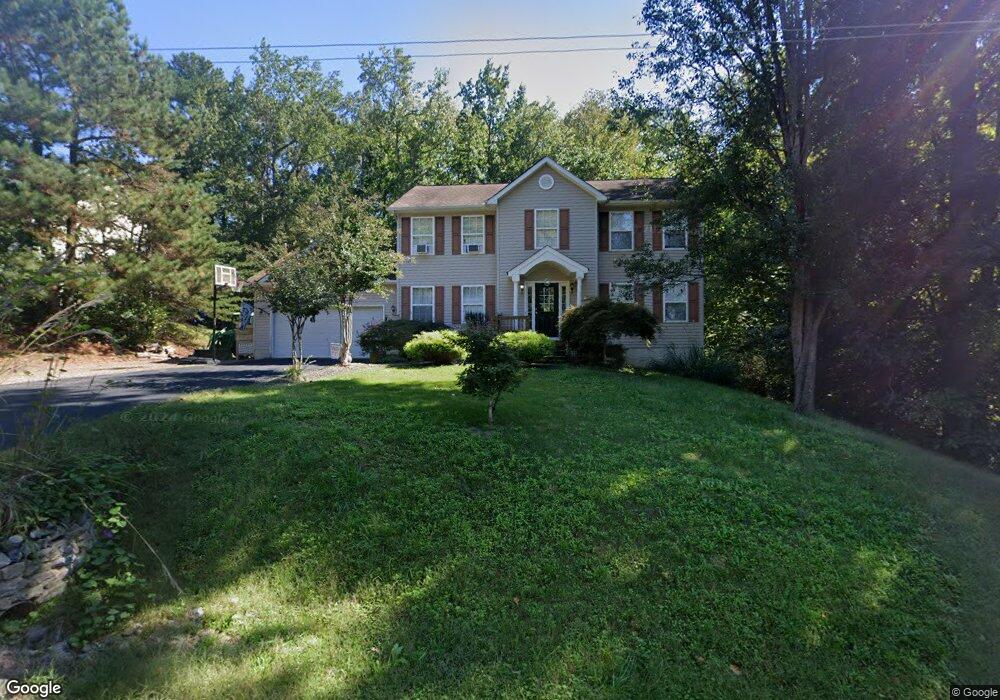
6420 Dawes Dr King George, VA 22485
Estimated Value: $466,000 - $552,000
4
Beds
4
Baths
2,864
Sq Ft
$181/Sq Ft
Est. Value
About This Home
This home is located at 6420 Dawes Dr, King George, VA 22485 and is currently estimated at $517,611, approximately $180 per square foot. 6420 Dawes Dr is a home located in King George County with nearby schools including Sealston Elementary School, King George Middle School, and King George High School.
Ownership History
Date
Name
Owned For
Owner Type
Purchase Details
Closed on
Feb 17, 2023
Sold by
Norris Paula C
Bought by
Norris Paula C and Norris John
Current Estimated Value
Purchase Details
Closed on
Jun 28, 2016
Sold by
Briggs William L and Briggs Joan C
Bought by
Briggs William L and Briggs Joan C
Purchase Details
Closed on
Jan 19, 2016
Sold by
Briggs William L and Briggs Joan C
Bought by
Briggs William L and Briggs Joan C
Purchase Details
Closed on
Nov 19, 2009
Sold by
Bank Of New York Mellon
Bought by
Briggs William L and Hancock Paula C
Home Financials for this Owner
Home Financials are based on the most recent Mortgage that was taken out on this home.
Original Mortgage
$220,924
Interest Rate
4.92%
Mortgage Type
FHA
Purchase Details
Closed on
Mar 26, 2009
Sold by
M E R S Inc
Bought by
Recontrust Co Na
Create a Home Valuation Report for This Property
The Home Valuation Report is an in-depth analysis detailing your home's value as well as a comparison with similar homes in the area
Home Values in the Area
Average Home Value in this Area
Purchase History
| Date | Buyer | Sale Price | Title Company |
|---|---|---|---|
| Norris Paula C | -- | None Listed On Document | |
| Briggs William L | -- | None Available | |
| Briggs William L | -- | None Available | |
| Briggs William L | $297,000 | -- | |
| Recontrust Co Na | $292,000 | -- |
Source: Public Records
Mortgage History
| Date | Status | Borrower | Loan Amount |
|---|---|---|---|
| Previous Owner | Briggs William L | $220,924 |
Source: Public Records
Tax History Compared to Growth
Tax History
| Year | Tax Paid | Tax Assessment Tax Assessment Total Assessment is a certain percentage of the fair market value that is determined by local assessors to be the total taxable value of land and additions on the property. | Land | Improvement |
|---|---|---|---|---|
| 2025 | $3,282 | $482,700 | $55,000 | $427,700 |
| 2024 | $3,282 | $482,700 | $55,000 | $427,700 |
| 2023 | $3,282 | $482,700 | $55,000 | $427,700 |
| 2022 | $3,089 | $482,700 | $55,000 | $427,700 |
| 2021 | $2,124 | $290,900 | $51,000 | $239,900 |
| 2020 | $2,036 | $290,900 | $51,000 | $239,900 |
| 2019 | $2,036 | $290,900 | $51,000 | $239,900 |
| 2018 | $2,036 | $290,900 | $51,000 | $239,900 |
| 2017 | $1,918 | $274,000 | $51,000 | $223,000 |
| 2016 | $1,863 | $274,000 | $51,000 | $223,000 |
| 2015 | -- | $274,000 | $51,000 | $223,000 |
| 2014 | -- | $274,000 | $51,000 | $223,000 |
Source: Public Records
Map
Nearby Homes
- 6391 Wheeler Dr
- 6193 Wheeler Dr
- 6234 Wheeler Dr
- 6077 Hamlin Cir
- LOT 117 Colfax Dr
- 8477 Colfax Dr
- 9065 Dallas Ct
- 8438 Colfax Dr
- 0 Belle Dr Unit VAKG2006212
- 9397 Inaugural Dr
- 7224 Washington Dr
- 7512 Marmion Ln
- 0 Jefferson Dr Unit VAKG2006130
- Lot 24 Compass Ct
- 7504 Cleveland Dr
- 7369 Buchanan Dr
- 0 Dahlgren Rd
- 8314 Myrtle Ln
- LOT 2 Caledon Rd
- 0 Fairview Dr
- 6406 Dawes Dr
- 0 Dawes Dr Unit KG6758594
- 6388 Dawes Dr
- 6448 Dawes Dr
- 8538 Tompkins Dr
- 6451 Dawes Dr
- 6376 Dawes Dr
- 8521 Tompkins Dr
- 8532 Tompkins Dr
- 6389 Dawes Dr
- 8452 Reagan Dr
- 8479 Reagan Dr
- 8487 Reagan Dr
- 8493 Reagan Dr
- 6360 Dawes Dr
- 8463 Reagan Dr
- 8505 Reagan Dr
- 8505 RM 2 Reagan Dr
- 8505 RM 3 Reagan Dr
- 8505 RM 1 Reagan Dr