Estimated Value: $275,000 - $394,000
3
Beds
2
Baths
1,849
Sq Ft
$183/Sq Ft
Est. Value
About This Home
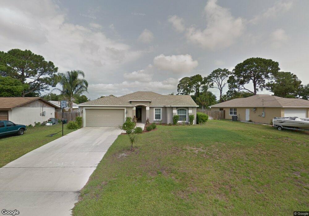
This home is located at 6420 Hudson Rd, Cocoa, FL 32927 and is currently estimated at $339,106, approximately $183 per square foot. 6420 Hudson Rd is a home located in Brevard County with nearby schools including Enterprise Elementary School, Space Coast Junior/Senior High School, and East Atlantic Prep of Brevard County.
Ownership History
Date
Name
Owned For
Owner Type
Purchase Details
Closed on
Mar 17, 2004
Sold by
Nottage Ramona L and Nottage Charlton
Bought by
Nottage Charlton and Nottage Ramona L
Current Estimated Value
Home Financials for this Owner
Home Financials are based on the most recent Mortgage that was taken out on this home.
Original Mortgage
$127,000
Outstanding Balance
$59,146
Interest Rate
5.62%
Estimated Equity
$279,960
Purchase Details
Closed on
Feb 17, 1999
Sold by
Anderson Abron and Anderson Ramona L
Bought by
Anderson Ramona L
Create a Home Valuation Report for This Property
The Home Valuation Report is an in-depth analysis detailing your home's value as well as a comparison with similar homes in the area
Home Values in the Area
Average Home Value in this Area
Purchase History
| Date | Buyer | Sale Price | Title Company |
|---|---|---|---|
| Nottage Charlton | -- | Titlecorp Of Florida | |
| Anderson Ramona L | -- | -- |
Source: Public Records
Mortgage History
| Date | Status | Borrower | Loan Amount |
|---|---|---|---|
| Open | Nottage Charlton | $127,000 |
Source: Public Records
Tax History
| Year | Tax Paid | Tax Assessment Tax Assessment Total Assessment is a certain percentage of the fair market value that is determined by local assessors to be the total taxable value of land and additions on the property. | Land | Improvement |
|---|---|---|---|---|
| 2025 | $4,292 | $292,950 | -- | -- |
| 2024 | $4,124 | $295,660 | -- | -- |
| 2023 | $4,124 | $283,800 | $0 | $0 |
| 2022 | $3,706 | $263,260 | $0 | $0 |
| 2021 | $3,445 | $209,380 | $42,000 | $167,380 |
| 2020 | $3,178 | $190,090 | $40,000 | $150,090 |
| 2019 | $1,296 | $95,120 | $0 | $0 |
| 2018 | $1,288 | $93,350 | $0 | $0 |
| 2017 | $1,279 | $91,430 | $0 | $0 |
| 2016 | $1,280 | $89,550 | $18,000 | $71,550 |
| 2015 | $1,295 | $88,930 | $15,000 | $73,930 |
| 2014 | $1,296 | $88,230 | $11,000 | $77,230 |
Source: Public Records
Map
Nearby Homes
- 6438 Hudson Rd
- 5601 Banos Ave
- 5680 Banos Ave
- 6481 La Brea Ave
- 5721 Beaverbrook St
- 6450 Ember Ave
- 6581 Bancroft Ave
- 6615 Dock Ave
- 5220 Holden Rd
- 5215 Holden Rd
- 6643 Emil Ave
- 5221 Carrick Rd
- 00 Unknown
- 0 Aruin St Unit 1222557
- 6460 Ainsworth Rd
- 6250 Ainsworth Rd
- 5946 Deer Ln
- 5945 Coker Ave
- 6020 Cannon Ave
- 23-35-21-JX-B-2 Aruin St
- 6414 Hudson Rd
- 6426 Hudson Rd
- 6365 Irving Rd
- 6432 Hudson Rd
- 6408 Hudson Rd
- 6415 Hudson Rd
- 6351 Irving Rd
- 6409 Hudson Rd
- 6433 Hudson Rd
- 6345 Irving Rd
- 6377 Irving Rd
- 6403 Hudson Rd
- 6444 Hudson Rd
- 6370 Irving Rd
- 6360 Irving Rd
- 6435 Hudson Rd
- 6396 Hudson Rd
- 6333 Irving Rd Unit 4
- 6333 Irving Rd
- 6397 Hudson Rd
Your Personal Tour Guide
Ask me questions while you tour the home.