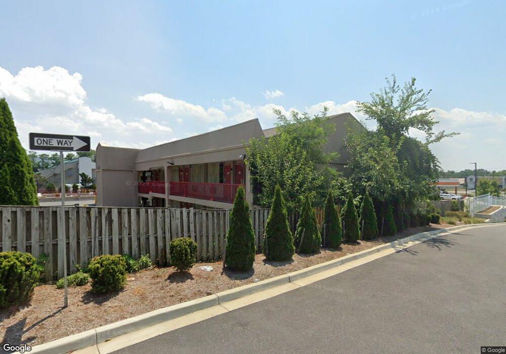
6422 Baltimore National Pike Baltimore, MD 21228
Estimated Value: $4,619,835
--
Bed
--
Bath
--
Sq Ft
2.36
Acres
About This Home
This home is located at 6422 Baltimore National Pike, Baltimore, MD 21228 and is currently estimated at $4,619,835. 6422 Baltimore National Pike is a home located in Baltimore County with nearby schools including Woodbridge Elementary School, Southwest Academy, and Woodlawn High School.
Ownership History
Date
Name
Owned For
Owner Type
Purchase Details
Closed on
May 6, 1994
Sold by
40142 General Partnership
Bought by
Shri Shiva Corporation
Current Estimated Value
Purchase Details
Closed on
Jan 26, 1989
Sold by
Berman Allan L Berman Jean R
Bought by
40142 General Partnership
Create a Home Valuation Report for This Property
The Home Valuation Report is an in-depth analysis detailing your home's value as well as a comparison with similar homes in the area
Home Values in the Area
Average Home Value in this Area
Purchase History
| Date | Buyer | Sale Price | Title Company |
|---|---|---|---|
| Shri Shiva Corporation | $1,115,000 | -- | |
| 40142 General Partnership | $241,600 | -- |
Source: Public Records
Tax History Compared to Growth
Tax History
| Year | Tax Paid | Tax Assessment Tax Assessment Total Assessment is a certain percentage of the fair market value that is determined by local assessors to be the total taxable value of land and additions on the property. | Land | Improvement |
|---|---|---|---|---|
| 2025 | $113,821 | $3,319,000 | $664,800 | $2,654,200 |
| 2024 | $113,821 | $3,882,300 | $664,800 | $3,217,500 |
| 2023 | $44,329 | $4,000,000 | $664,800 | $3,335,200 |
| 2022 | $41,855 | $4,000,000 | $664,800 | $3,335,200 |
| 2021 | $77,779 | $4,259,400 | $664,800 | $3,594,600 |
| 2020 | $77,779 | $4,427,500 | $664,800 | $3,762,700 |
| 2019 | $85,553 | $4,446,733 | $0 | $0 |
| 2018 | $63,980 | $3,305,067 | $0 | $0 |
| 2017 | $69,881 | $2,163,400 | $0 | $0 |
| 2016 | $47,328 | $2,075,600 | $0 | $0 |
| 2015 | $47,328 | $1,987,800 | $0 | $0 |
| 2014 | $47,328 | $1,900,000 | $0 | $0 |
Source: Public Records
Map
Nearby Homes
- 1109 Pomelo Ct
- 6263 Gilston Park Rd
- 2100 Chantilla Rd
- 627 Meyers Dr Unit PARCEL 108
- 627 Meyers Dr
- 18 Upman Ct
- 1916 Old Frederick Rd
- 2208 W Geipe Rd
- 1013 Cummings Ave
- 1019 Cummings Ave
- 1111 Cummings Ave
- 1108 Handy Ave
- 1914 Windys Run Rd
- 2229 W Geipe Rd
- 2124 Chantilla Rd
- 353 N Beaumont Ave
- 2120 Cedar Circle Dr
- 6200 Gilston Park Rd
- 437 Neepier Rd
- 343 N Beaumont Ave
- 6424 Baltimore National Pike
- 6402 Baltimore National Pike
- 6408 Baltimore National Pike
- 6430 Baltimore National Pike
- 1942 Powers Ln
- 6400 Baltimore National Pike
- 6440 Baltimore National Pike
- 1934 Powers Ln
- 6338 Baltimore National Pike
- 1931 Powers Ln
- 6336 Baltimore National Pike
- 6427 Baltimore National Pike
- 6405 Baltimore National Pike
- 1932 Powers Ln
- 6415 Baltimore National Pike
- 6332 Baltimore National Pike
- 6335 Baltimore National Pike
- 6456 Baltimore National Pike
- 1928 Powers Ln
- 6328 Baltimore National Pike