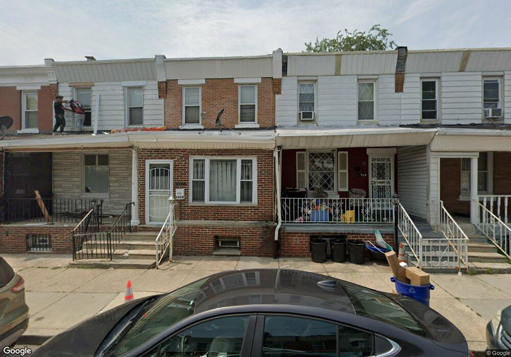
6424 N Lambert St Philadelphia, PA 19138
East Germantown NeighborhoodEstimated Value: $164,792 - $187,000
3
Beds
1
Bath
1,110
Sq Ft
$156/Sq Ft
Est. Value
About This Home
This home is located at 6424 N Lambert St, Philadelphia, PA 19138 and is currently estimated at $173,698, approximately $156 per square foot. 6424 N Lambert St is a home located in Philadelphia County with nearby schools including Prince Hall School, Gen. Louis Wagner Middle School, and Martin Luther King High School.
Ownership History
Date
Name
Owned For
Owner Type
Purchase Details
Closed on
Aug 25, 2000
Sold by
Stockton Oliver Barbara J and Stockton Barbara J
Bought by
Vanburen Ericka S
Current Estimated Value
Home Financials for this Owner
Home Financials are based on the most recent Mortgage that was taken out on this home.
Original Mortgage
$43,239
Outstanding Balance
$15,176
Interest Rate
7.96%
Mortgage Type
FHA
Estimated Equity
$158,522
Create a Home Valuation Report for This Property
The Home Valuation Report is an in-depth analysis detailing your home's value as well as a comparison with similar homes in the area
Home Values in the Area
Average Home Value in this Area
Purchase History
| Date | Buyer | Sale Price | Title Company |
|---|---|---|---|
| Vanburen Ericka S | $43,900 | -- |
Source: Public Records
Mortgage History
| Date | Status | Borrower | Loan Amount |
|---|---|---|---|
| Open | Vanburen Ericka S | $43,239 |
Source: Public Records
Tax History Compared to Growth
Tax History
| Year | Tax Paid | Tax Assessment Tax Assessment Total Assessment is a certain percentage of the fair market value that is determined by local assessors to be the total taxable value of land and additions on the property. | Land | Improvement |
|---|---|---|---|---|
| 2026 | $1,621 | $153,300 | $30,660 | $122,640 |
| 2025 | $1,621 | $153,300 | $30,660 | $122,640 |
| 2024 | $1,621 | $153,300 | $30,660 | $122,640 |
| 2023 | $1,621 | $115,800 | $23,160 | $92,640 |
| 2022 | $539 | $70,800 | $23,160 | $47,640 |
| 2021 | $1,169 | $0 | $0 | $0 |
| 2020 | $1,169 | $0 | $0 | $0 |
| 2019 | $1,221 | $0 | $0 | $0 |
| 2018 | $1,169 | $0 | $0 | $0 |
| 2017 | $1,169 | $0 | $0 | $0 |
| 2016 | $749 | $0 | $0 | $0 |
| 2015 | $809 | $0 | $0 | $0 |
| 2014 | -- | $90,400 | $7,410 | $82,990 |
| 2012 | -- | $9,440 | $1,282 | $8,158 |
Source: Public Records
Map
Nearby Homes
- 6420 N Woodstock St
- 1914 W 65th Ave
- 6321 N 21st St
- 2012 E Chelten Ave
- 6329 N Beechwood St
- 6329 N Woodstock St
- 6419 Limekiln Pike
- 2105 Stenton Ave
- 6308 N Norwood St
- 6531 N Beechwood St
- 2115 Stenton Ave
- 2125 Stenton Ave
- 2120 66th Ave
- 6558 Limekiln Pike
- 6436 N 20th St
- 6240 N 21st St
- 5725 Crittenden St
- 2152 Stenton Ave
- 6603 N 21st St
- 1226 E Chelten Ave
- 6420 N Lambert St
- 6422 N Lambert St
- 6418 N Lambert St
- 6416 N Lambert St
- 6414 N Lambert St
- 6426 N Lambert St
- 6412 N Lambert St
- 6428 N Lambert St
- 6410 N Lambert St
- 6430 N Lambert St
- 6408 N Lambert St
- 6432 N Lambert St
- 6423 N 21st St
- 6417 N 21st St
- 6425 N 21st St
- 6415 N 21st St
- 6421 N Lambert St
- 6419 N 21st St
- 6429 N 21st St
- 6427 N 21st St