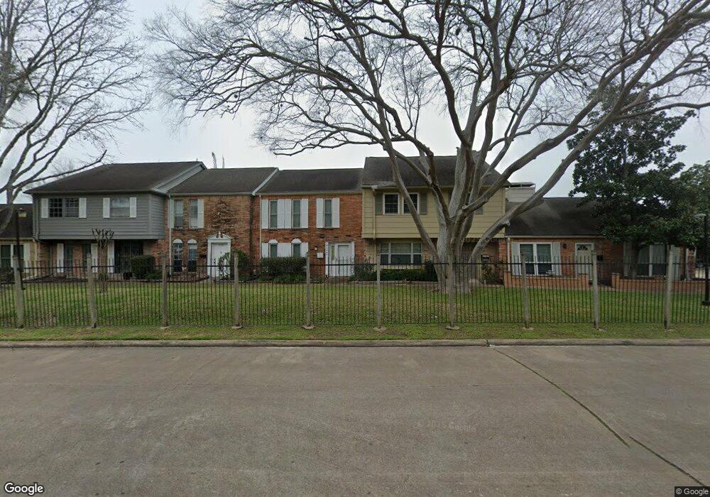
6426 Bankside Dr Unit 14 Houston, TX 77096
Brays Oaks NeighborhoodEstimated Value: $117,000 - $139,000
2
Beds
2
Baths
1,116
Sq Ft
$115/Sq Ft
Est. Value
About This Home
This home is located at 6426 Bankside Dr Unit 14, Houston, TX 77096 and is currently estimated at $128,694, approximately $115 per square foot. 6426 Bankside Dr Unit 14 is a home located in Harris County with nearby schools including Tinsley Elementary School, Fondren Middle School, and Westbury High School.
Ownership History
Date
Name
Owned For
Owner Type
Purchase Details
Closed on
Mar 1, 2016
Sold by
Muhammad Jayvon and Isaacs Desjunae
Bought by
Kuntz Mary Catherine
Current Estimated Value
Home Financials for this Owner
Home Financials are based on the most recent Mortgage that was taken out on this home.
Original Mortgage
$50,000
Outstanding Balance
$30,907
Interest Rate
3.81%
Mortgage Type
New Conventional
Estimated Equity
$97,787
Purchase Details
Closed on
Feb 15, 2006
Sold by
Keco Llc
Bought by
Muhammad Jayvon
Purchase Details
Closed on
Sep 21, 2005
Sold by
Compass Bank
Bought by
Keco Llc
Purchase Details
Closed on
Apr 14, 1999
Sold by
Binder Paul and Binder Marlyn
Bought by
Grigsby Leslie Lee
Home Financials for this Owner
Home Financials are based on the most recent Mortgage that was taken out on this home.
Original Mortgage
$35,400
Interest Rate
7.06%
Create a Home Valuation Report for This Property
The Home Valuation Report is an in-depth analysis detailing your home's value as well as a comparison with similar homes in the area
Home Values in the Area
Average Home Value in this Area
Purchase History
| Date | Buyer | Sale Price | Title Company |
|---|---|---|---|
| Kuntz Mary Catherine | $50,000 | None Available | |
| Muhammad Jayvon | -- | Alamo Title Company | |
| Keco Llc | -- | Austin Title Company | |
| Grigsby Leslie Lee | -- | Fidelity National Title |
Source: Public Records
Mortgage History
| Date | Status | Borrower | Loan Amount |
|---|---|---|---|
| Open | Kuntz Mary Catherine | $50,000 | |
| Previous Owner | Grigsby Leslie Lee | $35,400 |
Source: Public Records
Tax History Compared to Growth
Tax History
| Year | Tax Paid | Tax Assessment Tax Assessment Total Assessment is a certain percentage of the fair market value that is determined by local assessors to be the total taxable value of land and additions on the property. | Land | Improvement |
|---|---|---|---|---|
| 2025 | $2,332 | $114,560 | $42,423 | $72,137 |
| 2024 | $2,332 | $126,450 | $32,747 | $93,703 |
| 2023 | $2,332 | $115,754 | $27,091 | $88,663 |
| 2022 | $2,290 | $99,469 | $19,351 | $80,118 |
| 2021 | $2,057 | $88,257 | $19,351 | $68,906 |
| 2020 | $2,057 | $81,584 | $19,351 | $62,233 |
| 2019 | $2,146 | $81,584 | $19,351 | $62,233 |
| 2018 | $1,584 | $0 | $0 | $0 |
| 2017 | $1,649 | $62,717 | $13,000 | $49,717 |
| 2016 | $1,529 | $58,185 | $11,000 | $47,185 |
| 2015 | $788 | $55,540 | $11,000 | $44,540 |
| 2014 | $788 | $30,650 | $11,000 | $19,650 |
Source: Public Records
Map
Nearby Homes
- 6432 Bankside Dr
- 6430 Bankside Dr Unit 12
- 6370 Creekbend Dr Unit 55
- 6358 Creekbend Dr Unit 102
- 6226 Hummingbird St
- 6354 Creekbend Dr Unit 104
- 6222 Vicki John Dr
- 6330 Creekbend Dr Unit D
- 6207 Rollingbrook Dr
- 10631 Sandpiper Dr
- 10614 Sandpiper Dr
- 10930 Bob White Dr
- 6335 Portal Dr
- 6103 Portal Dr
- 6115 Lymbar Dr
- 6026 Willowbend Blvd
- 7607 Bankside Dr
- 10110 Bob White Dr
- 7603 Portal Dr
- 6214 Yarwell Dr
- 6428 Bankside Dr
- 6424 Bankside Dr Unit 15
- 6422 Bankside Dr Unit 16
- 6437 Creekbend Dr Unit 141
- 6439 Creekbend Dr Unit 142
- 6406 Bankside Dr Unit 53
- 6404 Bankside Dr Unit 52
- 6408 Bankside Dr Unit 54
- 6410 Bankside Dr
- 6402 Bankside Dr
- 6434 Bankside Dr
- 6434 Bankside Dr Unit 24
- 6441 Creekbend Dr Unit 143
- 6412 Bankside Dr Unit 56
- 6316 Bankside Dr Unit 61
- 6318 Bankside Dr Unit 62
- 6320 Bankside Dr
- 6322 Bankside Dr Unit 64
- 6443 Creekbend Dr Unit 144
- 6436 Bankside Dr Unit 23
