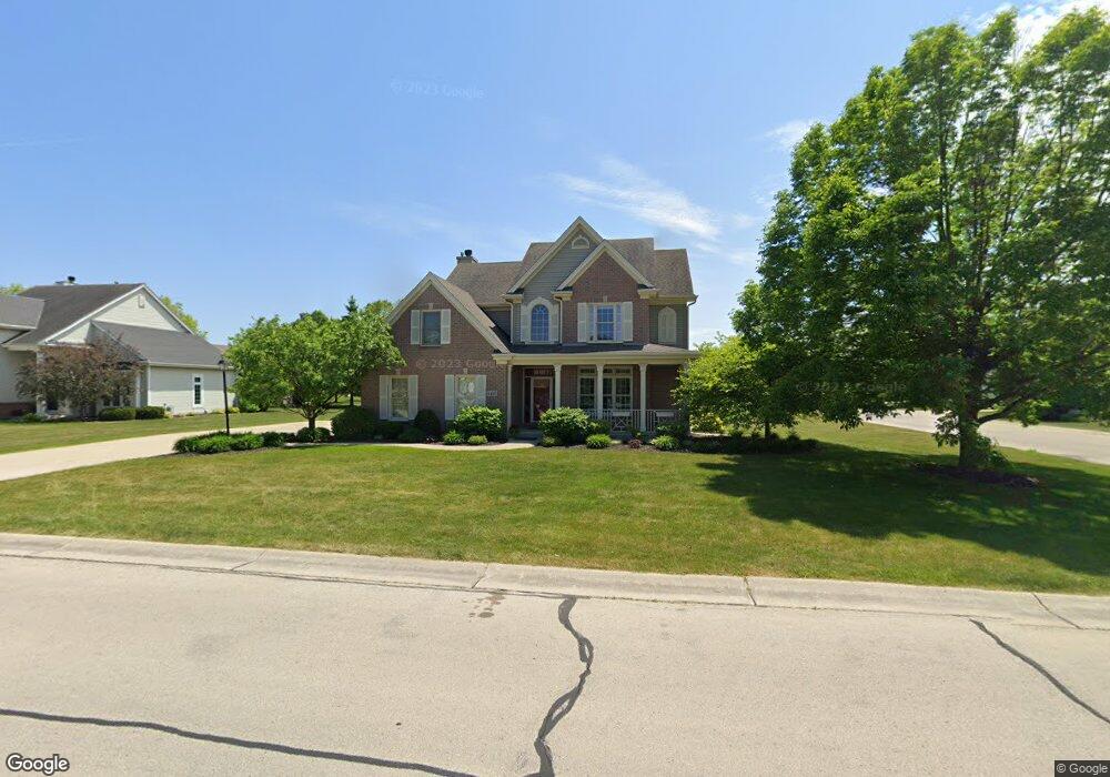
6429 Lincrest Dr Mount Pleasant, WI 53406
Estimated Value: $505,892 - $570,000
3
Beds
3
Baths
2,306
Sq Ft
$234/Sq Ft
Est. Value
About This Home
This home is located at 6429 Lincrest Dr, Mount Pleasant, WI 53406 and is currently estimated at $540,723, approximately $234 per square foot. 6429 Lincrest Dr is a home located in Racine County with nearby schools including Gifford Elementary School, Case High School, and Racine Christian School.
Ownership History
Date
Name
Owned For
Owner Type
Purchase Details
Closed on
Oct 6, 2014
Sold by
Elrod James L
Bought by
Harris James R
Current Estimated Value
Purchase Details
Closed on
Mar 10, 2008
Sold by
Elrod Jody A
Bought by
Elrod James L
Home Financials for this Owner
Home Financials are based on the most recent Mortgage that was taken out on this home.
Original Mortgage
$309,000
Interest Rate
5.75%
Mortgage Type
New Conventional
Create a Home Valuation Report for This Property
The Home Valuation Report is an in-depth analysis detailing your home's value as well as a comparison with similar homes in the area
Home Values in the Area
Average Home Value in this Area
Purchase History
| Date | Buyer | Sale Price | Title Company |
|---|---|---|---|
| Harris James R | $265,000 | -- | |
| Elrod James L | -- | None Available |
Source: Public Records
Mortgage History
| Date | Status | Borrower | Loan Amount |
|---|---|---|---|
| Previous Owner | Elrod James L | $309,000 |
Source: Public Records
Tax History Compared to Growth
Tax History
| Year | Tax Paid | Tax Assessment Tax Assessment Total Assessment is a certain percentage of the fair market value that is determined by local assessors to be the total taxable value of land and additions on the property. | Land | Improvement |
|---|---|---|---|---|
| 2024 | $7,691 | $489,500 | $77,000 | $412,500 |
| 2023 | $7,728 | $460,700 | $71,800 | $388,900 |
| 2022 | $6,759 | $401,500 | $71,800 | $329,700 |
| 2021 | $6,937 | $366,000 | $65,300 | $300,700 |
| 2020 | $6,541 | $337,800 | $55,400 | $282,400 |
| 2019 | $6,205 | $334,000 | $55,400 | $278,600 |
| 2018 | $6,285 | $300,600 | $43,900 | $256,700 |
| 2017 | $5,891 | $292,500 | $43,900 | $248,600 |
| 2016 | $5,582 | $261,100 | $43,900 | $217,200 |
| 2015 | $5,527 | $261,100 | $43,900 | $217,200 |
| 2014 | $5,165 | $258,400 | $43,900 | $214,500 |
| 2013 | $5,544 | $258,400 | $43,900 | $214,500 |
Source: Public Records
Map
Nearby Homes
- 2421 Dover Ln
- 2314 Raintree Ln
- 6147 Carriage Hills Dr
- Weston Traditional Plan at Auburn Hills
- 3234 Blue Star Cir
- 6130 Northwestern Ave
- 3240 Blue Star Cir
- 7136 Parkside Ln Unit 122
- Kimberly Plan at Auburn Hills
- Thomas Plan at Auburn Hills
- Springfield Plan at Auburn Hills
- Oakland Plan at Auburn Hills
- 3232 Bergamot Dr
- 3242 Bergamot Dr
- 7131 Fieldview Dr
- 3306 Bergamont Dr
- 1517 Summerset Dr Unit 83
- 5535 Sandy Ln
- 5402 Cynthia Ln
- 6510 Spring St Unit 17
- 6417 Lincrest Dr
- 2631 Dover Ln
- 6455 Lincrest Dr
- 6422 Lincrest Dr
- 6434 Lincrest Dr
- 2621 Dover Ln
- 2640 Penbrook Dr
- 6401 Lincrest Dr
- 6410 Lincrest Dr
- 2630 Dover Ln
- 2630 Penbrook Dr
- 6507 Lincrest Dr
- 2618 Dover Ln
- 2611 Dover Ln
- 6500 Lincrest Dr
- 6400 Lincrest Dr
- 2620 Penbrook Dr
- 6429 Wembly Ln
- 6421 Wembly Ln
- 6437 Wembly Ln