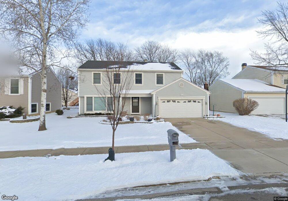
643 Brian Ave Schaumburg, IL 60194
West Schaumburg NeighborhoodEstimated Value: $457,594 - $552,000
4
Beds
3
Baths
1,992
Sq Ft
$261/Sq Ft
Est. Value
About This Home
This home is located at 643 Brian Ave, Schaumburg, IL 60194 and is currently estimated at $519,149, approximately $260 per square foot. 643 Brian Ave is a home located in Cook County with nearby schools including Elizabeth Blackwell Elementary School, Jane Addams Junior High School, and Schaumburg High School.
Ownership History
Date
Name
Owned For
Owner Type
Purchase Details
Closed on
Sep 18, 2023
Sold by
Patel Surendra R
Bought by
Patel Surendra R and Surendra Rambhai Patel Living Trust
Current Estimated Value
Purchase Details
Closed on
Apr 7, 2023
Sold by
Patel Surendra R and Patel Minaxi S
Bought by
Patel Surendra R and Patel Minaxi S
Create a Home Valuation Report for This Property
The Home Valuation Report is an in-depth analysis detailing your home's value as well as a comparison with similar homes in the area
Home Values in the Area
Average Home Value in this Area
Purchase History
| Date | Buyer | Sale Price | Title Company |
|---|---|---|---|
| Patel Surendra R | -- | None Listed On Document | |
| Patel Surendra R | -- | Chicago Title |
Source: Public Records
Tax History
| Year | Tax Paid | Tax Assessment Tax Assessment Total Assessment is a certain percentage of the fair market value that is determined by local assessors to be the total taxable value of land and additions on the property. | Land | Improvement |
|---|---|---|---|---|
| 2025 | $6,969 | $45,000 | $7,475 | $37,525 |
| 2024 | $6,969 | $30,848 | $6,175 | $24,673 |
| 2023 | $7,856 | $30,848 | $6,175 | $24,673 |
| 2022 | $7,856 | $35,079 | $6,175 | $28,904 |
| 2021 | $6,691 | $28,069 | $4,225 | $23,844 |
| 2020 | $7,565 | $30,982 | $4,225 | $26,757 |
| 2019 | $7,573 | $34,425 | $4,225 | $30,200 |
| 2018 | $6,559 | $28,037 | $3,575 | $24,462 |
| 2017 | $6,487 | $28,037 | $3,575 | $24,462 |
| 2016 | $6,821 | $28,973 | $3,575 | $25,398 |
| 2015 | $6,032 | $24,660 | $3,087 | $21,573 |
| 2014 | $7,193 | $26,878 | $3,087 | $23,791 |
| 2013 | $6,991 | $26,878 | $3,087 | $23,791 |
Source: Public Records
Map
Nearby Homes
- 2207 Ramsey Cir Unit 1
- 720 Huntly Ct Unit 1
- 2216 Andover Ct
- 730 Hamilton Cir
- 2019 Williamsburg Dr
- 1913 Windsong Dr Unit 28-4
- 323 Green Knoll Ln Unit 1818
- 158 Hastings Mill Rd
- 1941 Quaker Hollow Ln Unit 11
- 1026 Denham Place Unit 1
- 1975 Windsong Dr Unit 333E1
- 775 Harmon Blvd
- 1801 Epping Place
- 845 Harmon Blvd
- 138 White Branch Ct S Unit 541
- 2400 Mallow Ct Unit Z1
- 304 Glasgow Ln Unit X1
- 35 Cloverdale Ln
- 1975 Leiter Way Unit 12002
- 1982 Leiter Way Unit 13004