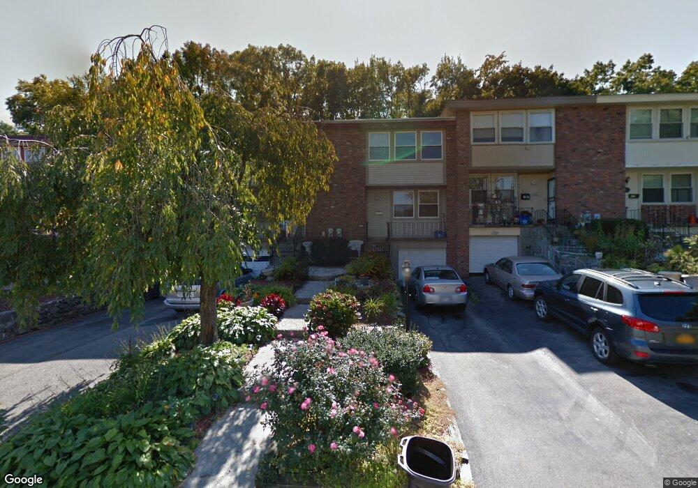
643 Kissam Rd Peekskill, NY 10566
Estimated Value: $258,000 - $445,000
About This Home
This home is located at 643 Kissam Rd, Peekskill, NY 10566 and is currently estimated at $374,558. 643 Kissam Rd is a home located in Westchester County with nearby schools including Oakside School, Hillcrest School, and Woodside Elementary School.
Ownership History
We collect this data history from publicly available records. To have your information removed, we recommend requesting removal directly through your county’s website.
Purchase Details
Purchase Details
Purchase Details
Home Financials for this Owner
Home Financials are based on the most recent Mortgage that was taken out on this home.Home Values in the Area
Average Home Value in this Area
Purchase History
We collect this data history from publicly available records. To have your information removed, we recommend requesting removal directly through your county’s website.
| Date | Buyer | Sale Price | Title Company |
|---|---|---|---|
| -- | None Listed On Document | ||
| -- | Stewart Title Insurance Co | ||
| $116,000 | Chicago Title Insurance Co |
Mortgage History
We collect this data history from publicly available records. To have your information removed, we recommend requesting removal directly through your county’s website.
| Date | Status | Borrower | Loan Amount |
|---|---|---|---|
| Previous Owner | $113,702 |
Tax History
We collect this data history from publicly available records. To have your information removed, we recommend requesting removal directly through your county’s website.
| Year | Tax Paid | Tax Assessment Tax Assessment Total Assessment is a certain percentage of the fair market value that is determined by local assessors to be the total taxable value of land and additions on the property. | Land | Improvement |
|---|---|---|---|---|
| 2025 | $6,610 | $5,293 | $1,300 | $3,993 |
| 2024 | $6,585 | $5,293 | $1,300 | $3,993 |
| 2023 | $6,480 | $5,293 | $1,300 | $3,993 |
| 2022 | $4,626 | $5,293 | $1,300 | $3,993 |
| 2021 | $6,218 | $5,293 | $1,300 | $3,993 |
| 2020 | $4,038 | $5,293 | $1,300 | $3,993 |
| 2019 | $3,743 | $5,293 | $1,300 | $3,993 |
| 2018 | $1,064 | $5,293 | $1,300 | $3,993 |
| 2017 | $0 | $5,293 | $1,300 | $3,993 |
| 2016 | $3,025 | $5,293 | $1,300 | $3,993 |
| 2015 | -- | $5,293 | $1,300 | $3,993 |
| 2014 | $2,063 | $5,293 | $1,300 | $3,993 |
| 2013 | $2,063 | $5,293 | $1,300 | $3,993 |
Map
- 6 Rolling Way Unit 6D
- 158 Rolling Way
- 10 N James St Unit N
- 9 N James St Unit B
- 8 N James St Unit I
- 7 N James St Unit 7K
- 540 N James St
- 800 Oakwood Dr
- 152 Overlook Ave Unit 2C
- 150 Overlook Ave Unit 5F
- 150 Overlook Ave Unit 4L
- 150 Overlook Ave Unit 2k
- 150 Overlook Ave Unit 7B
- 1011 Parkway Place
- 653 Highland Ave
- 103 Leda Dr
- 841 King St
- 208 N James St
- 925 Reynolds St
- 1206 Main St
Ask me questions while you tour the home.