643 N Aspen Dr Brian Head, UT 84719
Estimated Value: $623,610 - $637,000
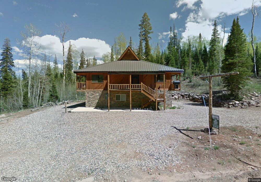
About This Home
This home is located at 643 N Aspen Dr, Brian Head, UT 84719 and is currently estimated at $630,305, approximately $257 per square foot. 643 N Aspen Dr is a home located in Iron County with nearby schools including Parowan School, Parowan High School, and Cedar City High School.
Ownership History
We collect this data history from publicly available records. To have your information removed, we recommend requesting removal directly through your county’s website.
Purchase Details
Purchase Details
Home Financials for this Owner
Home Financials are based on the most recent Mortgage that was taken out on this home.Purchase Details
Home Values in the Area
Average Home Value in this Area
Purchase History
We collect this data history from publicly available records. To have your information removed, we recommend requesting removal directly through your county’s website.
| Date | Buyer | Sale Price | Title Company |
|---|---|---|---|
| -- | None Available | ||
| -- | None Available | ||
| -- | None Available |
Mortgage History
We collect this data history from publicly available records. To have your information removed, we recommend requesting removal directly through your county’s website.
| Date | Status | Borrower | Loan Amount |
|---|---|---|---|
| Open | $157,500 |
Tax History
We collect this data history from publicly available records. To have your information removed, we recommend requesting removal directly through your county’s website.
| Year | Tax Paid | Tax Assessment Tax Assessment Total Assessment is a certain percentage of the fair market value that is determined by local assessors to be the total taxable value of land and additions on the property. | Land | Improvement |
|---|---|---|---|---|
| 2025 | $4,685 | $594,154 | $78,867 | $515,287 |
| 2023 | $3,717 | $606,545 | $78,865 | $527,680 |
| 2022 | $5,918 | $596,260 | $68,580 | $527,680 |
| 2021 | $4,177 | $420,865 | $30,000 | $390,865 |
| 2020 | $4,010 | $368,440 | $30,000 | $338,440 |
| 2019 | $4,341 | $368,780 | $30,000 | $338,780 |
| 2018 | $4,248 | $349,605 | $30,000 | $319,605 |
| 2017 | $4,270 | $349,605 | $30,000 | $319,605 |
| 2016 | $4,301 | $330,550 | $40,000 | $290,550 |
| 2015 | $4,230 | $302,915 | $0 | $0 |
| 2014 | $4,004 | $260,365 | $0 | $0 |
Map
- 280 W Bobcat Rd
- 390 W Spruce St
- 590 W Kokopelli Loop
- 237 Circle Dr
- 1550 Aspen Dr
- 646 W Ski View Dr
- 181 Gurr Well Rd
- 539 N Half Circle Dr
- 0 W Kokopelli Loop Unit 114908
- 0 W Kokopelli Loop Unit 2808823
- 699 W Hunter Ridge Dr
- 524 W Ski View Dr
- 660 W Ski View Dr
- 223 W Hunter Ridge Dr Unit 3306
- 223 W Hunter Ridge Dr Unit b303
- 223 W Hunter Ridge Dr Unit 2303
- 223 W Hunter Ridge Dr Unit 121
- 223 W Hunter Ridge Dr Unit e208
- 223 W Hunter Ridge Dr Unit 2314
- 223 W Hunter Ridge Dr Unit 1300
- 643 N Aspen Dr Unit Mountairevergreen bl
- 643 Aspen Dr
- 643 Aspen Dr Unit Mountairevergreen bl
- 656 N Aspen Dr Unit SI ID1023374P
- 656 N Aspen Dr
- 353 Fir St
- 333 Fir St
- 143 Utah 143 Unit B303
- 336 Fir St Unit 3
- 358 Fir St Unit Lot 5 U-A
- 287 Fir St
- 342 Fir St Unit A
- 358 Fir St Unit A
- 287 Fir St Unit A
- 342 Fir St Unit 1
- 342 Fir St
- 367 Fir St
- South W Kokopelli Loop
- 320 Fir St Unit Mountair Evergr u-A
- 320 Fir St
Ask me questions while you tour the home.