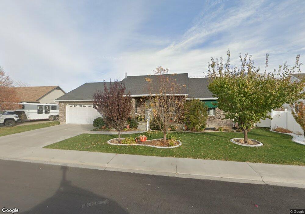
643 S 1850 E Spanish Fork, UT 84660
Estimated Value: $590,000 - $737,000
5
Beds
3
Baths
3,546
Sq Ft
$180/Sq Ft
Est. Value
About This Home
This home is located at 643 S 1850 E, Spanish Fork, UT 84660 and is currently estimated at $638,203, approximately $179 per square foot. 643 S 1850 E is a home located in Utah County with nearby schools including Larsen Elementary School, Spanish Fork Jr High School, and Spanish Fork High School.
Ownership History
Date
Name
Owned For
Owner Type
Purchase Details
Closed on
Jun 26, 2018
Sold by
Neary Lettie
Bought by
Maxwell Maxwell W and Maxwell Jeannie
Current Estimated Value
Purchase Details
Closed on
Jan 3, 2005
Sold by
Yorgason Floyd W and Yorgason Tamara P
Bought by
Terry Dean R and Terry Deann P
Home Financials for this Owner
Home Financials are based on the most recent Mortgage that was taken out on this home.
Original Mortgage
$30,000
Interest Rate
5.74%
Mortgage Type
Seller Take Back
Purchase Details
Closed on
Jun 26, 2000
Sold by
Jex Kent T
Bought by
Yorgason Floyd W and Yorgason Tamara P
Home Financials for this Owner
Home Financials are based on the most recent Mortgage that was taken out on this home.
Original Mortgage
$157,400
Interest Rate
7.5%
Create a Home Valuation Report for This Property
The Home Valuation Report is an in-depth analysis detailing your home's value as well as a comparison with similar homes in the area
Home Values in the Area
Average Home Value in this Area
Purchase History
| Date | Buyer | Sale Price | Title Company |
|---|---|---|---|
| Maxwell Maxwell W | -- | North American Title | |
| Terry Dean R | -- | Equity Title Agency Inc | |
| Yorgason Floyd W | -- | Security Title & Abstract |
Source: Public Records
Mortgage History
| Date | Status | Borrower | Loan Amount |
|---|---|---|---|
| Previous Owner | Terry Dean R | $30,000 | |
| Previous Owner | Yorgason Floyd W | $157,400 |
Source: Public Records
Tax History
| Year | Tax Paid | Tax Assessment Tax Assessment Total Assessment is a certain percentage of the fair market value that is determined by local assessors to be the total taxable value of land and additions on the property. | Land | Improvement |
|---|---|---|---|---|
| 2025 | $2,811 | $321,640 | -- | -- |
| 2024 | $2,811 | $289,740 | $0 | $0 |
| 2023 | $2,876 | $296,725 | $0 | $0 |
| 2022 | $2,774 | $280,720 | $0 | $0 |
| 2021 | $2,359 | $381,900 | $110,000 | $271,900 |
| 2020 | $2,235 | $351,800 | $100,000 | $251,800 |
| 2019 | $2,060 | $341,100 | $89,300 | $251,800 |
| 2018 | $2,040 | $326,600 | $80,700 | $245,900 |
| 2017 | $1,829 | $157,355 | $0 | $0 |
| 2016 | $1,708 | $145,035 | $0 | $0 |
| 2015 | $1,589 | $133,320 | $0 | $0 |
| 2014 | $1,485 | $125,070 | $0 | $0 |
Source: Public Records
Map
Nearby Homes
- 2034 E 800 S
- 839 S 1760 E
- 1658 Dover Dr
- 1897 E 280 S
- 236 S 1800 E
- 938 S 1740 E
- 2308 E 850 South St Unit 10
- 1878 E 1050 S
- 1692 E 1000 S
- 2342 E 830 S Unit 27
- 2342 E 830 S
- 2342 E 830 S Unit 26
- 1061 S 2230 E
- 1166 S 1920 E
- 762 S 1360 E Unit 25
- 815 S 1300 E Unit 34
- 1147 S 1660 E
- 857 S 1300 E Unit 32
- 816 S 1300 E
- 834 S 1300 #16gc E
Your Personal Tour Guide
Ask me questions while you tour the home.