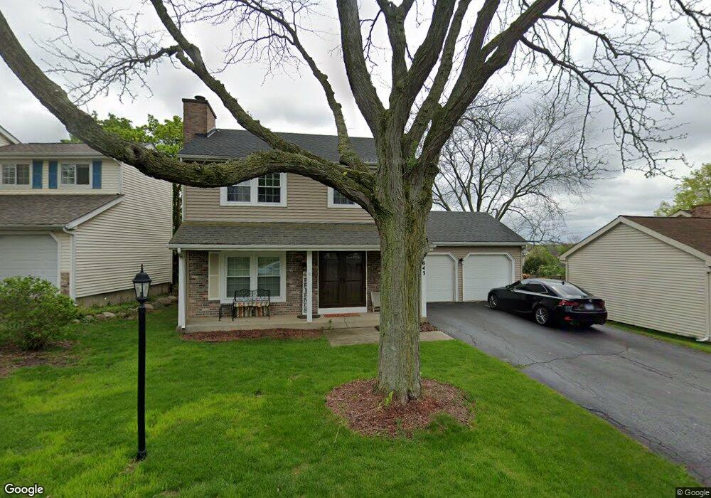
643 Stewart Ct Gurnee, IL 60031
Estimated Value: $327,804 - $355,000
4
Beds
3
Baths
2,111
Sq Ft
$160/Sq Ft
Est. Value
About This Home
This home is located at 643 Stewart Ct, Gurnee, IL 60031 and is currently estimated at $337,701, approximately $159 per square foot. 643 Stewart Ct is a home located in Lake County with nearby schools including Woodland Primary School, Woodland Elementary School, and Woodland Intermediate School.
Ownership History
Date
Name
Owned For
Owner Type
Purchase Details
Closed on
Nov 17, 2011
Sold by
Federal Home Loan Mortgage Corporation
Bought by
Edwards Leroy
Current Estimated Value
Home Financials for this Owner
Home Financials are based on the most recent Mortgage that was taken out on this home.
Original Mortgage
$126,704
Outstanding Balance
$86,275
Interest Rate
3.99%
Mortgage Type
FHA
Estimated Equity
$251,426
Purchase Details
Closed on
Oct 21, 2010
Sold by
Niemotka Ray J
Bought by
Federal Home Loan Mortgage Corp
Purchase Details
Closed on
Feb 23, 2004
Sold by
Ditmars Donald M and Ditmars Laura A
Bought by
Niemotka Ray J and Niemotka Amanda C
Home Financials for this Owner
Home Financials are based on the most recent Mortgage that was taken out on this home.
Original Mortgage
$176,000
Interest Rate
5.65%
Mortgage Type
Purchase Money Mortgage
Create a Home Valuation Report for This Property
The Home Valuation Report is an in-depth analysis detailing your home's value as well as a comparison with similar homes in the area
Home Values in the Area
Average Home Value in this Area
Purchase History
| Date | Buyer | Sale Price | Title Company |
|---|---|---|---|
| Edwards Leroy | $130,000 | Attorneys Title Guaranty Fun | |
| Federal Home Loan Mortgage Corp | -- | None Available | |
| Niemotka Ray J | $220,000 | Burnet Title Llc |
Source: Public Records
Mortgage History
| Date | Status | Borrower | Loan Amount |
|---|---|---|---|
| Open | Edwards Leroy | $126,704 | |
| Previous Owner | Niemotka Ray J | $176,000 |
Source: Public Records
Tax History
| Year | Tax Paid | Tax Assessment Tax Assessment Total Assessment is a certain percentage of the fair market value that is determined by local assessors to be the total taxable value of land and additions on the property. | Land | Improvement |
|---|---|---|---|---|
| 2024 | $7,148 | $91,365 | $10,547 | $80,818 |
| 2023 | $6,594 | $80,740 | $9,320 | $71,420 |
| 2022 | $6,594 | $73,651 | $9,532 | $64,119 |
| 2021 | $5,702 | $67,977 | $8,798 | $59,179 |
| 2020 | $5,512 | $66,306 | $8,582 | $57,724 |
| 2019 | $5,351 | $64,381 | $8,333 | $56,048 |
| 2018 | $4,956 | $60,825 | $3,652 | $57,173 |
| 2017 | $4,900 | $59,082 | $3,547 | $55,535 |
| 2016 | $4,849 | $56,451 | $3,389 | $53,062 |
| 2015 | $4,709 | $53,538 | $3,214 | $50,324 |
| 2014 | $5,530 | $48,450 | $3,171 | $45,279 |
| 2012 | $5,247 | $62,685 | $3,195 | $59,490 |
Source: Public Records
Map
Nearby Homes
- 649 Wilbur Ct
- 651 White Ct
- 705 Colby Ct Unit U78
- 727 Colby Ct Unit U57
- 598 Dunham Rd Unit U297
- 650 Whitney Ct Unit 211
- 690 Chandler Rd Unit 211
- 690 Chandler Rd Unit 302
- 748 Chandler Rd
- 6167 Golfview Dr
- 920 Vose Dr Unit 304
- 920 Vose Dr Unit 106
- 801 Dunhill Ct
- 6091 Washington St
- 32981 N River Rd
- 6296 Doral Dr
- 387 Long Hill Rd
- 17150 W Washington St
- 6349 Braxton Ct
- 256 Hill n Dale Ct
Your Personal Tour Guide
Ask me questions while you tour the home.