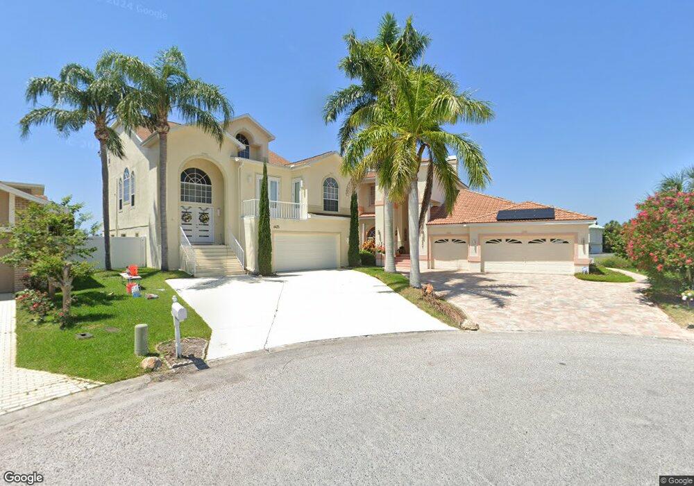
6431 Garland Ct New Port Richey, FL 34652
New Port Richey West NeighborhoodEstimated Value: $756,000 - $1,003,000
3
Beds
3
Baths
3,674
Sq Ft
$236/Sq Ft
Est. Value
About This Home
This home is located at 6431 Garland Ct, New Port Richey, FL 34652 and is currently estimated at $868,231, approximately $236 per square foot. 6431 Garland Ct is a home located in Pasco County with nearby schools including Richey Elementary School, Gulf Middle School, and Gulf High School.
Ownership History
Date
Name
Owned For
Owner Type
Purchase Details
Closed on
Apr 5, 2012
Sold by
Patterson Vivian J
Bought by
Larsen David A and Larsen Karen L
Current Estimated Value
Home Financials for this Owner
Home Financials are based on the most recent Mortgage that was taken out on this home.
Original Mortgage
$262,500
Interest Rate
3%
Mortgage Type
New Conventional
Create a Home Valuation Report for This Property
The Home Valuation Report is an in-depth analysis detailing your home's value as well as a comparison with similar homes in the area
Home Values in the Area
Average Home Value in this Area
Purchase History
| Date | Buyer | Sale Price | Title Company |
|---|---|---|---|
| Larsen David A | $350,000 | Attorney |
Source: Public Records
Mortgage History
| Date | Status | Borrower | Loan Amount |
|---|---|---|---|
| Previous Owner | Larsen David A | $262,500 |
Source: Public Records
Tax History Compared to Growth
Tax History
| Year | Tax Paid | Tax Assessment Tax Assessment Total Assessment is a certain percentage of the fair market value that is determined by local assessors to be the total taxable value of land and additions on the property. | Land | Improvement |
|---|---|---|---|---|
| 2025 | $6,023 | $393,200 | -- | -- |
| 2024 | $6,023 | $382,120 | -- | -- |
| 2023 | $5,807 | $370,990 | $0 | $0 |
| 2022 | $5,227 | $360,190 | $0 | $0 |
| 2021 | $5,138 | $349,700 | $146,500 | $203,200 |
| 2020 | $5,062 | $344,880 | $142,454 | $202,426 |
| 2019 | $4,985 | $337,130 | $0 | $0 |
| 2018 | $4,899 | $330,853 | $0 | $0 |
| 2017 | $4,882 | $330,853 | $0 | $0 |
| 2016 | $4,801 | $317,383 | $0 | $0 |
| 2015 | $4,778 | $309,985 | $0 | $0 |
| 2014 | $4,653 | $323,241 | $139,829 | $183,412 |
Source: Public Records
Map
Nearby Homes
- 4425 Gulfside Dr
- 6340 Garland Ct
- 6517 Channelside Dr
- 6209 Spoonbill Dr
- 6306 Garland Ct
- 6316 Spoonbill Dr
- 6312 Spoonbill Dr
- 6340 Spoonbill Dr
- 6208 Spoonbill Dr
- 6344 Spoonbill Dr
- 6513 Sand Shore Ln
- 6241 Bayside Dr
- 6170 Seaside Dr
- 6225 Bayside Dr
- 6244 Spoonbill Dr
- 6116 Seaside Dr
- 4335 Sanddollar Ct
- 4632 Heavens Way
- 6711 Arroyo Dr
- 4400 Sanddollar Ct
- 6425 Garland Ct
- 6421 Garland Ct Unit 1B
- 6430 Garland Ct
- 6415 Garland Ct
- 6426 Garland Ct
- 6420 Garland Ct
- 6411 Garland Ct
- 6416 Garland Ct
- 4350 Green Key Rd
- 6410 Garland Ct
- 6405 Garland Ct Unit 1B
- 6406 Garland Ct
- 4330 Green Key Rd
- 6359 Garland Ct
- 6435 Drake Ct
- 6400 Garland Ct
- 6441 Drake Ct
- 6351 Garland Ct
- 4300 Green Key Rd
- 6445 Drake Ct