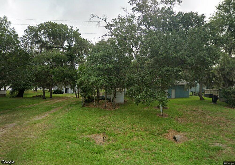
6434 County Road 659 Brazoria, TX 77422
Estimated Value: $183,123 - $294,000
2
Beds
1
Bath
984
Sq Ft
$238/Sq Ft
Est. Value
About This Home
This home is located at 6434 County Road 659, Brazoria, TX 77422 and is currently estimated at $234,281, approximately $238 per square foot. 6434 County Road 659 is a home located in Brazoria County with nearby schools including Sweeny Elementary School, Sweeny Junior High School, and Sweeny High School.
Ownership History
Date
Name
Owned For
Owner Type
Purchase Details
Closed on
Apr 5, 2004
Sold by
Sherbrook Phillip Dean and Sherbrook Sheryl Elsie
Bought by
Morris Robert Glenn
Current Estimated Value
Purchase Details
Closed on
Jun 13, 2001
Sold by
Cole Michael J and Cole Lisa
Bought by
Davis Keith and Davis Judith
Home Financials for this Owner
Home Financials are based on the most recent Mortgage that was taken out on this home.
Original Mortgage
$58,500
Interest Rate
7.08%
Create a Home Valuation Report for This Property
The Home Valuation Report is an in-depth analysis detailing your home's value as well as a comparison with similar homes in the area
Home Values in the Area
Average Home Value in this Area
Purchase History
| Date | Buyer | Sale Price | Title Company |
|---|---|---|---|
| Morris Robert Glenn | -- | American Title Co | |
| Davis Keith | -- | American Title Co |
Source: Public Records
Mortgage History
| Date | Status | Borrower | Loan Amount |
|---|---|---|---|
| Previous Owner | Davis Keith | $58,500 |
Source: Public Records
Tax History Compared to Growth
Tax History
| Year | Tax Paid | Tax Assessment Tax Assessment Total Assessment is a certain percentage of the fair market value that is determined by local assessors to be the total taxable value of land and additions on the property. | Land | Improvement |
|---|---|---|---|---|
| 2025 | $2,728 | $165,110 | $52,400 | $112,710 |
| 2023 | $2,728 | $140,000 | $47,569 | $92,431 |
| 2022 | $2,237 | $116,100 | $37,850 | $78,250 |
| 2021 | $1,921 | $91,370 | $37,850 | $53,520 |
| 2020 | $1,985 | $88,760 | $31,690 | $57,070 |
| 2019 | $2,038 | $87,370 | $30,040 | $57,330 |
| 2018 | $2,267 | $98,410 | $41,080 | $57,330 |
| 2017 | $1,799 | $77,600 | $40,420 | $37,180 |
| 2016 | $1,918 | $82,760 | $40,420 | $42,340 |
| 2015 | $1,724 | $69,860 | $30,150 | $39,710 |
| 2014 | $1,724 | $74,190 | $24,180 | $50,010 |
Source: Public Records
Map
Nearby Homes
- 6418 County Road 659
- 6345 County Road 659
- 6377 County Road 659
- 0 County Road 659 Unit 51464010
- 6840 County Road 659
- 4302 Cr 306
- 7068 County Road 659
- 7088 County Road 659
- 3054 Fm 2611 Rd
- 0 N Belt Dr
- 00 N Belt Dr
- TBD N Belt Dr
- 5031 County Road 819
- Lot 1 County Road 819
- 0 County Road 819
- 000 Pine St
- 6326 Cuarto St
- Lot 23 Cuarto
- 6314 Sexto St
- 0 County Road 306 Unit 25212710
- 1254 County Road 659
- 1254 Cr659
- 6436 County Road 659
- 1256 County Road 659
- 2 County Road 659
- 1253 County Road 659
- 0000 County Road 659
- 00 County Road 659
- 6422 Cr 659
- 6447 County Road 659
- 6418 Cr 659
- 6454 Cr 659
- 6454 County Road 659
- 6464 County Road 659
- 6455 County Road 659
- 6458 County Road 659
- 6420 County Road 659
- 6460 County Road 659
- 6462 Cr 659
- 6406 County Road 659
