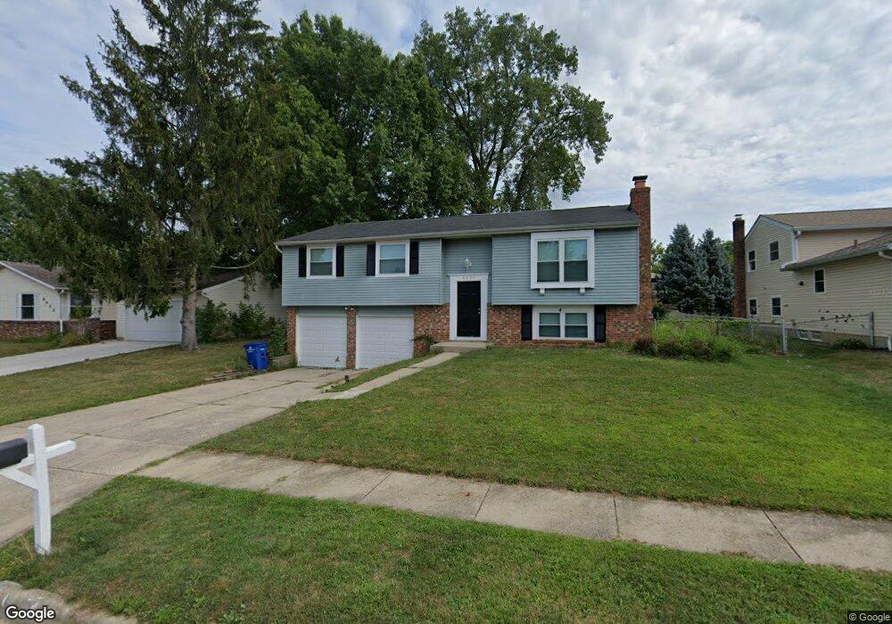
6434 Lanercost Rd Reynoldsburg, OH 43068
Estimated Value: $253,000 - $282,000
3
Beds
3
Baths
1,094
Sq Ft
$239/Sq Ft
Est. Value
About This Home
This home is located at 6434 Lanercost Rd, Reynoldsburg, OH 43068 and is currently estimated at $261,825, approximately $239 per square foot. 6434 Lanercost Rd is a home located in Franklin County with nearby schools including Slate Ridge Elementary School, Baldwin Road Junior High School, and Hannah J Ashton Middle School.
Ownership History
Date
Name
Owned For
Owner Type
Purchase Details
Closed on
Mar 30, 2018
Bought by
Home Sfr Borrower Iv Llc
Current Estimated Value
Home Financials for this Owner
Home Financials are based on the most recent Mortgage that was taken out on this home.
Interest Rate
4.44%
Purchase Details
Closed on
May 3, 2013
Sold by
Martom Properties I Llc
Bought by
2013 A Property Holdgins Llc
Purchase Details
Closed on
May 9, 2005
Sold by
Martom Properties Llc
Bought by
Martom Properties 1 Llc
Purchase Details
Closed on
Jul 30, 1999
Sold by
Pratt Mark S and Pratt Kayla
Bought by
Martom Properties Llc
Purchase Details
Closed on
Aug 28, 1992
Create a Home Valuation Report for This Property
The Home Valuation Report is an in-depth analysis detailing your home's value as well as a comparison with similar homes in the area
Home Values in the Area
Average Home Value in this Area
Purchase History
| Date | Buyer | Sale Price | Title Company |
|---|---|---|---|
| Home Sfr Borrower Iv Llc | $22,607,088 | -- | |
| 2013 A Property Holdgins Llc | $244,800 | None Available | |
| Martom Properties 1 Llc | -- | -- | |
| Martom Properties Llc | -- | Capcity Title | |
| -- | $88,700 | -- |
Source: Public Records
Mortgage History
| Date | Status | Borrower | Loan Amount |
|---|---|---|---|
| Closed | Home Sfr Borrower Iv Llc | -- |
Source: Public Records
Tax History Compared to Growth
Tax History
| Year | Tax Paid | Tax Assessment Tax Assessment Total Assessment is a certain percentage of the fair market value that is determined by local assessors to be the total taxable value of land and additions on the property. | Land | Improvement |
|---|---|---|---|---|
| 2024 | $3,882 | $74,030 | $20,200 | $53,830 |
| 2023 | $3,709 | $74,030 | $20,200 | $53,830 |
| 2022 | $3,678 | $55,520 | $6,690 | $48,830 |
| 2021 | $3,692 | $55,520 | $6,690 | $48,830 |
| 2020 | $3,767 | $55,520 | $6,690 | $48,830 |
| 2019 | $4,677 | $55,520 | $6,690 | $48,830 |
| 2018 | $2,680 | $39,770 | $6,690 | $33,080 |
| 2017 | $2,982 | $39,770 | $6,690 | $33,080 |
| 2016 | $2,364 | $28,180 | $6,300 | $21,880 |
| 2015 | $2,378 | $28,180 | $6,300 | $21,880 |
| 2014 | $2,505 | $30,660 | $6,300 | $24,360 |
| 2013 | $1,435 | $36,085 | $7,420 | $28,665 |
Source: Public Records
Map
Nearby Homes
- 6549 Santa Cruz Place
- 6348 E Livingston Ave
- 6682 Woodsedge Dr
- 0 Brice Rd
- 0 Radekin Rd Unit 225029852
- 6728 Greenbush Dr
- 1550 Idlewild Dr
- 6772 Gilette Dr
- 6658 Furth Dr
- 1324 Idlewild Dr
- 1334 Manor Dr
- 1328 Manor Dr
- 6584 Benjamin Dr
- 6793 Laird Ave
- 1888 Birkdale Dr
- 1603 Hallworth Ct Unit 16038
- 1474 Marty Dr
- 1481 Riverton Ct E
- 1748 Sunapple Way Unit 1748
- 5781 Hallridge Cir Unit B
- 6442 Lanercost Rd
- 6451 Hurlingham Rd
- 6441 Hurlingham Rd
- 6452 Lanercost Rd
- 6412 Lanercost Rd
- 6459 Hurlingham Rd
- 6433 Lanercost Rd
- 6433 Hurlingham Rd
- 6421 Lanercost Rd
- 6460 Lanercost Rd
- 6465 Hurlingham Rd
- 2095 Leah Ln
- 2040 Lynbridge Dr
- 6411 Lanercost Rd
- 2052 Lynbridge Dr
- 2032 Lynbridge Dr
- 6472 Lanercost Rd
- 6475 Hurlingham Rd
- 2078 Lynbridge Dr