Estimated Value: $326,000 - $372,000
3
Beds
2
Baths
1,791
Sq Ft
$195/Sq Ft
Est. Value
About This Home
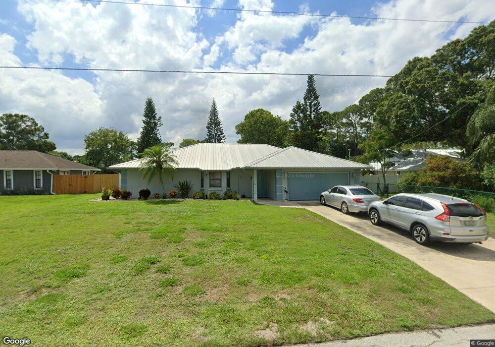
This home is located at 6436 Dane Ave, Cocoa, FL 32927 and is currently estimated at $349,114, approximately $194 per square foot. 6436 Dane Ave is a home located in Brevard County with nearby schools including Challenger 7 Elementary School, Space Coast Junior/Senior High School, and Sculptor Charter School.
Ownership History
Date
Name
Owned For
Owner Type
Purchase Details
Closed on
Jan 27, 2015
Sold by
Messemer John E and Messemer Donna
Bought by
Messemer Family Trust
Current Estimated Value
Purchase Details
Closed on
Dec 15, 1998
Sold by
Carson Robert Kemp and Carson Elizabeth G
Bought by
Messemer John E and Messmer Donna
Home Financials for this Owner
Home Financials are based on the most recent Mortgage that was taken out on this home.
Original Mortgage
$95,000
Interest Rate
6.9%
Create a Home Valuation Report for This Property
The Home Valuation Report is an in-depth analysis detailing your home's value as well as a comparison with similar homes in the area
Home Values in the Area
Average Home Value in this Area
Purchase History
| Date | Buyer | Sale Price | Title Company |
|---|---|---|---|
| Messemer Family Trust | -- | Attorney | |
| Messemer John E | $107,000 | -- |
Source: Public Records
Mortgage History
| Date | Status | Borrower | Loan Amount |
|---|---|---|---|
| Previous Owner | Messemer John E | $95,000 |
Source: Public Records
Tax History
| Year | Tax Paid | Tax Assessment Tax Assessment Total Assessment is a certain percentage of the fair market value that is determined by local assessors to be the total taxable value of land and additions on the property. | Land | Improvement |
|---|---|---|---|---|
| 2025 | $1,558 | $114,760 | -- | -- |
| 2024 | $1,520 | $111,530 | -- | -- |
| 2023 | $1,520 | $108,290 | $0 | $0 |
| 2022 | $1,418 | $105,140 | $0 | $0 |
| 2021 | $1,420 | $102,080 | $0 | $0 |
| 2020 | $1,358 | $100,680 | $0 | $0 |
| 2019 | $1,295 | $98,420 | $0 | $0 |
| 2018 | $1,288 | $96,590 | $0 | $0 |
| 2017 | $1,283 | $94,610 | $0 | $0 |
| 2016 | $1,286 | $92,670 | $18,000 | $74,670 |
| 2015 | $1,302 | $92,030 | $15,000 | $77,030 |
| 2014 | $1,304 | $91,300 | $11,000 | $80,300 |
Source: Public Records
Map
Nearby Homes
- 6450 Ember Ave
- 00 Unknown
- 5220 Holden Rd
- 5215 Holden Rd
- 6375 Cable Ave
- 6438 Hudson Rd
- 6615 Dock Ave
- 5221 Carrick Rd
- 0000 Grissom Pkwy
- 6481 La Brea Ave
- 6760 Cairo Rd
- 4975 Fay Blvd
- 5095 Hogan Place
- 6094 Cardiff Ave
- 5601 Banos Ave
- 6020 Cannon Ave
- 6620 Grissom Pkwy
- 6581 Bancroft Ave
- 6210 Stillwater Ave
- 5680 Banos Ave
Your Personal Tour Guide
Ask me questions while you tour the home.