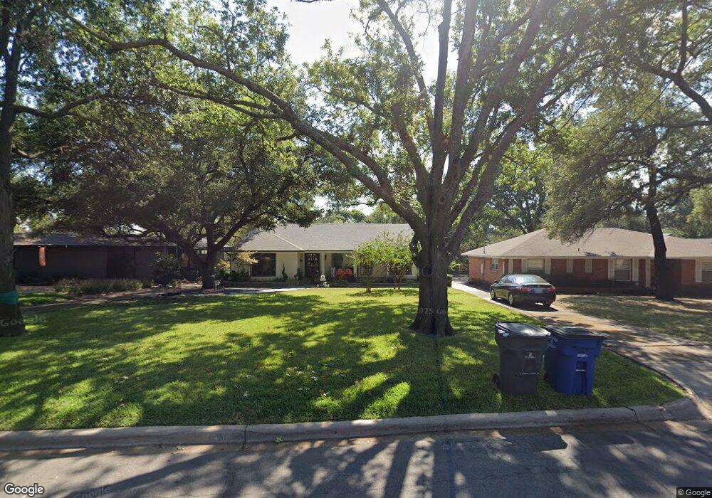
6436 Patrick Dr Dallas, TX 75214
Northeast Dallas NeighborhoodEstimated Value: $994,000 - $1,170,000
3
Beds
2
Baths
2,220
Sq Ft
$468/Sq Ft
Est. Value
About This Home
This home is located at 6436 Patrick Dr, Dallas, TX 75214 and is currently estimated at $1,038,982, approximately $468 per square foot. 6436 Patrick Dr is a home located in Dallas County with nearby schools including Lakewood Elementary School, J L Long Middle School, and Woodrow Wilson High School.
Ownership History
Date
Name
Owned For
Owner Type
Purchase Details
Closed on
May 14, 2015
Sold by
Bailey Kirk and Bailey Debbie Huddleston
Bought by
Bailey Brian
Current Estimated Value
Home Financials for this Owner
Home Financials are based on the most recent Mortgage that was taken out on this home.
Original Mortgage
$360,000
Outstanding Balance
$277,532
Interest Rate
3.7%
Mortgage Type
Seller Take Back
Estimated Equity
$761,450
Purchase Details
Closed on
Mar 14, 2015
Sold by
Bailey Kirk and Bailey Debbie Huddleston
Bought by
Bailey Brian
Home Financials for this Owner
Home Financials are based on the most recent Mortgage that was taken out on this home.
Original Mortgage
$360,000
Interest Rate
3.68%
Mortgage Type
Seller Take Back
Purchase Details
Closed on
Sep 13, 2006
Sold by
Estate Of Ruby Morris
Bought by
Bailey Kirk
Purchase Details
Closed on
Nov 1, 2002
Sold by
Cott Marion B
Bought by
Morris Ruby B
Create a Home Valuation Report for This Property
The Home Valuation Report is an in-depth analysis detailing your home's value as well as a comparison with similar homes in the area
Home Values in the Area
Average Home Value in this Area
Purchase History
| Date | Buyer | Sale Price | Title Company |
|---|---|---|---|
| Bailey Brian | -- | Tiago Title Llc | |
| Bailey Brian | -- | Tiago Title Llc | |
| Bailey Kirk | -- | Hftc | |
| Morris Ruby B | -- | -- |
Source: Public Records
Mortgage History
| Date | Status | Borrower | Loan Amount |
|---|---|---|---|
| Open | Bailey Brian | $360,000 | |
| Previous Owner | Bailey Brian | $360,000 |
Source: Public Records
Tax History Compared to Growth
Tax History
| Year | Tax Paid | Tax Assessment Tax Assessment Total Assessment is a certain percentage of the fair market value that is determined by local assessors to be the total taxable value of land and additions on the property. | Land | Improvement |
|---|---|---|---|---|
| 2025 | $15,029 | $1,100,000 | $630,590 | $469,410 |
| 2024 | $15,029 | $932,100 | $630,590 | $301,510 |
| 2023 | $15,029 | $861,560 | $630,590 | $230,970 |
| 2022 | $21,542 | $861,560 | $630,590 | $230,970 |
| 2021 | $15,867 | $601,470 | $420,390 | $181,080 |
| 2020 | $16,317 | $601,470 | $420,390 | $181,080 |
| 2019 | $17,113 | $601,470 | $420,390 | $181,080 |
| 2018 | $13,810 | $507,860 | $252,240 | $255,620 |
| 2017 | $12,931 | $475,530 | $252,240 | $223,290 |
| 2016 | $12,931 | $475,530 | $252,240 | $223,290 |
| 2015 | $10,270 | $374,410 | $124,500 | $249,910 |
| 2014 | $10,270 | $374,410 | $124,500 | $249,910 |
Source: Public Records
Map
Nearby Homes
- 6446 Lange Cir
- 6459 Trammel Dr
- 6537 Patrick Dr
- 6415 Axton Ln
- 6529 Trammel Dr
- 6269 Saratoga Cir
- 6474 Sudbury Dr
- 6527 Axton Cir
- 6305 Annapolis Ln
- 6314 Woodcrest Ln
- 6231 Berwyn Ln
- 6529 Saint Moritz Ave
- 6431 Dunstan Ln
- 4323 Ashford Dr
- 6711 Vada Dr
- 6720 Braeburn Dr
- 6222 E University Blvd
- 6746 Braeburn Dr
- 6644 Santa Anita Dr
- 6802 Vada Dr
- 6440 Patrick Dr
- 6430 Patrick Dr
- 6446 Patrick Dr
- 6424 Patrick Dr
- 6450 Patrick Dr
- 6435 Patrick Dr
- 6431 Patrick Dr
- 6416 Patrick Dr
- 6441 Patrick Dr
- 6425 Patrick Dr
- 6457 Lange Cir
- 6445 Patrick Dr
- 6421 Patrick Dr
- 6412 Patrick Dr
- 6463 Lange Cir
- 6451 Patrick Dr
- 6456 Patrick Dr
- 6451 Lange Cir
- 6441 Lange Cir
- 6447 Lange Cir