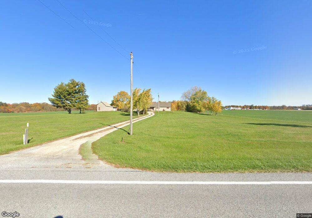
6437 State Route 219 New Knoxville, OH 45871
Estimated Value: $244,000 - $289,000
3
Beds
2
Baths
1,508
Sq Ft
$173/Sq Ft
Est. Value
About This Home
This home is located at 6437 State Route 219, New Knoxville, OH 45871 and is currently estimated at $260,718, approximately $172 per square foot. 6437 State Route 219 is a home with nearby schools including New Knoxville Elementary School.
Ownership History
Date
Name
Owned For
Owner Type
Purchase Details
Closed on
Oct 21, 2021
Sold by
Brogan Andrew L and Brogan Tawnya S
Bought by
Brogan Andrew L
Current Estimated Value
Home Financials for this Owner
Home Financials are based on the most recent Mortgage that was taken out on this home.
Original Mortgage
$70,000
Outstanding Balance
$56,236
Interest Rate
2.33%
Estimated Equity
$204,482
Purchase Details
Closed on
Nov 15, 2013
Sold by
Katterheinrich Gary and Katterheinrich Sylvia
Bought by
Katterheinrich Gary and Katterheinrich Sylvia
Purchase Details
Closed on
Oct 19, 1994
Sold by
Arnett Stephen W
Bought by
Brogan Andrew L
Purchase Details
Closed on
Mar 11, 1993
Sold by
Katterheinrich Gary
Bought by
Arnett Stephen W
Create a Home Valuation Report for This Property
The Home Valuation Report is an in-depth analysis detailing your home's value as well as a comparison with similar homes in the area
Home Values in the Area
Average Home Value in this Area
Purchase History
| Date | Buyer | Sale Price | Title Company |
|---|---|---|---|
| Brogan Andrew L | -- | None Available | |
| Katterheinrich Gary | -- | Attorney | |
| Brogan Andrew L | $35,000 | -- | |
| Arnett Stephen W | $30,000 | -- |
Source: Public Records
Mortgage History
| Date | Status | Borrower | Loan Amount |
|---|---|---|---|
| Open | Brogan Andrew L | $70,000 |
Source: Public Records
Tax History Compared to Growth
Tax History
| Year | Tax Paid | Tax Assessment Tax Assessment Total Assessment is a certain percentage of the fair market value that is determined by local assessors to be the total taxable value of land and additions on the property. | Land | Improvement |
|---|---|---|---|---|
| 2024 | $3,756 | $56,100 | $15,110 | $40,990 |
| 2023 | $1,632 | $56,100 | $15,110 | $40,990 |
| 2022 | $1,756 | $46,970 | $12,590 | $34,380 |
| 2021 | $1,737 | $46,970 | $12,590 | $34,380 |
| 2020 | $881 | $46,967 | $12,590 | $34,377 |
| 2019 | $1,496 | $39,967 | $10,668 | $29,299 |
| 2018 | $1,496 | $39,967 | $10,668 | $29,299 |
| 2017 | $1,498 | $39,967 | $10,668 | $29,299 |
| 2016 | $1,520 | $41,497 | $10,161 | $31,336 |
| 2015 | $1,481 | $41,497 | $10,161 | $31,336 |
| 2014 | $1,483 | $41,497 | $10,161 | $31,336 |
| 2013 | $1,750 | $41,497 | $10,161 | $31,336 |
Source: Public Records
Map
Nearby Homes
- 107 S Mill St
- 101 Saxony Dr
- 103 Saxony Dr
- 0 Saxony Unit 1032555
- 8937 Wiefenbach Rd
- 116 Meadowbrook Ln
- 0 S Beech St
- 0 Schwieterman Unit 4 290334
- 0 Schwieterman Unit 8 290342
- 0 Schwieterman Unit 10 290345
- 0 Schwieterman Unit 11 290346
- 0 Schwieterman Unit 1 290329
- 0 Schwieterman Unit 9 290344
- 0 Schwieterman Unit 7 290341
- 0 Schwieterman Unit 12 290347
- 0 Schwieterman Unit 13 290348
- 437 Woodward St
- 16785 Roettger Rd
- 408 S Vine St
- 602 Weston St
- 306 W Spring St
- 6953 Ohio 219 Unit 47
- 06319 State Route 219
- 113 Laura St
- 113 Laura St
- 111 Laura St
- 0 Laura St
- 109 Laura St
- 107 Laura St
- 112 Laura St
- 06247 State Route 219
- 110 Laura St
- 105 Laura St
- 108 Laura St
- 103 Laura St
- 106 Laura St
- 239 W State Route 219 St
- 101 Laura St
- 104 Laura St
- 228 W Spring St