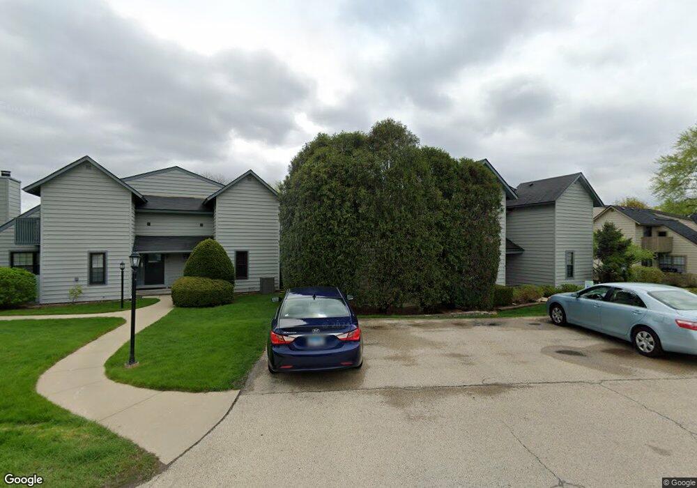
644 Chip Ct Unit U264 Gurnee, IL 60031
Estimated Value: $167,000 - $196,000
1
Bed
2
Baths
956
Sq Ft
$189/Sq Ft
Est. Value
About This Home
This home is located at 644 Chip Ct Unit U264, Gurnee, IL 60031 and is currently estimated at $180,714, approximately $189 per square foot. 644 Chip Ct Unit U264 is a home located in Lake County with nearby schools including Woodland Primary School, Woodland Elementary School, and Woodland Intermediate School.
Ownership History
Date
Name
Owned For
Owner Type
Purchase Details
Closed on
Jul 8, 2011
Sold by
Sutton Robert E and Sutton Harriet A
Bought by
Sigmar E Sobezak Trust and Carmella T Sobezak Trust
Current Estimated Value
Purchase Details
Closed on
Feb 17, 2005
Sold by
Sutton Robert E and Sutton Harriet A
Bought by
The Sutton Family Trust
Purchase Details
Closed on
Jul 29, 1996
Sold by
Kerrigan Phyllis and Kerrigan John V
Bought by
Sutton Robert E and Sutton Harriet A
Home Financials for this Owner
Home Financials are based on the most recent Mortgage that was taken out on this home.
Original Mortgage
$40,000
Interest Rate
8.33%
Create a Home Valuation Report for This Property
The Home Valuation Report is an in-depth analysis detailing your home's value as well as a comparison with similar homes in the area
Home Values in the Area
Average Home Value in this Area
Purchase History
| Date | Buyer | Sale Price | Title Company |
|---|---|---|---|
| Sigmar E Sobezak Trust | $50,000 | Fidelity National Title | |
| The Sutton Family Trust | -- | -- | |
| Sutton Robert E | $64,000 | First American Title |
Source: Public Records
Mortgage History
| Date | Status | Borrower | Loan Amount |
|---|---|---|---|
| Previous Owner | Sutton Robert E | $40,000 |
Source: Public Records
Tax History Compared to Growth
Tax History
| Year | Tax Paid | Tax Assessment Tax Assessment Total Assessment is a certain percentage of the fair market value that is determined by local assessors to be the total taxable value of land and additions on the property. | Land | Improvement |
|---|---|---|---|---|
| 2024 | $3,808 | $41,735 | $8,185 | $33,550 |
| 2023 | $3,280 | $38,747 | $7,599 | $31,148 |
| 2022 | $3,280 | $33,654 | $5,929 | $27,725 |
| 2021 | $2,804 | $30,475 | $5,369 | $25,106 |
| 2020 | $2,717 | $29,726 | $5,237 | $24,489 |
| 2019 | $2,642 | $28,863 | $5,085 | $23,778 |
| 2018 | $1,727 | $19,074 | $2,240 | $16,834 |
| 2017 | $1,710 | $18,528 | $2,176 | $16,352 |
| 2016 | $1,702 | $17,703 | $2,079 | $15,624 |
| 2015 | $1,663 | $16,790 | $1,972 | $14,818 |
| 2014 | $1,751 | $17,810 | $1,945 | $15,865 |
| 2012 | $1,511 | $17,947 | $1,960 | $15,987 |
Source: Public Records
Map
Nearby Homes
- 651 White Ct
- 638 Dordan Ct
- 690 Chandler Rd Unit 207
- 690 Chandler Rd Unit 305
- 741 Colby Ct Unit U42
- 711 Creekside Cir Unit 103
- 600 Creekside Cir Unit 85
- 640 Wilbur Ct
- 776 Chandler Rd
- 6121 Brookstone Place
- 917 Vose Dr Unit 304
- 6141 Crossland Blvd
- 920 Vose Dr Unit 304
- 920 Vose Dr Unit 106
- 920 Vose Dr Unit 105
- 914 Vose Dr
- 6161 Oakmont Ln
- 6191 Oakmont Ln
- 6296 Doral Dr
- 6359 Doral Dr
- 648 Chip Ct Unit U262
- 650 Chip Ct Unit U261
- 646 Chip Ct
- 642 Chip Ct Unit U265
- 640 Chip Ct Unit U266
- 646 Mitchell Ct
- 648 Mitchell Ct
- 638 Chip Ct
- 636 Chip Ct Unit U268
- 643 Mitchell Ct Unit U250
- 645 Mitchell Ct
- 650 Mitchell Ct
- 652 Mitchell Ct Unit U247
- 647 Mitchell Ct Unit U246
- 649 Mitchell Ct Unit U245
- 634 Chip Ct Unit U277
- 632 Chip Ct
- 630 Chip Ct
- 647 Beth Ct Unit U232
- 651 Beth Ct Unit U230