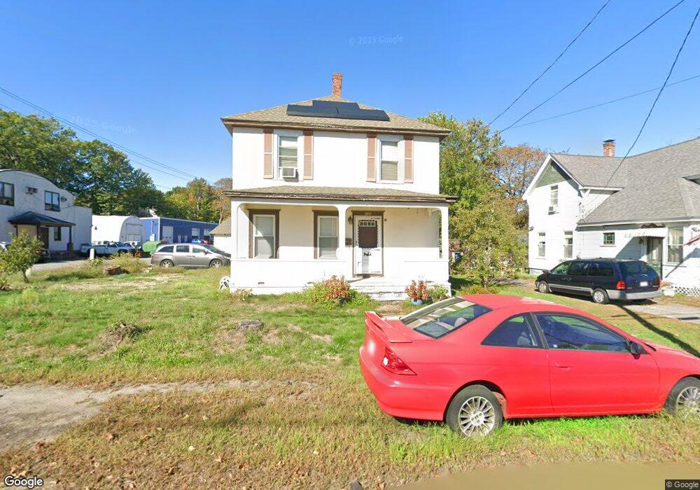
644 High St Clinton, MA 01510
Estimated Value: $409,000 - $482,000
4
Beds
2
Baths
1,524
Sq Ft
$285/Sq Ft
Est. Value
About This Home
This home is located at 644 High St, Clinton, MA 01510 and is currently estimated at $434,313, approximately $284 per square foot. 644 High St is a home located in Worcester County with nearby schools including Clinton Elementary School, Clinton Senior High School, and Clinton Middle School.
Ownership History
Date
Name
Owned For
Owner Type
Purchase Details
Closed on
Mar 15, 2004
Sold by
Chrch Of St Alban
Bought by
Tovar Alexis D
Current Estimated Value
Home Financials for this Owner
Home Financials are based on the most recent Mortgage that was taken out on this home.
Original Mortgage
$185,250
Outstanding Balance
$85,249
Interest Rate
5.67%
Mortgage Type
Purchase Money Mortgage
Estimated Equity
$349,064
Purchase Details
Closed on
Oct 26, 1998
Sold by
Cozzens Barb Stewart
Bought by
Church Of St Alban
Home Financials for this Owner
Home Financials are based on the most recent Mortgage that was taken out on this home.
Original Mortgage
$105,300
Interest Rate
6.74%
Mortgage Type
Purchase Money Mortgage
Create a Home Valuation Report for This Property
The Home Valuation Report is an in-depth analysis detailing your home's value as well as a comparison with similar homes in the area
Home Values in the Area
Average Home Value in this Area
Purchase History
| Date | Buyer | Sale Price | Title Company |
|---|---|---|---|
| Tovar Alexis D | $195,000 | -- | |
| Church Of St Alban | $117,000 | -- | |
| Tovar Alexis D | $195,000 | -- | |
| Church Of St Alban | $117,000 | -- |
Source: Public Records
Mortgage History
| Date | Status | Borrower | Loan Amount |
|---|---|---|---|
| Open | Tovar Alexis D | $185,250 | |
| Closed | Church Of St Alban | $185,250 | |
| Previous Owner | Church Of St Alban | $105,300 | |
| Previous Owner | Church Of St Alban | $50,000 |
Source: Public Records
Tax History
| Year | Tax Paid | Tax Assessment Tax Assessment Total Assessment is a certain percentage of the fair market value that is determined by local assessors to be the total taxable value of land and additions on the property. | Land | Improvement |
|---|---|---|---|---|
| 2025 | $4,091 | $307,600 | $79,500 | $228,100 |
| 2024 | $3,874 | $294,800 | $79,500 | $215,300 |
| 2023 | $3,633 | $271,700 | $72,300 | $199,400 |
| 2022 | $3,617 | $242,600 | $65,700 | $176,900 |
| 2021 | $3,376 | $211,800 | $62,600 | $149,200 |
| 2020 | $2,928 | $189,000 | $62,600 | $126,400 |
| 2019 | $2,756 | $173,000 | $60,800 | $112,200 |
| 2018 | $3,007 | $177,100 | $68,300 | $108,800 |
| 2017 | $2,426 | $137,300 | $57,000 | $80,300 |
| 2016 | $2,451 | $141,900 | $57,000 | $84,900 |
| 2015 | $2,169 | $130,200 | $55,300 | $74,900 |
| 2014 | $2,103 | $130,200 | $55,300 | $74,900 |
Source: Public Records
Map
Nearby Homes
- 508 High St
- 93 Forest St
- 101 Woodruff Rd
- 57 Clark St
- 719 Main St
- 0 Parker Rd
- 46 Woodruff Rd
- 25 Pearl St
- 12 Woodruff Rd
- 55 Sterling St Unit 306
- 55 Sterling St Unit 312
- 55 Sterling St Unit 314
- 55 Sterling St Unit 212
- 308 Ridgefield Cir Unit C
- 76 Mill St Unit 3
- 5 Catherine St
- 920 Ridgefield Cir Unit C
- 132 Kilbourn Rd
- 155 Cedar St
- 610 Ridgefield Cir Unit B
- 650 High St
- 136 Allen St
- 640 High St
- 633 High St
- 128 Allen St
- 634 High St
- 637 High St
- 658 High St Unit 14
- 658 High St
- 129 Allen St
- 672 High St Unit 674
- 672-674 High St
- 674 High St
- 656 High St Unit 204
- 656 High St Unit 13
- 656 High St Unit 12
- 656 High St Unit 11
- 656 High St Unit 10
- 656 High St Unit 9
- 656 High St Unit 8
Your Personal Tour Guide
Ask me questions while you tour the home.