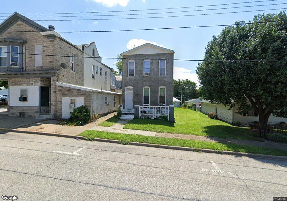
644 State St Quincy, IL 62301
Estimated Value: $66,000 - $90,000
4
Beds
2
Baths
2,120
Sq Ft
$36/Sq Ft
Est. Value
About This Home
This home is located at 644 State St, Quincy, IL 62301 and is currently estimated at $76,667, approximately $36 per square foot. 644 State St is a home located in Adams County with nearby schools including Denman Elementary School, Quincy Junior High School, and Quincy Senior High School.
Ownership History
Date
Name
Owned For
Owner Type
Purchase Details
Closed on
Mar 15, 2022
Sold by
Baehr Samuel P and Baehr Tammy K
Bought by
Us Property Holdings Llc
Current Estimated Value
Home Financials for this Owner
Home Financials are based on the most recent Mortgage that was taken out on this home.
Original Mortgage
$130,000
Outstanding Balance
$121,366
Interest Rate
3.85%
Mortgage Type
New Conventional
Estimated Equity
-$44,699
Purchase Details
Closed on
Mar 29, 2018
Sold by
Delonjay Jeffrey S
Bought by
Baehr Samuel P and Baehr Tammy K
Home Financials for this Owner
Home Financials are based on the most recent Mortgage that was taken out on this home.
Original Mortgage
$105,200
Interest Rate
4.38%
Mortgage Type
New Conventional
Create a Home Valuation Report for This Property
The Home Valuation Report is an in-depth analysis detailing your home's value as well as a comparison with similar homes in the area
Home Values in the Area
Average Home Value in this Area
Purchase History
| Date | Buyer | Sale Price | Title Company |
|---|---|---|---|
| Us Property Holdings Llc | $130,000 | Title Center | |
| Baehr Samuel P | $138,000 | Illinois Real Estate Title |
Source: Public Records
Mortgage History
| Date | Status | Borrower | Loan Amount |
|---|---|---|---|
| Open | Us Property Holdings Llc | $130,000 | |
| Previous Owner | Baehr Samuel P | $105,200 |
Source: Public Records
Tax History Compared to Growth
Tax History
| Year | Tax Paid | Tax Assessment Tax Assessment Total Assessment is a certain percentage of the fair market value that is determined by local assessors to be the total taxable value of land and additions on the property. | Land | Improvement |
|---|---|---|---|---|
| 2024 | $858 | $13,160 | $2,940 | $10,220 |
| 2023 | $1,004 | $13,350 | $2,730 | $10,620 |
| 2022 | $1,004 | $14,980 | $2,550 | $12,430 |
| 2021 | $1,012 | $14,680 | $2,500 | $12,180 |
| 2020 | $992 | $14,390 | $3,280 | $11,110 |
| 2019 | $973 | $14,230 | $3,240 | $10,990 |
| 2018 | $679 | $9,810 | $3,180 | $6,630 |
| 2017 | $662 | $9,710 | $3,150 | $6,560 |
| 2016 | $649 | $9,310 | $3,020 | $6,290 |
| 2015 | $6,232,600 | $9,310 | $3,020 | $6,290 |
| 2012 | $551 | $7,950 | $2,920 | $5,030 |
Source: Public Records
Map
Nearby Homes