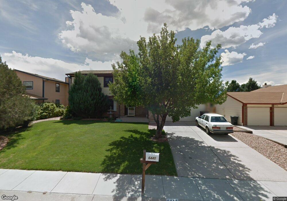
6440 Snowbird Dr Colorado Springs, CO 80918
Pulpit Rock NeighborhoodEstimated Value: $453,235 - $509,000
4
Beds
4
Baths
2,010
Sq Ft
$241/Sq Ft
Est. Value
About This Home
This home is located at 6440 Snowbird Dr, Colorado Springs, CO 80918 and is currently estimated at $484,309, approximately $240 per square foot. 6440 Snowbird Dr is a home located in El Paso County with nearby schools including King Elementary School, Russell Middle School, and Coronado High School.
Ownership History
Date
Name
Owned For
Owner Type
Purchase Details
Closed on
Jul 20, 2000
Sold by
Mcnally Michael L and Mcnally Diane L
Bought by
Dunn Kenneth D and Dunn Cynthia L
Current Estimated Value
Home Financials for this Owner
Home Financials are based on the most recent Mortgage that was taken out on this home.
Original Mortgage
$155,200
Outstanding Balance
$56,047
Interest Rate
8.36%
Estimated Equity
$428,262
Purchase Details
Closed on
Sep 8, 1995
Sold by
Michael Gene Y and Michael Ruth K
Bought by
Mcnally Michael L and Mcnally Diane L
Home Financials for this Owner
Home Financials are based on the most recent Mortgage that was taken out on this home.
Original Mortgage
$60,000
Interest Rate
7.76%
Purchase Details
Closed on
Mar 1, 1979
Bought by
Dunn Cynthia L
Create a Home Valuation Report for This Property
The Home Valuation Report is an in-depth analysis detailing your home's value as well as a comparison with similar homes in the area
Home Values in the Area
Average Home Value in this Area
Purchase History
| Date | Buyer | Sale Price | Title Company |
|---|---|---|---|
| Dunn Kenneth D | $160,000 | -- | |
| Mcnally Michael L | $127,000 | First American Title | |
| Dunn Cynthia L | -- | -- |
Source: Public Records
Mortgage History
| Date | Status | Borrower | Loan Amount |
|---|---|---|---|
| Open | Dunn Kenneth D | $155,200 | |
| Previous Owner | Mcnally Michael L | $60,000 |
Source: Public Records
Tax History Compared to Growth
Tax History
| Year | Tax Paid | Tax Assessment Tax Assessment Total Assessment is a certain percentage of the fair market value that is determined by local assessors to be the total taxable value of land and additions on the property. | Land | Improvement |
|---|---|---|---|---|
| 2025 | $1,558 | $32,570 | -- | -- |
| 2024 | $1,076 | $32,470 | $4,840 | $27,630 |
| 2022 | $947 | $23,880 | $4,300 | $19,580 |
| 2021 | $1,028 | $24,570 | $4,430 | $20,140 |
| 2020 | $899 | $20,400 | $3,850 | $16,550 |
| 2019 | $894 | $20,400 | $3,850 | $16,550 |
| 2018 | $1,144 | $15,590 | $3,240 | $12,350 |
| 2017 | $1,083 | $15,590 | $3,240 | $12,350 |
| 2016 | $863 | $14,880 | $3,340 | $11,540 |
| 2015 | $859 | $14,880 | $3,340 | $11,540 |
| 2014 | $814 | $13,520 | $3,300 | $10,220 |
Source: Public Records
Map
Nearby Homes
- 6470 Lehman Dr
- 2113 Roundtop Ct
- 6530 Brook Park Dr
- 6145 Pine Hill Dr
- 6119 Pine Hill Dr
- 6107 Pine Hill Dr
- 1850 Brookdale Dr
- 6041 Kingdom View
- 6035 Tuckerman Ln
- 1892 Brookdale Dr
- 6447 Jonathan Ct Unit E1
- 6075 Castlewood Ln
- 5950 Ridge Brook Ln
- 6641 Gambol Quail Dr W
- 6632 Dublin Loop W
- 6633 Dublin Loop W Unit 4
- 6170 Castlewood Ln
- 6655 Sproul Ln
- 1725 Applewood Ridge Ct
- 6438 Village Ln Unit 6438
- 6450 Snowbird Dr
- 6430 Snowbird Dr
- 2330 Ptarmigan Ln
- 2320 Ptarmigan Ln
- 6460 Snowbird Dr
- 2340 Ptarmigan Ln
- 6420 Snowbird Dr
- 6445 Snowbird Dr
- 2310 Ptarmigan Ln
- 6455 Snowbird Dr
- 6435 Snowbird Dr
- 2350 Ptarmigan Ln
- 6465 Snowbird Dr
- 6425 Snowbird Dr
- 6410 Snowbird Dr
- 2315 Ptarmigan Ln
- 2325 Roundtop Dr
- 6510 Lehman Dr
- 2315 Roundtop Dr
- 2325 Ptarmigan Ln