64409 M 62 Cassopolis, MI 49031
Estimated Value: $232,000 - $298,000
--
Bed
--
Bath
1,638
Sq Ft
$163/Sq Ft
Est. Value
About This Home
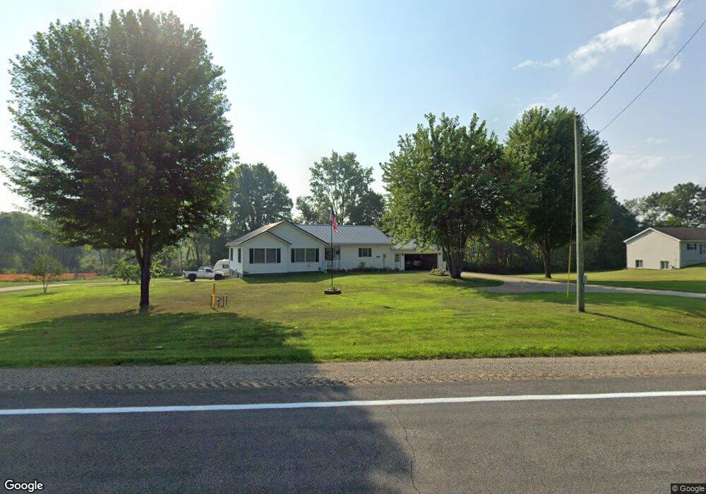
This home is located at 64409 M 62, Cassopolis, MI 49031 and is currently estimated at $266,178, approximately $162 per square foot. 64409 M 62 is a home located in Cass County with nearby schools including Sam Adams Elementary School, Cassopolis Middle School, and Cassopolis Ross Beatty High School.
Ownership History
Date
Name
Owned For
Owner Type
Purchase Details
Closed on
Nov 8, 2021
Sold by
Kendall Rocky
Bought by
Kendall Rocky and Rocky Kendall Revocable Trust
Current Estimated Value
Purchase Details
Closed on
Aug 1, 2018
Sold by
Jeffries Milo Scott
Bought by
Kendall Rocky and Kendall Karen
Purchase Details
Closed on
Jul 25, 2018
Sold by
Davis Sally
Bought by
Jeffries Milo Scott
Purchase Details
Closed on
Jun 1, 2005
Sold by
Davis Fred and Davis Sally
Bought by
Jeffries Milo Scott
Create a Home Valuation Report for This Property
The Home Valuation Report is an in-depth analysis detailing your home's value as well as a comparison with similar homes in the area
Home Values in the Area
Average Home Value in this Area
Purchase History
| Date | Buyer | Sale Price | Title Company |
|---|---|---|---|
| Kendall Rocky | -- | None Available | |
| Kendall Rocky | $82,700 | Meridian Title Corp | |
| Jeffries Milo Scott | -- | Meridian Title Corp | |
| Jeffries Milo Scott | -- | -- |
Source: Public Records
Tax History Compared to Growth
Tax History
| Year | Tax Paid | Tax Assessment Tax Assessment Total Assessment is a certain percentage of the fair market value that is determined by local assessors to be the total taxable value of land and additions on the property. | Land | Improvement |
|---|---|---|---|---|
| 2025 | $1,633 | $146,800 | $20,600 | $126,200 |
| 2024 | $677 | $137,800 | $18,900 | $118,900 |
| 2023 | $646 | $98,200 | $0 | $0 |
| 2022 | $615 | $93,200 | $0 | $0 |
| 2021 | $1,412 | $103,800 | $0 | $0 |
| 2020 | $1,397 | $55,000 | $0 | $0 |
| 2019 | $2,501 | $100,300 | $0 | $0 |
| 2018 | $842 | $98,100 | $0 | $0 |
| 2017 | $825 | $98,000 | $0 | $0 |
| 2016 | $817 | $97,400 | $0 | $0 |
| 2015 | -- | $86,200 | $0 | $0 |
| 2011 | -- | $78,997 | $0 | $0 |
Source: Public Records
Map
Nearby Homes
- 23803 Evan St
- 64145 Brick Church Rd
- 21932 Buffalo Ln
- V/L M 62
- 25481 Jefferson Center St
- 66150 Michigan 62
- 0 Forest Shores Dr Unit 23 25032476
- 0 Forest Shores Dr Unit 22 25032452
- Tract 7 Brookside Ct
- Tract 6 Brookside Ct
- Tract 5 Brookside Ct
- Tract 4 Deep Woods Dr
- Tract 3 Deep Woods Dr
- Tract #2 Deep Woods Dr
- Tract 1 Deep Woods Dr
- 21373 Sail Bay Dr
- 67354 Oil City Rd
- 22345 Woodland St
- 25740 Michigan 60
- 813 Park Shore Dr