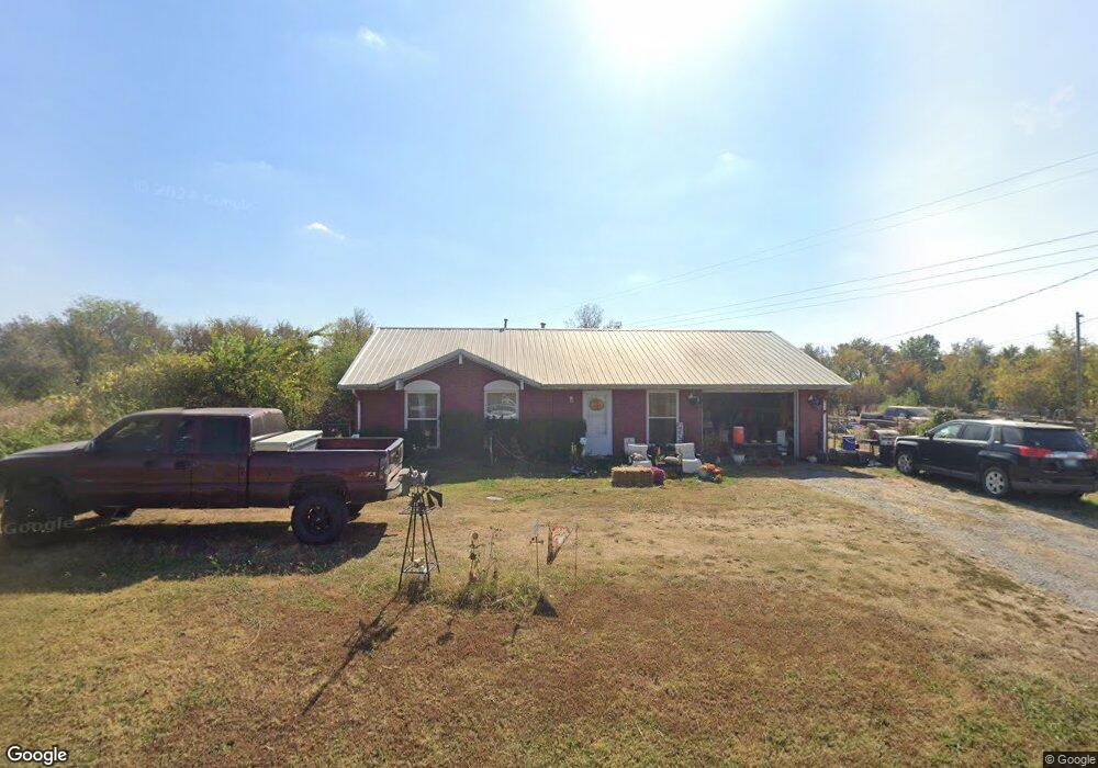
6441 Border Ave Muskogee, OK 74401
Estimated Value: $157,000 - $185,000
3
Beds
1
Bath
1,080
Sq Ft
$158/Sq Ft
Est. Value
About This Home
This home is located at 6441 Border Ave, Muskogee, OK 74401 and is currently estimated at $170,696, approximately $158 per square foot. 6441 Border Ave is a home located in Muskogee County with nearby schools including Cherokee Elementary School, 8th & 9th Grade Academy @ Alice Robertson, and Muskogee High School.
Ownership History
Date
Name
Owned For
Owner Type
Purchase Details
Closed on
Jun 29, 2012
Sold by
Williamson Hazel and Williamson Living Trust
Bought by
Portis Ashley and Portis Maurice
Current Estimated Value
Home Financials for this Owner
Home Financials are based on the most recent Mortgage that was taken out on this home.
Original Mortgage
$91,800
Outstanding Balance
$63,501
Interest Rate
3.79%
Mortgage Type
New Conventional
Estimated Equity
$107,195
Purchase Details
Closed on
Aug 30, 1994
Purchase Details
Closed on
Feb 1, 1992
Create a Home Valuation Report for This Property
The Home Valuation Report is an in-depth analysis detailing your home's value as well as a comparison with similar homes in the area
Home Values in the Area
Average Home Value in this Area
Purchase History
| Date | Buyer | Sale Price | Title Company |
|---|---|---|---|
| Portis Ashley | $90,000 | None Available | |
| -- | -- | -- | |
| -- | $42,000 | -- |
Source: Public Records
Mortgage History
| Date | Status | Borrower | Loan Amount |
|---|---|---|---|
| Open | Portis Ashley | $91,800 |
Source: Public Records
Tax History Compared to Growth
Tax History
| Year | Tax Paid | Tax Assessment Tax Assessment Total Assessment is a certain percentage of the fair market value that is determined by local assessors to be the total taxable value of land and additions on the property. | Land | Improvement |
|---|---|---|---|---|
| 2025 | $1,013 | $10,787 | $3,708 | $7,079 |
| 2024 | $1,013 | $10,474 | $3,600 | $6,874 |
| 2023 | $1,013 | $10,168 | $2,200 | $7,968 |
| 2022 | $906 | $10,168 | $2,200 | $7,968 |
| 2021 | $948 | $10,533 | $2,200 | $8,333 |
| 2020 | $940 | $10,533 | $2,200 | $8,333 |
| 2019 | $921 | $10,534 | $2,200 | $8,334 |
| 2018 | $901 | $10,534 | $2,200 | $8,334 |
| 2017 | $941 | $11,170 | $2,200 | $8,970 |
| 2016 | $928 | $10,874 | $2,200 | $8,674 |
| 2015 | $893 | $10,557 | $2,200 | $8,357 |
| 2014 | $881 | $10,250 | $2,200 | $8,050 |
Source: Public Records
Map
Nearby Homes
- 1231 S 61st St W
- 1741 S 64th St W
- 501 S 64th St W
- 1005 Kershaw Dr
- 907 Kershaw Dr
- 0 Junction St Unit 2537657
- 2251 S 64th St W
- 5431 Estelle
- 5419 Pine St
- 711 W Broadway St
- 000000 N 12th
- 1500 W Shawnee
- 0 W Hancock St Unit 2544790
- 0 W Hancock St Unit 16398614
- 5016 Denison St
- 5400 Rolling Oaks Trail
- 4410 W Okmulgee Ave
- 6351 W 23rd St N
- 4207 Denison St
- 4140 S Robb Ave
- 6401 Border Ave
- 1213 S 64th St W
- 1205 S 64th St W
- 6360 Border Ave
- 1210 S 64th St W
- 6350 Border Ave
- 6340 Border Ave
- 1200 S 64th St W
- 6651 Border Ave
- 6330 Border Ave
- 6320 Border Ave
- 1461 S 64th St W
- 6310 Border Ave
- 900 S 64th St W
- 6801 Border Ave
- 6302 Border Ave
- 1231 S 63rd St W
- 901 S 64th St W
- 6250 Border Ave
- 1235 S 61st St W