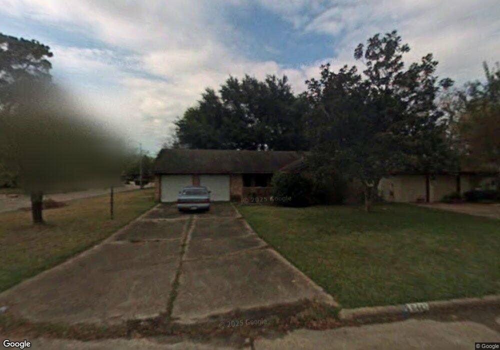
6442 Deirdre Anne Dr Houston, TX 77088
Greater Inwood NeighborhoodEstimated Value: $190,000 - $227,000
3
Beds
2
Baths
1,289
Sq Ft
$157/Sq Ft
Est. Value
About This Home
This home is located at 6442 Deirdre Anne Dr, Houston, TX 77088 and is currently estimated at $202,875, approximately $157 per square foot. 6442 Deirdre Anne Dr is a home located in Harris County with nearby schools including Edward a Vines EC/Pre-K/K School, Ermel Elementary School, and Dr. Viola K. Garcia Middle School.
Ownership History
Date
Name
Owned For
Owner Type
Purchase Details
Closed on
May 10, 2017
Sold by
Slaughter Johnny J and Slaughter Tina M
Bought by
Miranda Irais and Miranda Josefa
Current Estimated Value
Purchase Details
Closed on
May 25, 2011
Sold by
Sekumade John Baptist and Sekumade Ellen Carol
Bought by
Slaughter Johnny J and Slaughter Tina M
Purchase Details
Closed on
Aug 17, 2010
Sold by
Saunders Stanley Wayne
Bought by
Sekumade John Baptist and Sekumade Ellen Carol
Create a Home Valuation Report for This Property
The Home Valuation Report is an in-depth analysis detailing your home's value as well as a comparison with similar homes in the area
Home Values in the Area
Average Home Value in this Area
Purchase History
| Date | Buyer | Sale Price | Title Company |
|---|---|---|---|
| Miranda Irais | -- | First Western Title | |
| Slaughter Johnny J | -- | Chicago Title | |
| Sekumade John Baptist | -- | None Available |
Source: Public Records
Tax History Compared to Growth
Tax History
| Year | Tax Paid | Tax Assessment Tax Assessment Total Assessment is a certain percentage of the fair market value that is determined by local assessors to be the total taxable value of land and additions on the property. | Land | Improvement |
|---|---|---|---|---|
| 2025 | $4,232 | $175,000 | $52,300 | $122,700 |
| 2024 | $4,232 | $186,489 | $52,300 | $134,189 |
| 2023 | $4,232 | $176,290 | $52,300 | $123,990 |
| 2022 | $3,956 | $154,000 | $52,300 | $101,700 |
| 2021 | $2,881 | $114,692 | $16,656 | $98,036 |
| 2020 | $2,508 | $95,000 | $16,656 | $78,344 |
| 2019 | $2,946 | $106,460 | $12,659 | $93,801 |
| 2018 | $1,556 | $108,364 | $12,659 | $95,705 |
| 2017 | $2,875 | $108,364 | $12,659 | $95,705 |
| 2016 | $2,483 | $93,586 | $12,659 | $80,927 |
| 2015 | $2,363 | $93,586 | $12,659 | $80,927 |
| 2014 | $2,363 | $88,796 | $12,659 | $76,137 |
Source: Public Records
Map
Nearby Homes
- 6407 Deirdre Anne Dr
- 6310 Silver Chalice Dr
- 6902 Anson Point Ln
- 6338 Maple Hill Dr
- 8610 Twillingate Ln
- 7218 Jadewood Dr Unit 770
- 6430 Pirtlewood Cir
- 8615 Black Tern Ln
- 7218 Stonegate Dr
- 7219 Ridge Oak Dr
- 6931 Wagonwheel Ln
- 6311 Fairwood Dr
- 7146 Bayou Forest Dr
- 6202 Wagonwheel Cir
- 7259 Shady Arbor Ln
- 6918 Bent Branch Dr
- 7318 Shady Grove Ln
- 7402 Alabonson Rd Unit 303
- 7402 Alabonson Rd Unit 506
- 7402 Alabonson Rd Unit 309
- 6438 Deirdre Anne Dr
- 6439 Lautrec Dr
- 6434 Deirdre Anne Dr
- 6435 Lautrec Dr
- 6462 Lautrec Dr
- 6431 Lautrec Dr
- 6458 Lautrec Dr
- 6455 Deirdre Anne Dr
- 6439 Deirdre Anne Dr
- 6430 Deirdre Anne Dr
- 6443 Deirdre Anne Dr
- 6435 Deirdre Anne Dr
- 6454 Lautrec Dr
- 6427 Lautrec Dr
- 6447 Deirdre Anne Dr
- 6431 Deirdre Anne Dr
- 6451 Deirdre Anne Dr
- 6426 Deirdre Anne Dr
- 6450 Lautrec Dr
- 6427 Deirdre Anne Dr