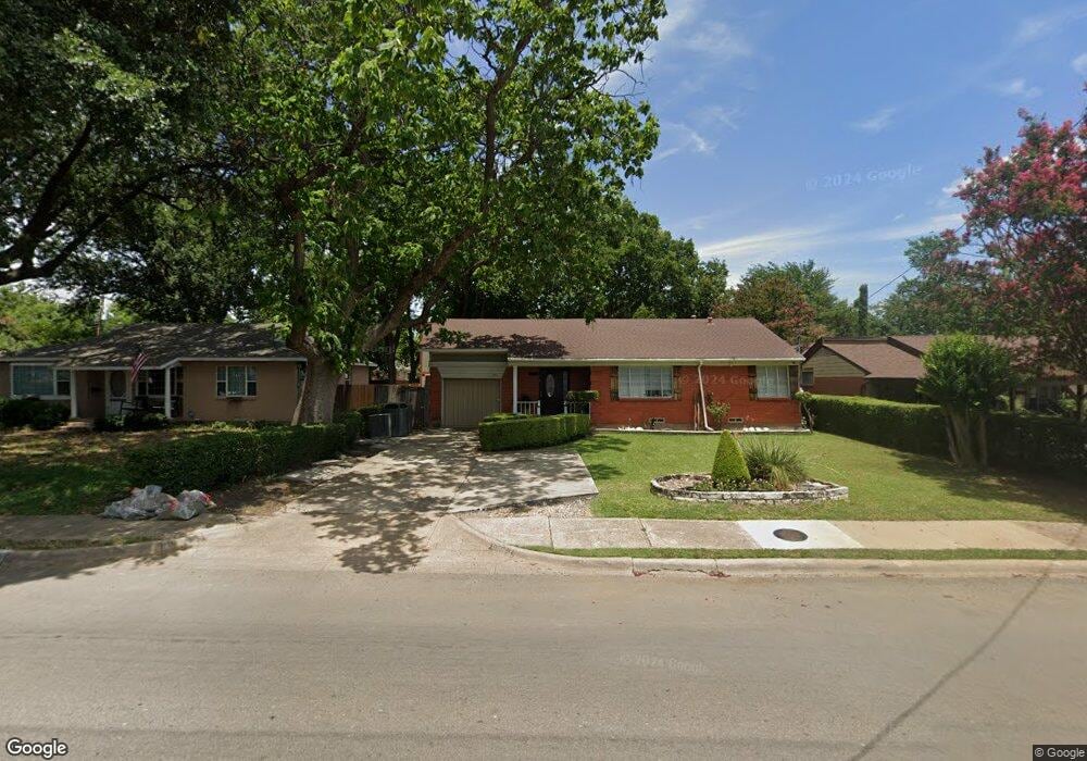
6443 Fisher Rd Dallas, TX 75214
Northeast Dallas NeighborhoodEstimated Value: $393,000 - $448,981
3
Beds
1
Bath
1,062
Sq Ft
$397/Sq Ft
Est. Value
About This Home
This home is located at 6443 Fisher Rd, Dallas, TX 75214 and is currently estimated at $421,995, approximately $397 per square foot. 6443 Fisher Rd is a home located in Dallas County with nearby schools including Dan D Rogers Elementary School, Benjamin Franklin International Exploratory Academy, and Hillcrest High School.
Ownership History
Date
Name
Owned For
Owner Type
Purchase Details
Closed on
Dec 16, 1993
Sold by
Rodgers Ray S and Rodgers Stacy S
Bought by
Miranda Roberto and Miranda Beatriz
Current Estimated Value
Home Financials for this Owner
Home Financials are based on the most recent Mortgage that was taken out on this home.
Original Mortgage
$56,525
Interest Rate
7.06%
Mortgage Type
New Conventional
Create a Home Valuation Report for This Property
The Home Valuation Report is an in-depth analysis detailing your home's value as well as a comparison with similar homes in the area
Home Values in the Area
Average Home Value in this Area
Purchase History
| Date | Buyer | Sale Price | Title Company |
|---|---|---|---|
| Miranda Roberto | -- | Southwest Land Title |
Source: Public Records
Mortgage History
| Date | Status | Borrower | Loan Amount |
|---|---|---|---|
| Closed | Miranda Roberto | $56,525 | |
| Closed | Miranda Roberto | $2,000 |
Source: Public Records
Tax History Compared to Growth
Tax History
| Year | Tax Paid | Tax Assessment Tax Assessment Total Assessment is a certain percentage of the fair market value that is determined by local assessors to be the total taxable value of land and additions on the property. | Land | Improvement |
|---|---|---|---|---|
| 2025 | $6,273 | $447,200 | $304,920 | $142,280 |
| 2024 | $6,273 | $280,680 | $140,000 | $140,680 |
| 2023 | $6,273 | $235,720 | $94,500 | $141,220 |
| 2022 | $5,894 | $235,720 | $94,500 | $141,220 |
| 2021 | $6,218 | $235,720 | $94,500 | $141,220 |
| 2020 | $6,395 | $235,720 | $94,500 | $141,220 |
| 2019 | $6,707 | $235,720 | $94,500 | $141,220 |
| 2018 | $5,797 | $213,170 | $94,500 | $118,670 |
| 2017 | $4,493 | $165,230 | $94,500 | $70,730 |
| 2016 | $4,493 | $165,230 | $94,500 | $70,730 |
| 2015 | $2,274 | $118,450 | $47,250 | $71,200 |
| 2014 | $2,274 | $106,200 | $35,000 | $71,200 |
Source: Public Records
Map
Nearby Homes
- 6546 E Lovers Ln
- 6333 Town Hill Ln
- 6327 Town Hill Ln
- 6646 E Lovers Ln Unit 602
- 6646 E Lovers Ln Unit 808
- 6646 E Lovers Ln Unit 501
- 6646 E Lovers Ln Unit 702
- 6646 E Lovers Ln Unit 301
- 6646 E Lovers Ln Unit 1308
- 6646 E Lovers Ln Unit 1201
- 6517 Highgate Ln
- 6350 Glennox Ln
- 6611 Highgate Ln
- 6349 Highgate Ln
- 6431 Dunstan Ln
- 6108 Abrams Rd Unit 613F
- 6108 Abrams Rd Unit 223B
- 6108 Abrams Rd Unit 601F
- 6108 Abrams Rd Unit 216B
- 6108 Abrams Rd Unit 512E
- 6449 Fisher Rd
- 6439 Fisher Rd
- 6455 Fisher Rd
- 6435 Fisher Rd
- 6440 Lontos Dr
- 6438 Lontos Dr
- 6446 Lontos Dr
- 6436 Lontos Dr
- 6429 Fisher Rd
- 6460 Fisher Rd
- 6434 Lontos Dr
- 6450 Lontos Dr
- 6432 Lontos Dr
- 6418 Lontos Dr
- 6424 Fisher Trail Unit 123
- 6428 Lontos Dr
- 6426 Lontos Dr
- 6458 Lontos Dr
- 6464 Fisher Rd
- 6423 Fisher Rd