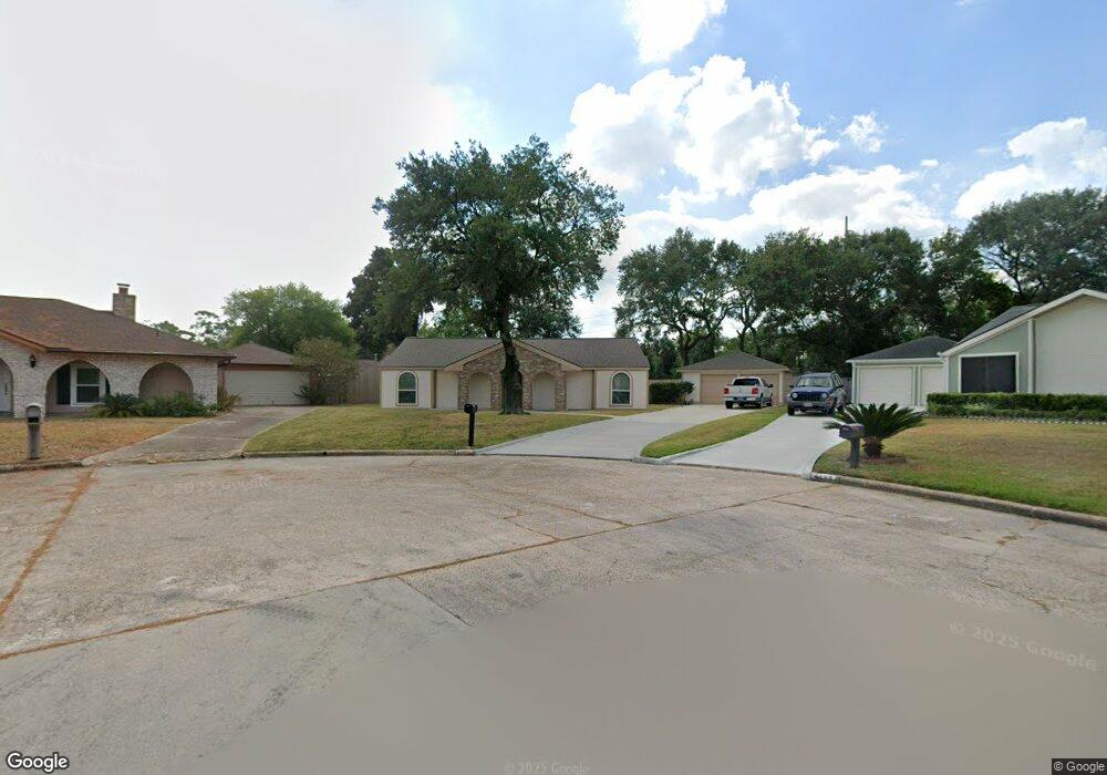
6443 Menwood Cir Houston, TX 77088
Greater Inwood NeighborhoodEstimated Value: $214,916 - $255,000
3
Beds
2
Baths
1,675
Sq Ft
$138/Sq Ft
Est. Value
About This Home
This home is located at 6443 Menwood Cir, Houston, TX 77088 and is currently estimated at $230,729, approximately $137 per square foot. 6443 Menwood Cir is a home located in Harris County with nearby schools including Edward a Vines EC/Pre-K/K School, J. Ruth Smith Elementary, and Hoffman Middle School.
Ownership History
Date
Name
Owned For
Owner Type
Purchase Details
Closed on
Jul 26, 2000
Sold by
Chavis Terry S and Chavis Terry
Bought by
Mccartney Karen Jodi
Current Estimated Value
Home Financials for this Owner
Home Financials are based on the most recent Mortgage that was taken out on this home.
Original Mortgage
$69,600
Outstanding Balance
$25,254
Interest Rate
8.23%
Estimated Equity
$205,475
Create a Home Valuation Report for This Property
The Home Valuation Report is an in-depth analysis detailing your home's value as well as a comparison with similar homes in the area
Home Values in the Area
Average Home Value in this Area
Purchase History
| Date | Buyer | Sale Price | Title Company |
|---|---|---|---|
| Mccartney Karen Jodi | -- | Fidelity National Title |
Source: Public Records
Mortgage History
| Date | Status | Borrower | Loan Amount |
|---|---|---|---|
| Open | Mccartney Karen Jodi | $69,600 | |
| Closed | Mccartney Karen Jodi | $8,700 |
Source: Public Records
Tax History Compared to Growth
Tax History
| Year | Tax Paid | Tax Assessment Tax Assessment Total Assessment is a certain percentage of the fair market value that is determined by local assessors to be the total taxable value of land and additions on the property. | Land | Improvement |
|---|---|---|---|---|
| 2025 | $2,852 | $206,138 | $46,148 | $159,990 |
| 2024 | $2,852 | $198,877 | $46,148 | $152,729 |
| 2023 | $2,852 | $198,877 | $46,148 | $152,729 |
| 2022 | $3,785 | $190,904 | $32,963 | $157,941 |
| 2021 | $3,603 | $143,447 | $20,602 | $122,845 |
| 2020 | $3,786 | $143,447 | $20,602 | $122,845 |
| 2019 | $3,803 | $137,439 | $17,306 | $120,133 |
| 2018 | $1,492 | $128,875 | $17,306 | $111,569 |
| 2017 | $3,141 | $128,875 | $17,306 | $111,569 |
| 2016 | $2,855 | $107,627 | $17,306 | $90,321 |
| 2015 | $2,327 | $109,141 | $17,306 | $91,835 |
| 2014 | $2,327 | $105,580 | $17,306 | $88,274 |
Source: Public Records
Map
Nearby Homes
- 6430 Pirtlewood Cir
- 7219 Ridge Oak Dr
- 7218 Jadewood Dr Unit 770
- 6311 Fairwood Dr
- 7402 Alabonson Rd Unit 506
- 7402 Alabonson Rd Unit 309
- 7402 Alabonson Rd Unit 510
- 7402 Alabonson Rd Unit 108
- 6303 Greenway Forest Ln
- 7146 Bayou Forest Dr
- 6310 Silver Chalice Dr
- 6407 Deirdre Anne Dr
- 9515 Summer Laurel Ln
- 9519 Summer Laurel Ln
- 9614 Summer Laurel Ln
- 7727 Green Lawn Dr
- 6338 Maple Hill Dr
- 6931 Wagonwheel Ln
- 7750 Green Lawn Dr
- 7868 Green Lawn Dr Unit 7868
- 6434 Pirtlewood Cir
- 6446 Menwood Cir
- 6439 Menwood Cir
- 6438 Pirtlewood Cir
- 6442 Menwood Cir
- 6435 Menwood CI
- 6435 Menwood Cir
- 6426 Pirtlewood Cir
- 6439 Pirtlewood Cir
- 6438 Menwood Cir
- 6434 Menwood Cir
- 6435 Pirtlewood Cir
- 6431 Pirtlewood Cir
- 7203 Jadewood Dr
- 6427 Menwood Cir
- 6418 Pirtlewood Cir
- 6430 Fairwood Dr
- 6426 Menwood CI
- 6426 Menwood Cir
- 6426 Fairwood Dr