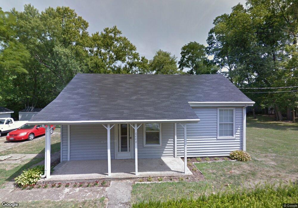
6444 Locust St West Chester, OH 45069
West Chester Township NeighborhoodEstimated Value: $152,000 - $474,000
3
Beds
1
Bath
1,720
Sq Ft
$174/Sq Ft
Est. Value
About This Home
This home is located at 6444 Locust St, West Chester, OH 45069 and is currently estimated at $299,643, approximately $174 per square foot. 6444 Locust St is a home located in Butler County with nearby schools including Freedom Elementary School, Lakota Ridge Junior School, and Lakota West High School.
Ownership History
Date
Name
Owned For
Owner Type
Purchase Details
Closed on
Jan 31, 2025
Sold by
Baker Marion S
Bought by
Marion S Baker Family Trust and Baker
Current Estimated Value
Purchase Details
Closed on
Mar 28, 2022
Sold by
Needham Family Trust
Bought by
Baker Marion S
Purchase Details
Closed on
Mar 3, 2016
Sold by
Needham Kenneth L
Bought by
Needham Kenneth L and The Needham Family Trust
Create a Home Valuation Report for This Property
The Home Valuation Report is an in-depth analysis detailing your home's value as well as a comparison with similar homes in the area
Home Values in the Area
Average Home Value in this Area
Purchase History
| Date | Buyer | Sale Price | Title Company |
|---|---|---|---|
| Marion S Baker Family Trust | -- | None Listed On Document | |
| Marion S Baker Family Trust | -- | None Listed On Document | |
| Baker Marion S | $125,000 | Prodigy Title | |
| Needham Kenneth L | -- | None Available |
Source: Public Records
Tax History Compared to Growth
Tax History
| Year | Tax Paid | Tax Assessment Tax Assessment Total Assessment is a certain percentage of the fair market value that is determined by local assessors to be the total taxable value of land and additions on the property. | Land | Improvement |
|---|---|---|---|---|
| 2024 | $2,384 | $57,600 | $11,560 | $46,040 |
| 2023 | $2,368 | $57,600 | $11,560 | $46,040 |
| 2022 | $2,287 | $40,000 | $11,560 | $28,440 |
| 2021 | $1,585 | $38,640 | $11,560 | $27,080 |
| 2020 | $1,623 | $38,640 | $11,560 | $27,080 |
| 2019 | $3,183 | $33,220 | $10,520 | $22,700 |
| 2018 | $1,395 | $33,220 | $10,520 | $22,700 |
| 2017 | $1,406 | $33,220 | $10,520 | $22,700 |
| 2016 | $1,276 | $29,440 | $10,520 | $18,920 |
| 2015 | $1,278 | $29,440 | $10,520 | $18,920 |
| 2014 | $1,512 | $29,440 | $10,520 | $18,920 |
| 2013 | $1,512 | $32,650 | $8,130 | $24,520 |
Source: Public Records
Map
Nearby Homes
- 8919 Eagleview Dr
- 8859 Eagleview Dr
- 8831 Eagleview Dr
- 8871 Timberchase Ct
- 8583 Kates Way
- 6724 Maverick Dr
- Palisades Plan at West Ridge
- Brentwood Plan at West Ridge
- Wilshire Plan at West Ridge
- Moorgate Plan at West Ridge - Noble
- Everton Plan at West Ridge - Noble
- Kingsmark Plan at West Ridge - Prestige
- 6791 Cork Dr
- 6812 Cork Dr
- 7053 Laurel Oaks Dr
- 6592 Pullman Ct
- 8848 Oakcrest Way
- 7194 Laurel Oaks Dr
- 7186 Willow Oak Ct
- 8672 Rupp Farm Dr
- 6443 Locust St
- 6443 Locust St
- 9031 Cincinnati Dayton Rd
- 9039 Cincinnati Dayton Rd
- 6440 W Chester Rd
- 9023 Cincinnati Dayton Rd
- 9034 Cincinnati Dayton Rd
- 9015 Cincinnati Dayton Rd
- 9059 Cincinnati Dayton Rd
- 9007 Cincinnati Dayton Rd
- 6450 W Chester Rd
- 9003 Cincinnati Dayton Rd
- 9001 Cincinnati Dayton Rd
- 9069 Cincinnati Dayton Rd
- 9004 Cincinnati Dayton Rd
- 8982 Steeplechase Way
- 6412 Belmont Park Ct
- 8975 Steeplechase Way
- 9000 Cincinnati Dayton Rd Unit 85
- 9080 Cincinnati Dayton Rd