Estimated Value: $284,476 - $294,000
3
Beds
2
Baths
1,461
Sq Ft
$199/Sq Ft
Est. Value
About This Home
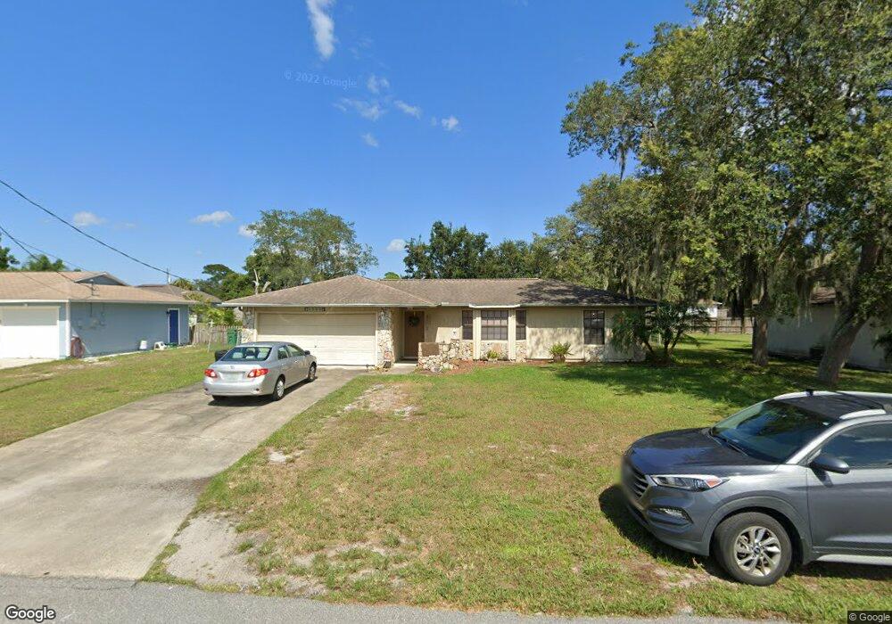
This home is located at 6445 W Baker Cir, Cocoa, FL 32927 and is currently estimated at $290,369, approximately $198 per square foot. 6445 W Baker Cir is a home located in Brevard County with nearby schools including Challenger 7 Elementary School, Space Coast Junior/Senior High School, and Sculptor Charter School.
Ownership History
Date
Name
Owned For
Owner Type
Purchase Details
Closed on
Oct 14, 1998
Sold by
Butler David B
Bought by
Butler Angela D
Current Estimated Value
Purchase Details
Closed on
Apr 29, 1994
Sold by
Morin Shawn D and Morin Nancy P
Bought by
Butler David B and Butler Angela D
Home Financials for this Owner
Home Financials are based on the most recent Mortgage that was taken out on this home.
Original Mortgage
$64,600
Interest Rate
7.77%
Create a Home Valuation Report for This Property
The Home Valuation Report is an in-depth analysis detailing your home's value as well as a comparison with similar homes in the area
Home Values in the Area
Average Home Value in this Area
Purchase History
| Date | Buyer | Sale Price | Title Company |
|---|---|---|---|
| Butler Angela D | -- | -- | |
| Butler David B | $68,000 | -- |
Source: Public Records
Mortgage History
| Date | Status | Borrower | Loan Amount |
|---|---|---|---|
| Previous Owner | Butler David B | $64,600 |
Source: Public Records
Tax History Compared to Growth
Tax History
| Year | Tax Paid | Tax Assessment Tax Assessment Total Assessment is a certain percentage of the fair market value that is determined by local assessors to be the total taxable value of land and additions on the property. | Land | Improvement |
|---|---|---|---|---|
| 2025 | $1,107 | $77,730 | -- | -- |
| 2024 | $1,082 | $75,540 | -- | -- |
| 2023 | $1,082 | $73,340 | $0 | $0 |
| 2022 | $1,021 | $71,210 | $0 | $0 |
| 2021 | $1,022 | $69,140 | $0 | $0 |
| 2020 | $964 | $68,190 | $0 | $0 |
| 2019 | $911 | $66,660 | $0 | $0 |
| 2018 | $911 | $65,420 | $0 | $0 |
| 2017 | $910 | $64,080 | $0 | $0 |
| 2016 | $917 | $62,770 | $18,000 | $44,770 |
| 2015 | $925 | $62,340 | $15,000 | $47,340 |
| 2014 | $929 | $61,850 | $11,000 | $50,850 |
Source: Public Records
Map
Nearby Homes
- 6390 Depot Ave
- 6375 Cable Ave
- 5265 Fay Blvd
- 0000 Grissom Pkwy
- 4975 Fay Blvd
- 6240 Grissom Pkwy
- 5049 Jamaica Rd
- 6175 Grissom Pkwy
- 5145 Fay Blvd
- 6499 Pleasant Ave
- 5149 Arlington Rd Unit 104
- 00 Unknown
- 6735 Grissom Pkwy
- 4635 Alfred St
- 5220 Holden Rd
- 6061 Banbury Ave
- 4560 Fay Blvd
- 5275 Holden Rd
- 6840 Anecia Ave
- 5914 Stillwater Ave
- 6465 W Baker Cir
- 6425 W Baker Cir
- 6434 Stillwater Ave
- 6422 Stillwater Ave
- 6446 Stillwater Ave
- 6485 W Baker Cir
- 6440 W Baker Cir
- 6420 W Baker Cir
- 6460 W Baker Cir
- 6410 Stillwater Ave
- 6400 W Baker Cir
- 4925 Bowie Ct
- 6495 W Baker Cir
- 6395 W Baker Cir
- 6545 W Baker Cir
- 6458 Stillwater Ave
- 6398 Stillwater Ave
- 6470 Stillwater Ave
- 6390 W Baker Cir
- 6445 Stillwater Ave