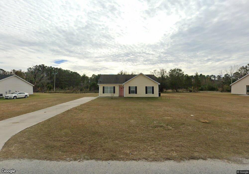
6446 Swallowtail Dr Statesboro, GA 30461
Estimated Value: $149,000 - $168,000
3
Beds
2
Baths
1,052
Sq Ft
$151/Sq Ft
Est. Value
About This Home
This home is located at 6446 Swallowtail Dr, Statesboro, GA 30461 and is currently estimated at $158,897, approximately $151 per square foot. 6446 Swallowtail Dr is a home located in Bulloch County with nearby schools including Statesboro High School, Mattie Lively Elementary School, and William James Middle School.
Ownership History
Date
Name
Owned For
Owner Type
Purchase Details
Closed on
Apr 15, 2021
Sold by
Smith Gary E
Bought by
Black Creek Re Holdings Llc
Current Estimated Value
Purchase Details
Closed on
Mar 16, 2012
Bought by
Smith Gary E
Purchase Details
Closed on
Jul 6, 2010
Sold by
Jennings Construction & Develo
Bought by
The Park Avenue Bank
Purchase Details
Closed on
Jul 2, 2007
Sold by
Not Provided
Bought by
Jennings Construction Development Inc
Home Financials for this Owner
Home Financials are based on the most recent Mortgage that was taken out on this home.
Original Mortgage
$350,000
Interest Rate
6.37%
Mortgage Type
New Conventional
Purchase Details
Closed on
Mar 1, 2002
Bought by
Jennings Vanessa M
Create a Home Valuation Report for This Property
The Home Valuation Report is an in-depth analysis detailing your home's value as well as a comparison with similar homes in the area
Home Values in the Area
Average Home Value in this Area
Purchase History
| Date | Buyer | Sale Price | Title Company |
|---|---|---|---|
| Black Creek Re Holdings Llc | $150,000 | -- | |
| Smith Gary E | $49,500 | -- | |
| -- | -- | -- | |
| The Park Avenue Bank | $77,800 | -- | |
| Jennings Construction Development Inc | -- | -- | |
| Jennings Vanessa M | -- | -- |
Source: Public Records
Mortgage History
| Date | Status | Borrower | Loan Amount |
|---|---|---|---|
| Previous Owner | Jennings Construction Development Inc | $350,000 |
Source: Public Records
Tax History Compared to Growth
Tax History
| Year | Tax Paid | Tax Assessment Tax Assessment Total Assessment is a certain percentage of the fair market value that is determined by local assessors to be the total taxable value of land and additions on the property. | Land | Improvement |
|---|---|---|---|---|
| 2024 | $990 | $44,440 | $5,240 | $39,200 |
| 2023 | $998 | $41,040 | $5,240 | $35,800 |
| 2022 | $646 | $35,891 | $5,264 | $30,627 |
| 2021 | $692 | $31,236 | $5,264 | $25,972 |
| 2020 | $683 | $30,061 | $5,264 | $24,797 |
| 2019 | $688 | $30,105 | $5,264 | $24,841 |
| 2018 | $704 | $29,919 | $5,264 | $24,655 |
| 2017 | $690 | $28,904 | $5,264 | $23,640 |
| 2016 | $688 | $28,121 | $5,264 | $22,857 |
| 2015 | $683 | $27,776 | $5,264 | $22,512 |
| 2014 | $632 | $27,776 | $5,264 | $22,512 |
Source: Public Records
Map
Nearby Homes
- 6459 Swallowtail Dr
- 306 Old Rockdale Dr
- 212 Manchester Dr Lot 2
- 30 Fields Park Rd
- 0 Bell Rd
- 136 Sweet Briar Trail
- 21901 U S 301
- 213 Manchester Dr Lot 13
- 214 Manchester Dr Unit LOT 1
- 209 Manchester Dr Lot 11
- 214 Manchester Dr
- 305 Livingston Bend Dr Lot 8
- 0 N Highway 301 Unit 13
- 0 N Highway 301 Unit 3 10556590
- 0 N Highway 301 Unit 10439137
- 0 N Highway 301 Unit 14
- 0 N Highway 301 Unit 25510573
- 0 N Highway 301 Unit 15
- 0 N Highway 301 Unit 25510576
- 212 Manchester Dr Unit 2
- 6442 Swallowtail Dr
- 6450 Swallowtail Dr
- 6300 Owl Dr
- 6462 Swallowtail Dr
- 6438 Swallowtail Dr
- 6454 Swallowtail Dr
- 6301 Owl Dr
- 6439 Swallowtail Dr
- 6304 Owl Dr
- 6434 Swallowtail Dr
- 6443 Swallowtail Dr Unit 39
- 6443 Swallowtail Dr
- 6458 Swallowtail Dr
- 6423 Swallowtail Dr
- 6305 Owl Dr
- 6305 Owl Dr Unit 47
- 0 Owl Dr Unit LOT 47 7124426
- 0 Owl Dr Unit 3185084
- 0 Owl Dr Unit 7010380
- 6447 Swallowtail Dr