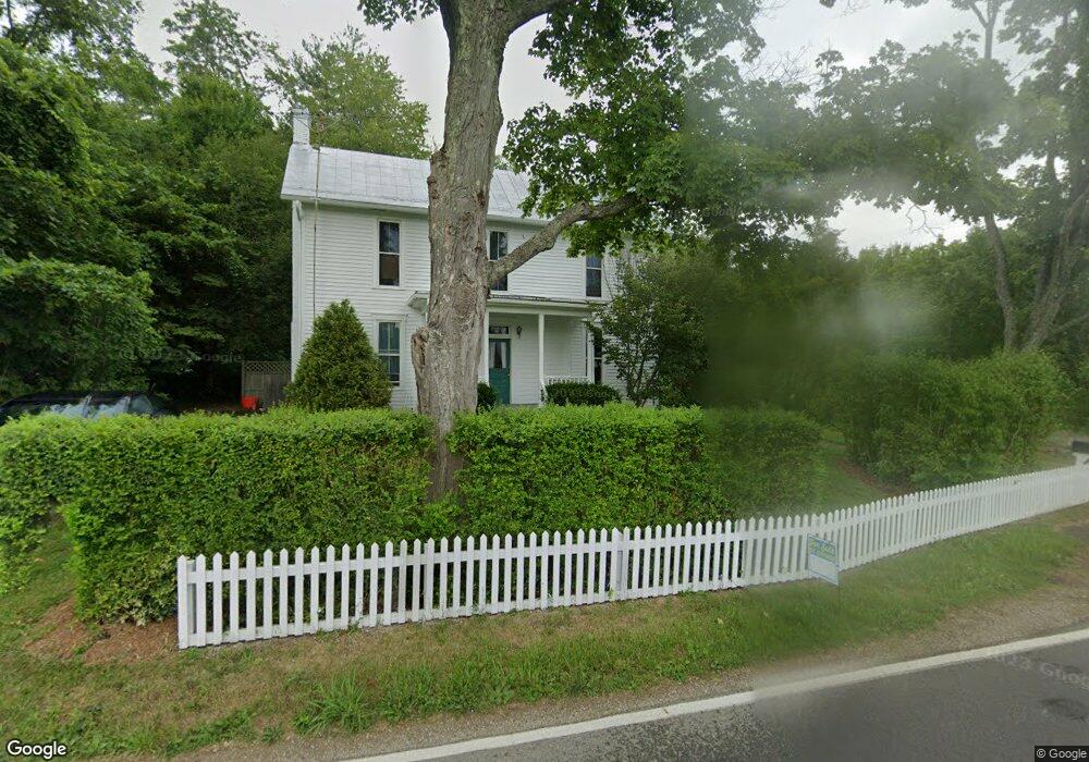
6449 Baker Rd Athens, OH 45701
Estimated Value: $279,514 - $334,000
3
Beds
2
Baths
2,108
Sq Ft
$145/Sq Ft
Est. Value
About This Home
This home is located at 6449 Baker Rd, Athens, OH 45701 and is currently estimated at $306,129, approximately $145 per square foot. 6449 Baker Rd is a home located in Athens County with nearby schools including Morrison-Gordon Elementary School, Athens Middle School, and Athens High School.
Ownership History
Date
Name
Owned For
Owner Type
Purchase Details
Closed on
Dec 2, 2013
Sold by
Lovdal Thomas H and Lovdal Lynn T
Bought by
Lovdal Thomas H and Lovdal Lynn T
Current Estimated Value
Purchase Details
Closed on
Jan 8, 2010
Sold by
Ing Direct
Bought by
Lovdal Thomas H
Purchase Details
Closed on
Sep 11, 2009
Sold by
Woodward Ilise and Aurora Loan Services Llc
Bought by
Ing Direct
Purchase Details
Closed on
Apr 23, 2007
Sold by
Woodward Dwight
Bought by
Woodward Ilise
Purchase Details
Closed on
Sep 1, 1990
Create a Home Valuation Report for This Property
The Home Valuation Report is an in-depth analysis detailing your home's value as well as a comparison with similar homes in the area
Home Values in the Area
Average Home Value in this Area
Purchase History
| Date | Buyer | Sale Price | Title Company |
|---|---|---|---|
| Lovdal Thomas H | -- | Attorney | |
| Lovdal Thomas H | $127,500 | Guardian Title & Guaranty Ag | |
| Ing Direct | $103,333 | None Available | |
| Woodward Ilise | -- | Attorney | |
| -- | $65,300 | -- |
Source: Public Records
Tax History
| Year | Tax Paid | Tax Assessment Tax Assessment Total Assessment is a certain percentage of the fair market value that is determined by local assessors to be the total taxable value of land and additions on the property. | Land | Improvement |
|---|---|---|---|---|
| 2024 | $3,104 | $55,260 | $17,770 | $37,490 |
| 2023 | $2,948 | $55,260 | $17,770 | $37,490 |
| 2022 | $2,691 | $47,940 | $17,770 | $30,170 |
| 2021 | $2,702 | $47,940 | $17,770 | $30,170 |
| 2020 | $2,616 | $47,940 | $17,770 | $30,170 |
| 2019 | $2,532 | $45,520 | $16,220 | $29,300 |
| 2018 | $2,502 | $45,520 | $16,220 | $29,300 |
| 2017 | $4,227 | $45,520 | $16,220 | $29,300 |
| 2016 | $2,239 | $41,840 | $15,890 | $25,950 |
| 2015 | $4,009 | $41,840 | $15,890 | $25,950 |
| 2014 | $4,009 | $41,840 | $15,890 | $25,950 |
| 2013 | $4,104 | $43,980 | $13,020 | $30,960 |
Source: Public Records
Map
Nearby Homes
- 180 Park
- 68 Leoda Rd
- 7480 Ridgeview Cir
- 5554 Gun Club Rd
- 7735 Country Club Rd Unit 4
- 0 Country Club Rd
- 8105 Rolling Hills Rd
- Lot 19 Rosemary Ln
- 7530 Hebbardsville Rd
- Lot 10 Hetherstone
- 7220 State Route 56
- 5985 Fisher Rd
- 6781 Beechwood Dr
- 7165 E Beechwood Dr
- 8747 Mclean Ln
- 8231 Ohio 56
- 7257 Beechwood Dr
- 5131 Wooten Rd
- 0 Echo Ln
- 31 Angela Dr
- 6525 Baker Rd
- 6490 Baker Rd
- 6350 Marion Johnson Rd
- 3 Annette Dr
- 10 Annette Dr
- 6005 Marion Johnson Rd
- 8 Annette Dr
- 6326 Baker Rd
- 6 Annette Dr
- 1 Annette Dr
- 3 Nurad Rd
- 6655 Brown Rd
- 2 Nurad Rd
- 4 Annette Dr
- 5995 Marion Johnson Rd
- 6000 Marion Johnson Rd
- 6707 Baker Rd
- 5957 Marion Johnson Rd
- 284 Park Lane Dr
- 51 Nurad Rd
Your Personal Tour Guide
Ask me questions while you tour the home.