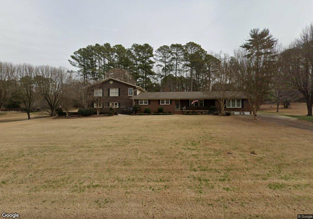
645 Campground Cir Scottsboro, AL 35769
Estimated Value: $441,000 - $706,301
--
Bed
1
Bath
4,046
Sq Ft
$141/Sq Ft
Est. Value
About This Home
This home is located at 645 Campground Cir, Scottsboro, AL 35769 and is currently estimated at $568,575, approximately $140 per square foot. 645 Campground Cir is a home located in Jackson County with nearby schools including Scottsboro High School.
Ownership History
Date
Name
Owned For
Owner Type
Purchase Details
Closed on
Oct 1, 2007
Sold by
Rogers Steve W and Rogers Cathy D
Bought by
Dunn Michael J and Dunn Cynthia A
Current Estimated Value
Home Financials for this Owner
Home Financials are based on the most recent Mortgage that was taken out on this home.
Original Mortgage
$212,000
Outstanding Balance
$133,732
Interest Rate
6.41%
Estimated Equity
$434,843
Purchase Details
Closed on
Mar 17, 2006
Sold by
Whitehead Whitehead Brenda Brenda and Whitehead Jones Brenda
Bought by
Rogers Steve W and Rogers Cathy D
Create a Home Valuation Report for This Property
The Home Valuation Report is an in-depth analysis detailing your home's value as well as a comparison with similar homes in the area
Home Values in the Area
Average Home Value in this Area
Purchase History
| Date | Buyer | Sale Price | Title Company |
|---|---|---|---|
| Dunn Michael J | -- | -- | |
| Rogers Steve W | $214,000 | -- |
Source: Public Records
Mortgage History
| Date | Status | Borrower | Loan Amount |
|---|---|---|---|
| Open | Dunn Michael J | $212,000 | |
| Closed | Dunn Michael J | $39,750 |
Source: Public Records
Tax History Compared to Growth
Tax History
| Year | Tax Paid | Tax Assessment Tax Assessment Total Assessment is a certain percentage of the fair market value that is determined by local assessors to be the total taxable value of land and additions on the property. | Land | Improvement |
|---|---|---|---|---|
| 2024 | $1,739 | $35,860 | $0 | $0 |
| 2023 | $1,475 | $35,660 | $0 | $0 |
| 2022 | $1,561 | $33,200 | $0 | $0 |
| 2021 | $1,561 | $33,200 | $0 | $0 |
| 2020 | $1,299 | $27,800 | $0 | $0 |
| 2019 | $1,291 | $27,620 | $0 | $0 |
| 2018 | $1,291 | $27,620 | $0 | $0 |
| 2017 | $1,291 | $276,200 | $0 | $0 |
| 2016 | $1,273 | $272,600 | $0 | $0 |
| 2015 | $1,273 | $272,600 | $0 | $0 |
| 2014 | $1,273 | $272,600 | $0 | $0 |
| 2013 | -- | $272,600 | $0 | $0 |
Source: Public Records
Map
Nearby Homes
- 3156 Lakeshore Dr
- 314 Campground Cir
- Lot 186 Bruce Dr
- 247 Bruce Dr
- 78 Bob Cir
- 27 Sumner Dr
- 128 Floyd Cir
- 436 Monte Sano Dr
- 207 Monte Sano Dr
- 3144 Clemons Rd
- 416 Monte Sano Dr
- Lot 76 Monte Sano Dr
- 907 Monte Sano Dr Unit Lot 43
- 326 Monte Sano Dr
- 161 Monte Sano Dr
- 186 Monte Sano Dr
- 711 Monte Sano Dr
- 148 Monte Sano Dr
- 342 Monte Sano Dr
- 106 Monte Sano Dr