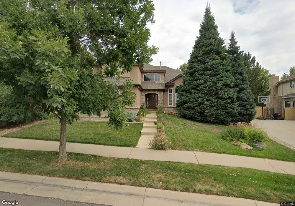
645 E Heartstrong St Superior, CO 80027
Estimated Value: $1,184,601 - $1,369,000
5
Beds
3
Baths
3,142
Sq Ft
$410/Sq Ft
Est. Value
About This Home
This home is located at 645 E Heartstrong St, Superior, CO 80027 and is currently estimated at $1,286,900, approximately $409 per square foot. 645 E Heartstrong St is a home located in Boulder County with nearby schools including Eldorado K-8 School, Superior Elementary School, and Monarch High School.
Ownership History
Date
Name
Owned For
Owner Type
Purchase Details
Closed on
Dec 14, 2016
Sold by
Munio Robert A and Munio Melissa L
Bought by
Robert A Munio and Robert Melissa L Munio Livng
Current Estimated Value
Home Financials for this Owner
Home Financials are based on the most recent Mortgage that was taken out on this home.
Original Mortgage
$332,000
Outstanding Balance
$153,985
Interest Rate
2.88%
Mortgage Type
New Conventional
Estimated Equity
$1,132,915
Purchase Details
Closed on
Nov 22, 2016
Sold by
Roberta Munio And Melisa L Munio Living
Bought by
Munio Robert A
Home Financials for this Owner
Home Financials are based on the most recent Mortgage that was taken out on this home.
Original Mortgage
$332,000
Outstanding Balance
$153,985
Interest Rate
2.88%
Mortgage Type
New Conventional
Estimated Equity
$1,132,915
Purchase Details
Closed on
Jun 29, 2011
Sold by
Munio Robert A and Munio Melissa L
Bought by
Robert A Munio & Melissa L Munio Living
Purchase Details
Closed on
Dec 10, 2010
Sold by
Munio Robert A and Munio Melissa L
Bought by
Munio Robert A
Purchase Details
Closed on
Jan 5, 2010
Sold by
Munio Robert A
Bought by
Robert A Munio & Melissa L Munio Living
Purchase Details
Closed on
Nov 26, 2002
Sold by
Munio Kathryn I
Bought by
Munio Robert A
Purchase Details
Closed on
Dec 30, 1999
Sold by
Marti Juan M and Marti Adela
Bought by
Munio Robert A
Home Financials for this Owner
Home Financials are based on the most recent Mortgage that was taken out on this home.
Original Mortgage
$200,000
Interest Rate
7.76%
Purchase Details
Closed on
Apr 8, 1994
Sold by
Richmond Homes Inc Ii
Bought by
Marti Juan M
Home Financials for this Owner
Home Financials are based on the most recent Mortgage that was taken out on this home.
Original Mortgage
$160,000
Interest Rate
7.31%
Purchase Details
Closed on
Mar 16, 1993
Bought by
Munio Robert A & Melissa L Living Trust
Purchase Details
Closed on
Feb 25, 1991
Bought by
Munio Robert A & Melissa L Living Trust
Create a Home Valuation Report for This Property
The Home Valuation Report is an in-depth analysis detailing your home's value as well as a comparison with similar homes in the area
Home Values in the Area
Average Home Value in this Area
Purchase History
| Date | Buyer | Sale Price | Title Company |
|---|---|---|---|
| Robert A Munio | -- | None Available | |
| Munio Robert A | -- | Land Title Guarantee Co | |
| Robert A Munio & Melissa L Munio Living | -- | None Available | |
| Munio Robert A | -- | Lsi | |
| Robert A Munio & Melissa L Munio Living | -- | None Available | |
| Munio Robert A | -- | -- | |
| Munio Robert A | $510,000 | -- | |
| Marti Juan M | $365,000 | Land Title | |
| Munio Robert A & Melissa L Living Trust | -- | -- | |
| Munio Robert A & Melissa L Living Trust | -- | -- |
Source: Public Records
Mortgage History
| Date | Status | Borrower | Loan Amount |
|---|---|---|---|
| Open | Munio Robert A | $332,000 | |
| Closed | Munio Robert A | $200,000 | |
| Previous Owner | Marti Juan M | $160,000 |
Source: Public Records
Tax History Compared to Growth
Tax History
| Year | Tax Paid | Tax Assessment Tax Assessment Total Assessment is a certain percentage of the fair market value that is determined by local assessors to be the total taxable value of land and additions on the property. | Land | Improvement |
|---|---|---|---|---|
| 2025 | $7,032 | $85,600 | $33,644 | $51,956 |
| 2024 | $7,032 | $85,600 | $33,644 | $51,956 |
| 2023 | $6,935 | $74,564 | $25,393 | $52,856 |
| 2022 | $5,730 | $54,780 | $19,571 | $35,209 |
| 2021 | $6,254 | $61,933 | $22,129 | $39,804 |
| 2020 | $5,770 | $54,919 | $27,742 | $27,177 |
| 2019 | $5,690 | $54,919 | $27,742 | $27,177 |
| 2018 | $5,554 | $53,100 | $17,424 | $35,676 |
| 2017 | $5,677 | $58,705 | $19,263 | $39,442 |
| 2016 | $5,881 | $53,149 | $18,069 | $35,080 |
| 2015 | $5,589 | $47,943 | $19,184 | $28,759 |
| 2014 | $5,090 | $47,943 | $19,184 | $28,759 |
Source: Public Records
Map
Nearby Homes
- 1540 Masters Ct
- 550 E Gill Way
- 520 Campo Way
- 1820 Vernon Ln
- 246 Rockview Dr
- 1697 High Plains Ct
- 725 E Wiggins St
- 1757 High Plains Ct
- 672 Central Park Cir
- 627 Discovery Pkwy
- 818 Promenade Dr
- 730 Promenade Dr
- 2007 Erie Ln
- 1340 Stoneham St
- 888 Northern Way
- 2361 Junegrass Ln
- 1899 Breen Ln
- Athmar Plan at Downtown Superior - Edge
- Wellshire Plan at Downtown Superior - Heights
- Kennedy Plan at Downtown Superior - Edge
- 665 E Heartstrong St
- 625 E Heartstrong St
- 620 E Heartstrong St
- 605 E Heartstrong St
- 600 E Heartstrong St
- 685 E Heartstrong St
- 1345 S Pitkin Ave
- 1325 S Pitkin Ave
- 1405 S Pitkin Ave
- 1305 S Pitkin Ave
- 1425 S Pitkin Ave
- 705 E Heartstrong St
- 1445 S Pitkin Ave
- 1465 S Pitkin Ave
- 725 E Heartstrong St
- 560 E Gill Way
- 1360 S Pitkin Ave
- 1380 S Pitkin Ave
- 1485 S Pitkin Ave
- 1400 S Pitkin Ave