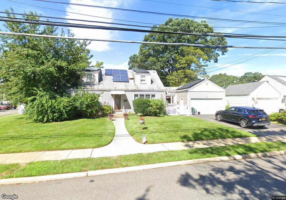
645 Franklin Ave Massapequa, NY 11758
Estimated Value: $773,907 - $795,000
--
Bed
2
Baths
1,804
Sq Ft
$435/Sq Ft
Est. Value
About This Home
This home is located at 645 Franklin Ave, Massapequa, NY 11758 and is currently estimated at $784,454, approximately $434 per square foot. 645 Franklin Ave is a home located in Nassau County with nearby schools including Massapequa High School - Ames Campus, Berner Middle School, and Massapequa High School.
Ownership History
Date
Name
Owned For
Owner Type
Purchase Details
Closed on
Feb 25, 2021
Sold by
Romney Albert A and Romney Sashana
Bought by
Mitchell Afiya R
Current Estimated Value
Purchase Details
Closed on
Aug 12, 2017
Sold by
Protano Nicholas E
Bought by
Protano Grace
Purchase Details
Closed on
Jul 10, 2015
Sold by
Huron Laura P
Bought by
Protano Nicholas E
Purchase Details
Closed on
Mar 20, 2003
Sold by
Protano Nicholas
Create a Home Valuation Report for This Property
The Home Valuation Report is an in-depth analysis detailing your home's value as well as a comparison with similar homes in the area
Home Values in the Area
Average Home Value in this Area
Purchase History
| Date | Buyer | Sale Price | Title Company |
|---|---|---|---|
| Mitchell Afiya R | $400,000 | None Available | |
| Protano Grace | -- | None Available | |
| Protano Grace | -- | None Available | |
| Protano Grace | -- | None Available | |
| Protano Nicholas E | -- | Fidelity National | |
| Protano Nicholas E | -- | Fidelity National | |
| Protano Nicholas E | -- | Fidelity National | |
| -- | -- | -- | |
| -- | -- | -- |
Source: Public Records
Tax History Compared to Growth
Tax History
| Year | Tax Paid | Tax Assessment Tax Assessment Total Assessment is a certain percentage of the fair market value that is determined by local assessors to be the total taxable value of land and additions on the property. | Land | Improvement |
|---|---|---|---|---|
| 2025 | $15,475 | $574 | $273 | $301 |
| 2024 | $4,407 | $547 | $260 | $287 |
| 2023 | $14,657 | $574 | $273 | $301 |
| 2022 | $14,657 | $574 | $273 | $301 |
| 2021 | $14,445 | $553 | $263 | $290 |
| 2020 | $14,002 | $836 | $578 | $258 |
| 2019 | $4,189 | $836 | $578 | $258 |
| 2018 | $7,821 | $836 | $0 | $0 |
| 2017 | $7,821 | $836 | $578 | $258 |
| 2016 | $11,820 | $836 | $578 | $258 |
| 2015 | $3,402 | $836 | $578 | $258 |
| 2014 | $3,402 | $836 | $578 | $258 |
| 2013 | $3,098 | $836 | $578 | $258 |
Source: Public Records
Map
Nearby Homes
- 128 Massachusetts Ave
- 163 Massachusetts Ave
- 102 Boston Ave
- 121 Ontario Ave
- 86 Cleveland Ave
- 136 Euclid Ave
- 73 Massachusetts Ave
- 70 Pittsburgh Ave
- 101 Toronto Ave
- 73 Chicago Ave
- 116 Parkhill Ave
- 104 Clark Ave
- 76 Hamilton Ave
- 20 Boston Ave
- 254 N Richmond Ave
- 203 N Manhattan Ave
- 11 Pittsburgh Ave
- 51 Michigan Ave
- 22 Commonwealth Ave
- 262 New Hampshire Ave
- 133 Massachusetts Ave
- 653 Franklin Ave
- 134 Commonwealth Ave
- 639 Franklin Ave
- 130 Massachusetts Ave
- 131 Massachusetts Ave
- 131 Massachusetts Ave
- 646 Franklin Ave
- 132 Commonwealth Ave
- 136 Commonwealth Ave
- 127 Massachusetts Ave
- 0 Commonwealth Ave Unit P1199996
- 132 Massachusetts Ave
- 134 Massachusetts Ave
- 135 Commonwealth Ave
- 137 Massachusetts Ave
- 125 Massachusetts Ave
- 635 Franklin Ave
- 131 Boston Ave
- 133 Commonwealth Ave Unit A