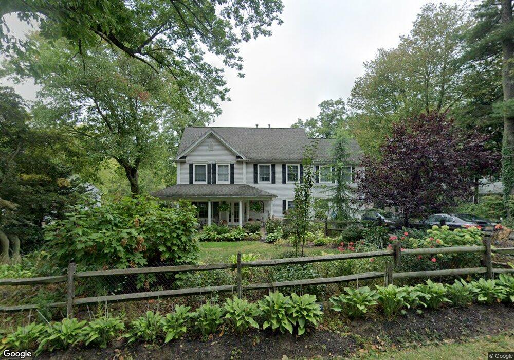
645 Locust Point Rd Rumson, NJ 07760
Estimated Value: $934,000 - $1,467,000
4
Beds
2
Baths
2,462
Sq Ft
$454/Sq Ft
Est. Value
About This Home
This home is located at 645 Locust Point Rd, Rumson, NJ 07760 and is currently estimated at $1,118,921, approximately $454 per square foot. 645 Locust Point Rd is a home located in Monmouth County with nearby schools including Navesink Elementary School, Bayshore Middle School, and Middletown - South High School.
Ownership History
Date
Name
Owned For
Owner Type
Purchase Details
Closed on
Jul 12, 1994
Sold by
Bohm Ronald
Bought by
Bjornsund William and Bjornsund Tricia
Current Estimated Value
Home Financials for this Owner
Home Financials are based on the most recent Mortgage that was taken out on this home.
Original Mortgage
$119,000
Interest Rate
8.19%
Mortgage Type
Purchase Money Mortgage
Create a Home Valuation Report for This Property
The Home Valuation Report is an in-depth analysis detailing your home's value as well as a comparison with similar homes in the area
Home Values in the Area
Average Home Value in this Area
Purchase History
| Date | Buyer | Sale Price | Title Company |
|---|---|---|---|
| Bjornsund William | $149,000 | -- |
Source: Public Records
Mortgage History
| Date | Status | Borrower | Loan Amount |
|---|---|---|---|
| Closed | Bjornsund William | $119,000 |
Source: Public Records
Tax History
| Year | Tax Paid | Tax Assessment Tax Assessment Total Assessment is a certain percentage of the fair market value that is determined by local assessors to be the total taxable value of land and additions on the property. | Land | Improvement |
|---|---|---|---|---|
| 2025 | $11,781 | $874,200 | $563,200 | $311,000 |
| 2024 | $11,735 | $716,200 | $410,900 | $305,300 |
| 2023 | $11,735 | $675,200 | $340,400 | $334,800 |
| 2022 | $10,325 | $531,600 | $212,800 | $318,800 |
| 2021 | $10,325 | $496,400 | $212,800 | $283,600 |
| 2020 | $10,327 | $483,000 | $205,800 | $277,200 |
| 2019 | $10,167 | $481,400 | $205,800 | $275,600 |
| 2018 | $10,865 | $501,400 | $238,700 | $262,700 |
| 2017 | $11,037 | $504,200 | $238,700 | $265,500 |
| 2016 | $10,114 | $474,600 | $225,200 | $249,400 |
| 2015 | $10,386 | $470,600 | $225,200 | $245,400 |
| 2014 | $9,663 | $427,000 | $202,700 | $224,300 |
Source: Public Records
Map
Nearby Homes
- 96 East Ave Unit 82
- 96 East Ave Unit 76
- 96 East Ave Unit 97
- 498 Central Ave
- 502 Central Ave
- 26 King James Ln
- 500 Central Ave
- 7100 Prospect Ave
- 6998 Prospect Ave
- 96 E East Ave Unit 37
- 114 Memorial Pkwy
- 254 1st Ave
- 50 Memorial Pkwy
- 19 Summit Ave
- 119 Chestnut Ave
- 48 Starr Ct
- 104 E Washington Ave
- 16 E Garfield Ave
- 12 E Garfield Ave
- 8 E Garfield Ave
- 641 Locust Point Rd
- 649 Locust Point Rd
- 637 Locust Point Rd
- 653 Locust Point Rd
- 650 Locust Point Rd
- 642 Locust Point Rd
- 638 Locust Point Rd
- 657 Locust Point Rd
- 654 Locust Point Rd
- 633 Locust Point Rd
- 634 Locust Point Rd
- 629 Locust Point Rd
- 35 Latham Ave
- 661 Locust Point Rd
- 658 Locust Point Rd
- 0 Stearns Ave Unit 22226493
- 0 Stearns Ave Unit 22217909
- 32 Meadowbrook Ave
- 625 Locust Point Rd
- 32 Meadowbrook Ave
Your Personal Tour Guide
Ask me questions while you tour the home.