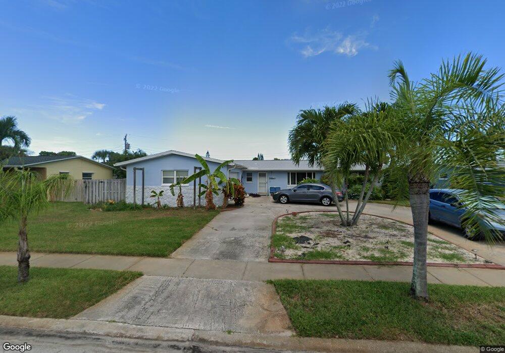
645 N Robin Way Satellite Beach, FL 32937
Estimated Value: $559,561 - $632,000
3
Beds
2
Baths
2,020
Sq Ft
$292/Sq Ft
Est. Value
About This Home
This home is located at 645 N Robin Way, Satellite Beach, FL 32937 and is currently estimated at $590,140, approximately $292 per square foot. 645 N Robin Way is a home located in Brevard County with nearby schools including Ocean Breeze Elementary School, Satellite Senior High School, and DeLaura Middle School.
Ownership History
Date
Name
Owned For
Owner Type
Purchase Details
Closed on
Jun 20, 2003
Sold by
Young Margie E
Bought by
Young William and Young Margie E
Current Estimated Value
Purchase Details
Closed on
Apr 15, 1994
Sold by
Clark Grace and Clark Donald L
Bought by
Mullins Margie Elizabeth
Home Financials for this Owner
Home Financials are based on the most recent Mortgage that was taken out on this home.
Original Mortgage
$84,000
Interest Rate
7.61%
Create a Home Valuation Report for This Property
The Home Valuation Report is an in-depth analysis detailing your home's value as well as a comparison with similar homes in the area
Home Values in the Area
Average Home Value in this Area
Purchase History
| Date | Buyer | Sale Price | Title Company |
|---|---|---|---|
| Young William | -- | -- | |
| Mullins Margie Elizabeth | $105,000 | -- |
Source: Public Records
Mortgage History
| Date | Status | Borrower | Loan Amount |
|---|---|---|---|
| Previous Owner | Mullins Margie Elizabeth | $84,000 |
Source: Public Records
Tax History Compared to Growth
Tax History
| Year | Tax Paid | Tax Assessment Tax Assessment Total Assessment is a certain percentage of the fair market value that is determined by local assessors to be the total taxable value of land and additions on the property. | Land | Improvement |
|---|---|---|---|---|
| 2025 | $2,425 | $164,420 | -- | -- |
| 2024 | $2,380 | $159,790 | -- | -- |
| 2023 | $2,380 | $155,140 | $0 | $0 |
| 2022 | $2,224 | $150,630 | $0 | $0 |
| 2021 | $2,282 | $146,250 | $0 | $0 |
| 2020 | $2,272 | $144,240 | $0 | $0 |
| 2019 | $2,252 | $141,000 | $0 | $0 |
| 2018 | $2,249 | $138,380 | $0 | $0 |
| 2017 | $2,090 | $135,540 | $0 | $0 |
| 2016 | $2,092 | $132,760 | $85,000 | $47,760 |
| 2015 | $2,141 | $131,840 | $75,000 | $56,840 |
| 2014 | $2,142 | $130,800 | $70,000 | $60,800 |
Source: Public Records
Map
Nearby Homes
- 235 S Marco Way
- 215 S Robert Way
- 210 Lynn Ave
- 699 Bimini Rd
- 105 Carissa Dr
- 589 Coconut St
- 155 Elm Ave
- 305 Wimico Dr
- 435 Desoto Pkwy
- 110 Desoto Pkwy Unit 5
- 431 E Amherst Cir
- 690 Trinidad Ct
- 380 Cherry Ct
- 765 Palm Dr
- 43 Anchor Dr
- 712 Sea Palm Ln
- 375 Cherry Dr
- 484 Greenway Ave
- 199 Skyline Ct
- 115 Martesia Way
- 635 N Robin Way
- 655 N Robin Way
- 250 Robert Ct
- 260 S Robert Way
- 640 N Robin Way
- 625 N Robin Way
- 650 N Robin Way
- 630 N Robin Way
- 660 N Robin Way
- 240 Robert Ct
- 245 S Robert Way
- 205 S Robert Way
- 255 S Robert Way
- 620 N Robin Way
- 311 Trinidad Dr
- 275 Lynn Ave
- 270 S Robert Way
- 309 Trinidad Dr
- 265 S Robert Way
- 265 Lynn Ave