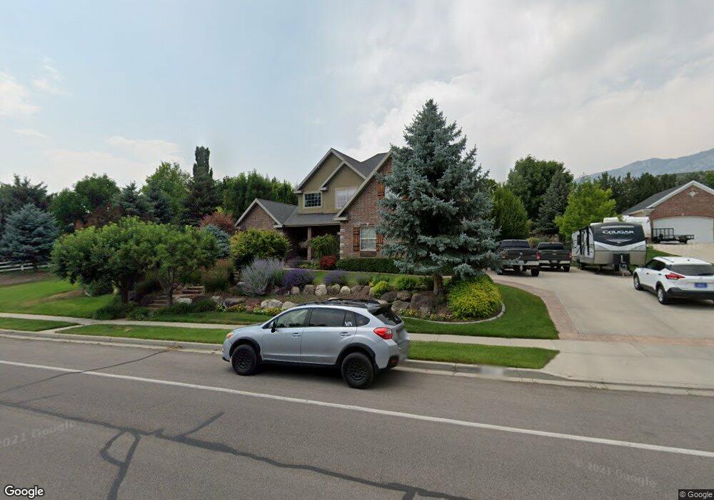
645 S Alpine Hwy Alpine, UT 84004
Estimated Value: $879,000
4
Beds
3
Baths
1,663
Sq Ft
$529/Sq Ft
Est. Value
About This Home
This home is located at 645 S Alpine Hwy, Alpine, UT 84004 and is currently priced at $879,000, approximately $528 per square foot. 645 S Alpine Hwy is a home located in Utah County with nearby schools including Westfield School, Timberline Middle School, and Lone Peak High School.
Ownership History
Date
Name
Owned For
Owner Type
Purchase Details
Closed on
Jan 4, 2021
Sold by
Burgess Clark V and Burgess Nora Kay
Bought by
Alpine City Corporation
Current Estimated Value
Purchase Details
Closed on
Dec 28, 2017
Sold by
Burgess Calrk
Bought by
Burges Clark V and Burgess Nora Kay
Purchase Details
Closed on
Oct 5, 2012
Sold by
Burgess Joann C and Joann C Burgess Survivor S Tru
Bought by
Burgess Clark
Purchase Details
Closed on
Mar 13, 2012
Sold by
Burgess Family Farms Llc
Bought by
Burgess Joann C and Burgess Trust
Purchase Details
Closed on
May 27, 2011
Sold by
Joann C Burgess Holdings Llc
Bought by
Burgess Family Farms Llc
Purchase Details
Closed on
Nov 10, 2010
Sold by
Burgess Joann C and The Van Edward Burgess Family
Bought by
Joann C Burgess Holdings Llc
Create a Home Valuation Report for This Property
The Home Valuation Report is an in-depth analysis detailing your home's value as well as a comparison with similar homes in the area
Home Values in the Area
Average Home Value in this Area
Purchase History
| Date | Buyer | Sale Price | Title Company |
|---|---|---|---|
| Alpine City Corporation | -- | None Available | |
| Burges Clark V | -- | None Available | |
| Burgess Clark | -- | None Available | |
| Burgess Joann C | -- | None Available | |
| Burgess Family Farms Llc | -- | None Available | |
| Joann C Burgess Holdings Llc | -- | None Available |
Source: Public Records
Tax History Compared to Growth
Tax History
| Year | Tax Paid | Tax Assessment Tax Assessment Total Assessment is a certain percentage of the fair market value that is determined by local assessors to be the total taxable value of land and additions on the property. | Land | Improvement |
|---|---|---|---|---|
| 2021 | $3,443 | $0 | $0 | $0 |
| 2020 | $2,545 | $1,691,200 | $1,380,700 | $310,500 |
| 2019 | $2,308 | $1,673,600 | $1,380,700 | $292,900 |
| 2018 | $2,339 | $1,673,600 | $1,380,700 | $292,900 |
| 2017 | $2,072 | $210,107 | $0 | $0 |
| 2016 | $2,158 | $203,980 | $0 | $0 |
| 2015 | $2,281 | $203,976 | $0 | $0 |
| 2014 | $2,240 | $198,157 | $0 | $0 |
Source: Public Records
Map
Nearby Homes
- 88 W Cascade Ave
- 868 S Braddock Ln
- 177 W Canyon Crest Rd
- 259 Twin River Loop
- 5377 W Evergreen Way
- 250 S Main St Unit 7
- 250 S Main St Unit 20
- 250 S Main St Unit 25
- 629 S Pheasant Ridge Cir
- 201 E Red Pine Dr Unit 17
- 5984 W 11200 N Unit 1
- 30 S Main St
- 364 E 280 S
- 5983 W 11270 N Unit 4
- 5976 W 11270 N Unit 5
- 48 N 100 E
- 5159 W 11000 N
- 5077 W 11000 N
- 5798 W 11350 N
- 546 River Meadow Dr
- 645 S Alpine Hwy
- 625 S Alpine Hwy
- 656 Bateman Ln
- 682 Bateman Ln
- 635 S Alpine Hwy
- 655 Alpine Hwy
- 177 Cascade Ave
- 177 Cascade Ave Unit 502
- 706 Bateman Ln
- 677 Alpine Hwy
- 677 S Alpine Hwy
- 224 Sunset Dr
- 244 Sunset Dr
- 206 Sunset Dr
- 264 Sunset Dr
- 651 Bateman Ln
- 154 May Cir
- 145 Cascade Ave
- 284 Sunset Dr
- 186 Sunset Dr